Weston in Lewis County, West Virginia — The American South (Appalachia)
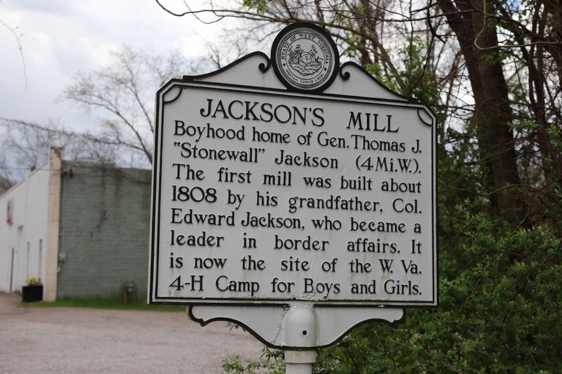
Jackson’s Mill
Topics. This historical marker is listed in these topic lists: Industry & Commerce • War, US Civil. A significant historical year for this entry is 1808.
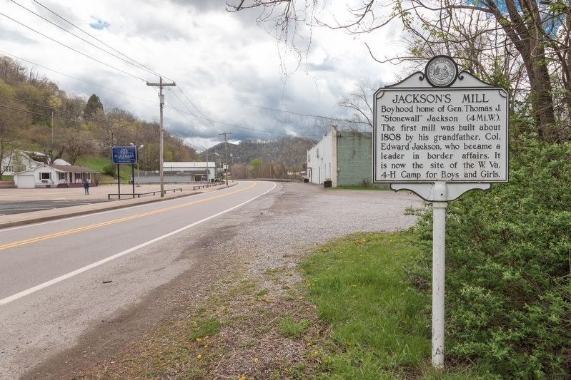
Location. 39° 2.791′ N, 80° 27.877′ W. Marker is in Weston, West Virginia, in Lewis County. Marker is on Main Avenue (U.S. 19) 0.3 miles north of East 6th Street, on the left when traveling north. Touch for map. Marker is at or near this postal address: 730 Main Ave, Weston WV 26452, United States of America. Touch for directions.
Other nearby markers. At least 8 other markers are within walking distance of this marker. Weston Colored School (approx. 0.4 miles away); Veterans Memorial (approx. half a mile away); a different marker also named Veterans Memorial (approx. half a mile away); Lewis County Casualties (approx. half a mile away); Korea (approx. half a mile away); Military Order of the Purple Heart Memorial (approx. half a mile away); a different marker also named Weston Colored School (approx. half a mile away); Weston State Hospital (approx. half a mile away). Touch for a list and map of all markers in Weston.
More about this marker. This West Virginia historical marker, with its white paint and no erection year or agency, is in the style of the markers erected in the 1930s, the first full decade of state-sponsored markers. The 1937 issue of West Virginia Historic and Scenic Highway Markers, compiled by Ross S. Johnston and Isaac McNeel and published by the State Road Commission of West Virginia, locates a marker with this same title and exact text at “U.S. 19 north of Weston.” This marker is in Weston proper.
This marker’s location is 4.1 road miles from Jackson’s Mill, but the mill is due north, not west like the marker says. And the intersection on U.S. 19 that would take you to the mill, County Route 12, is 1.4 miles further north, where there is another Jackson's Mill marker pointing the way (sort of). The current location of this marker, on a stretch of road without significant intersections, seems odd.
There is an intersection with U.S. 19 north of Weston that is due east from Jackson's Mill and 4 miles away. It is in Jane Lew, at U.S. 19 and High Street. Perhaps this marker was originally erected there.
Related markers. Click here for a list of markers that are related to this marker. They are the three different WV Archives and History markers all titled “Jackson’s Mill”.
Additional commentary.
1. The Three Jackson’s Mill Markers
The West Virginia Highway Markers Database of the the West Virginia Memory Project, a project of the West Virginia Department of Arts, Culture and History (a.k.a. WV Archives & History) and available online, lists three markers with this title. The locations given for each of the three markers is wrong. Here's what they were listing when this commentary was written:
1. This marker — U.S. 19 north at Jacksons Mill Road
2. The other Jackson's Mill marker — At entrance to mill off County Route 1
3. The Jackson's Mill / Jackson Graves marker — At entrance to Jackson's Mill Historic Area.
In fact, verified by photos and GPS coordinates, this marker is actually 1.4 miles south of Jacksons Mill Road; No. 2 is at the entrance to the mill, but on County Route 10, not Route 1; and No. 3 is actually located where this marker is supposed to be.
— Submitted May 24, 2021, by J. J. Prats of Powell, Ohio.
Credits. This page was last revised on May 24, 2021. It was originally submitted on May 24, 2021, by J. J. Prats of Powell, Ohio. This page has been viewed 138 times since then and 10 times this year. Photos: 1, 2. submitted on May 24, 2021, by J. J. Prats of Powell, Ohio.

