Constructing Fort Atkinson
The Story
| — | Fort Atkinson State Preserve | — |
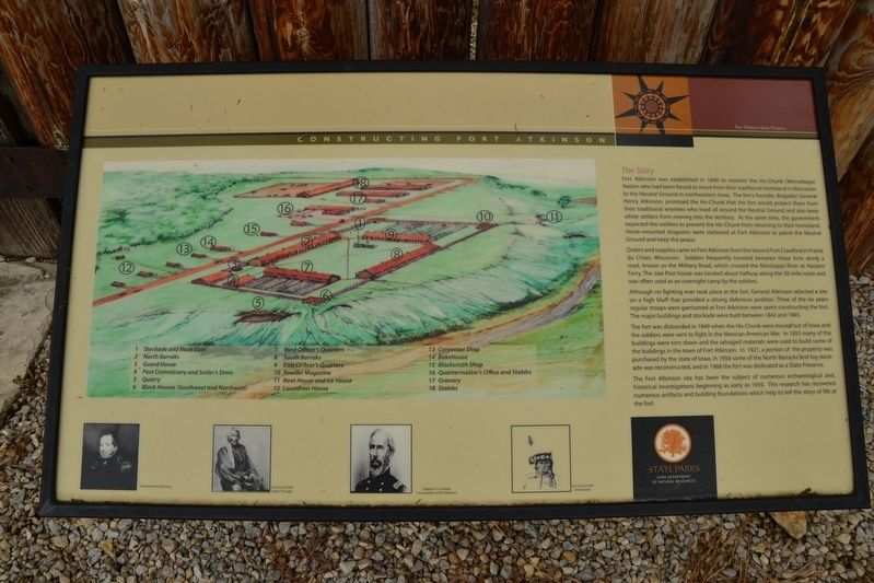
Orders and supplies came to Fort Atkinson from the Second Fort Crawford in Prairie du Chien, Wisconsin. Soldiers frequently traveled between these forts along a road, known as the Military Road, which crossed the Mississippi River at Harpers Ferry. The Joel Post house was located about halfway along the 50-mile route and was often used as an overnight camp by the soldiers.
Although no fighting ever took place at the fort, General Atkinson selected a site on a high bluff that provided a strong defensive position. Three of the six years regular troops
this page online
The fort was disbanded in 1849 when the Ho-Chunk were moved out of Iowa and the soldiers were sent to fight in the Mexican-American War. In 1855 many of the buildings were torn down and the salvaged materials were used to build some of the buildings in the town of Fort Atkinson. In 1921, a portion of the property was purchased by the state of Iowa, in 1958 some of the North Barracks and log stockade was reconstructed, and in 1968 the fort was dedicated as a State Preserve.
The Fort Atkinson site has been the subject of numerous archaeological and historical investigations beginning as early as 1939. This research has recovered numerous artifacts and building foundations which help to tell the story of life at the fort.
Erected by Iowa Department of Natural Resources.
Topics. This historical marker is listed in these topic lists: Forts and Castles • Indigenous Peoples and Communities • Settlements & Settlers. A significant historical year for this entry is 1840.
Location. 43° 8.739′ N, 91° 56.347′ W.
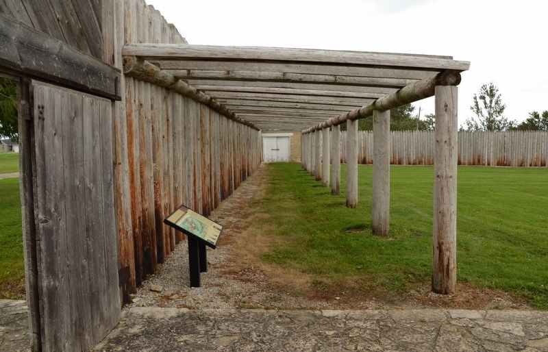

Regionally, this marker is in Northeast Iowa — the Driftless Area and in Eastern Iowa. It is also in the American Midwest, in the Corn Belt, and in the Driftless Area — Bluff Country. Globally, it is in North America, the Western Hemisphere, the Western World, and the Anglosphere. Historically, it finds itself in what was once the territory of the Mississippian Culture and also the Louisiana Purchase.
Other nearby markers. At least 8 other markers are within walking distance of this marker: Fort Atkinson (a few steps from this marker); North Barracks (a few steps from this marker); Stockade & Main Gate (within shouting distance of this marker); East Officers' Quarters (within shouting distance of this marker); Powder House (within shouting distance of this marker); South Barracks (within shouting distance of this marker); Guard House (within shouting distance of this marker); Sutler's Store and Post Commissary (about 300 feet away, measured in a direct line). Touch for a list and map of all markers in Fort Atkinson.
Credits. This page was last revised on May 26, 2021. It was originally submitted on May 24, 2021. This page has been viewed 486 times since then and 36 times this year. Photos: 1, 2. submitted on May 24, 2021. • Mark Hilton was the editor who published this page.
