Jamestown in James City County, Virginia — The American South (Mid-Atlantic)
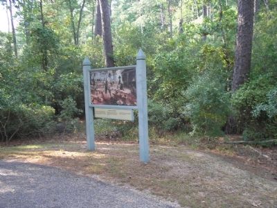
Excellent Good Timber
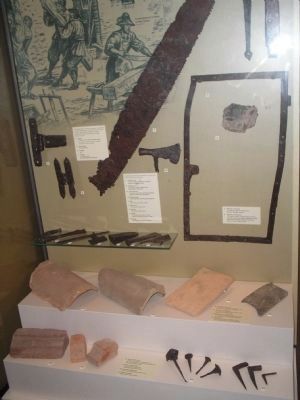
Jamestown’s ruins yielded many tools of woodcutters, sawyers, and carpenters. Coopers were especially busy. Barrels and casks bore shipments for England, and stored colonial supplies.
A two-man crosscut saw was recovered almost intact, from an abandoned site in New Towne. Pit saws were also used.
Erected by Colonial National Historic Park.
Topics. This historical marker is listed in this topic list: Colonial Era.
Location. 37° 12.608′ N, 76° 46.04′ W. Marker is in Jamestown, Virginia, in James City County. Marker is on Loop Drive, on the right when traveling west. Marker is on Jamestown Island, along the Loop Drive. Touch for map. Marker is in this post office area: Jamestown VA 23081, United States of America. Touch for directions.
Other nearby markers. At least 8 other markers are within walking distance of this marker. Jamestown Island (approx. 0.3 miles away); Homes to Last (approx. 0.3 miles away); On Roads of Water (approx. 0.4 miles away); A Diverse Jamestown Household 1620-1640 (approx. 0.4 miles away); May-Hartwell Site 1660-1699 (approx. 0.4 miles away); A Remarkable Collection 1670-1700 (approx. 0.4 miles away); An Upper-Class Neighborhood 1630s-1699 (approx. 0.4 miles away); The Ambler House (approx. 0.4 miles away). Touch for a list and map of all markers in Jamestown.
More about this marker. The top of the marker contains a picture of Jamestown colonists sawing and milling freshly cut timber.
Related markers. Click here for a list of markers that are related to this marker. Take a virtual tour of markers located along the Loop Drive on Jamestown Island.
Also see . . .
1. Island Loop Drive. Colonial National Historic Park from National Park Service website. (Submitted on March 27, 2009, by Bill Coughlin of Woodland Park, New Jersey.)
2. Historic Jamestowne. Historic Jamestowne is the site of the first permanent English settlement in America. The site is jointly administered by APVA Preservation Virginia and the National Park Service. (Submitted on March 27, 2009, by Bill Coughlin of Woodland Park, New Jersey.)
Credits. This page was last revised on June 16, 2016. It was originally submitted on March 27, 2009, by Bill Coughlin of Woodland Park, New Jersey. This page has been viewed 799 times since then and 22 times this year. Photos: 1, 2, 3, 4. submitted on March 27, 2009, by Bill Coughlin of Woodland Park, New Jersey.


