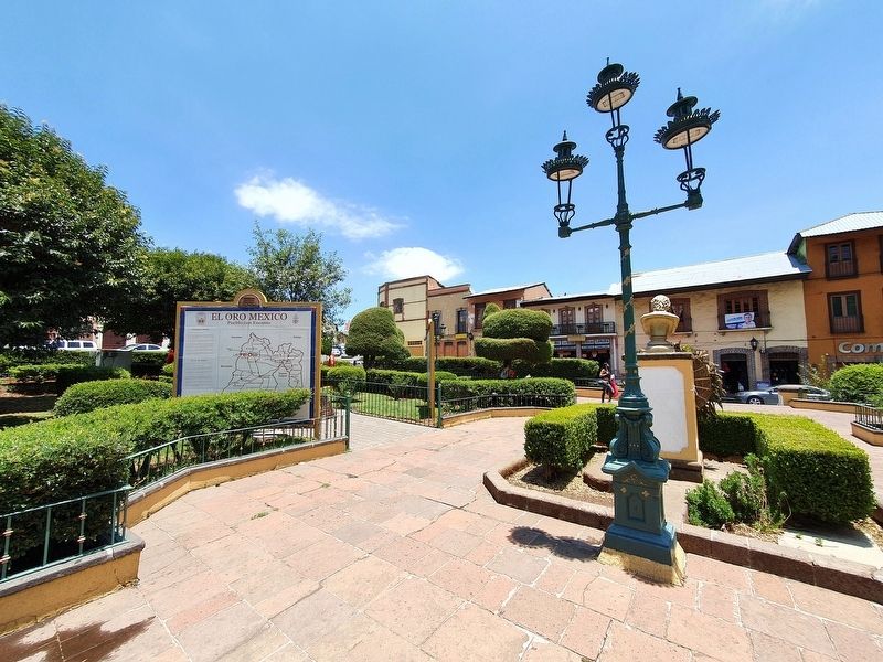
El Oro de Hidalgo, Mexico State, Mexico — The Central Highlands (North America)
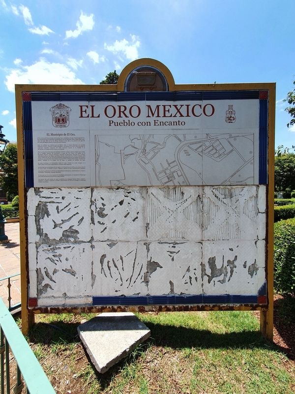
El Oro Mexico
Pueblo con encanto / A Charming Town
Inscription.
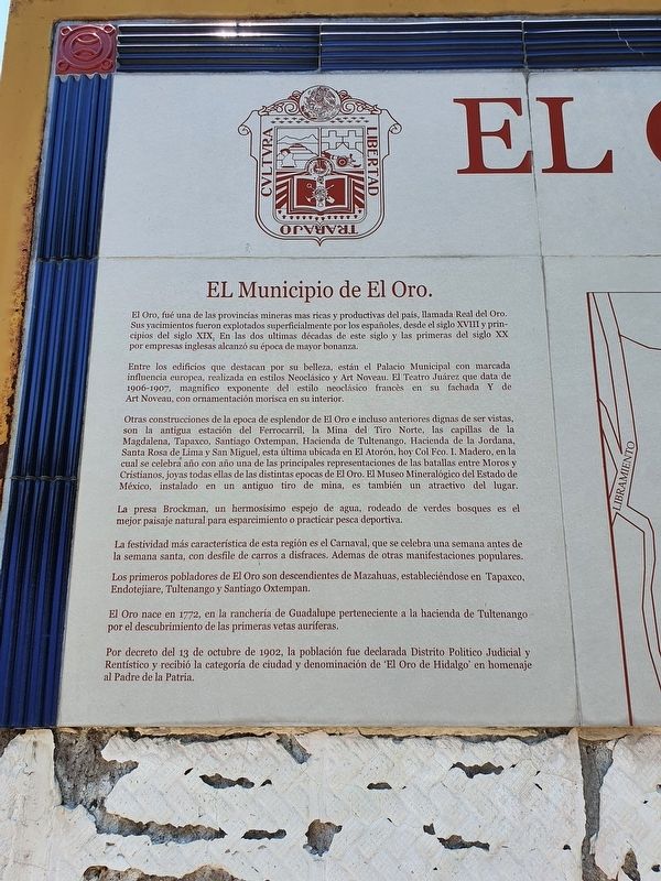
El Oro, fué una de las provincias mineras mas ricas y productivas del país, llamada Real del Oro. Sus yacimientos fueron explotados superficialmente por los españoles, desde el siglo XVIII y principios del siglo XIX. En los dos ultimas décadas de este siglo y Ias primeras del siglo XX por empresas inglesas alcanzó su época de mayor bonanza.
Entre los edificios que destacan por su belleza, están el Palacio Municipal con marcada influencia europea, realizada en estilos Neoclásico y Art Noveau. El Teatro Juárez que data de 1906-1907, magnífico exponente del estilo neoclásico francés en su fachada y de Art Noveau, con ornamentación morisca en su interior.
Otras construcciones de la epoca de esplendor de El Oro e incluso anteriores dignas de ser vistas, son la antigua estación del Ferrocarril, la Mina del Tiro Norte, las capillas de la Magdalena, Tapasco, Santiago Oxtempan, Hacienda de Tultenango, Hacienda de la Jordana, Santa Rosa de Lima y San Miguel, esta última ubicada en El Atorón, hoy Col Fco. L Madero, en la cual se celebra año con ano una de las principales representaciones de las batallas entre Moros y Cristianos, joyas todas ellas de las distintas epocas de El Oro. El Museo Mineralógico del Estado de México, instalado en un antiguo tiro de mina, es también un atractivo del lugar.
La presa Brockman, un hermosísimo espejo de agua, rodeado de verdes bosques es el mejor paisaje natural para esparcimiento o practicar pesca deportiva.
La festividad más característica de esta región es el Carnaval, que se celebra una semana antes de la semana santa, con desfile de carros a disfraces. Ademas de otras manifestaciones populares.
Los primeros pobladores de El Oro son descendientes de Mazahuas, estableciéndose en Tapaxco, Endotejiare, Tultenango y Santiago Oxtempan.
El Oro nace en 1772, en la rancheria de Guadalupe perteneciente a la hacienda de Tultenango por el descubrimiento de las primeras vetas auríferas.
Por decreto del 13 de octubre de 1902, la población fue declarada Distrito Politico Judicial y Rentístico y recibió la categoria de ciudad y denominación de ‘El Oro de Hidalgo’ en homenaje al Padre de la Patria.
Atractivos Turísticos de El Oro
Sitios de Interés
1 Palacio Municipal
2 Teatro Juárez
3 Jardin Madero
4 Templo y jardín de Guadalupe
5 Tiro Norte
6 Antigua Estación del Ferrocarril
7 Museo de la Minería del Estado de México
9 Estadio de Futbol "La Cabecilla"
10 Parque de Beisbol
11 Capilla del Santo Niño"
Servicios
12 Mercado Municipal
13 Terminal de autobuses
14 Gasolinera
15 Hospital General
16 DIF Municipal
17 Cruz Roja
18 Procuraduría de Justicia
19 Banco
20 Preparatoria Of. N° 2
21 Tecalli
22 Rastro municipal
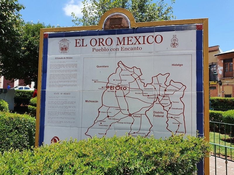
El Estado de México
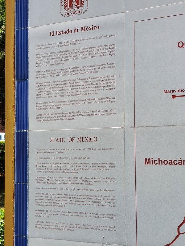
El Estado de México es un estado federal de México. Tiene una área de 22,357 km2 y cuenta aproximadamente con más de 15 millones de habitantes.
El estado comprende 125 municipios agrupados en 16 regiones que son: Región Amecameca, Región Atlacomulco, Región Chimalhuacán, Región Cuautitlán Izcalli, Región Ecatepec, Región Ixtapan de la Sal, Región Lerma, Región Naucalpan, Región Nezahualcoyotl, Región Tejupilco, Región Texcoco, Región Tlalnepantla, Región Toluca, Región Tultitlán, Región Valle de Bravo y Región Zumpango.
La mayor parte del territorio mexiquense se localiza en la parte central de la meseta de Anáhuac, y comprende los valles de México, Toluca, parte del valle de Puebla y las cadenas montañosas de Sierra Nevada, Monte de los Cruces, Monte Alto y Cumbres Occidentales.
El estado de México estuvo involucrado en algunos de los principales cambios sociopolíticos del siglo XIX. Durante la independencia sucedieron algunas reyertas de no poca importancia en su territorio, sobresale la batalla del Monte de las Cruces, en la que lidalgo derrota al ejercito realista comandado por el ieniente coronel Torcuato Trujillo. Consumada la independencia, el primero de 1824 se declaró al estado de México como libre y soberano, instalándose el mismo año el Primer Congreso del listado el dia 2 de marzo.
El 14 de febrero de 1827 se promulgo la primera Constitución Política del Estado de México en Texcoco (lugar donde estaban instalados los poderes del estado, luego lo capital pasó definitivamente a Toluca en 1830).
Después, durante las primeras decadas de vida independiente, el estado de México sufrirá numerosas secesiones, ya que del original estado de México surgirían los actuales estados de Hidalgo, Morelos, Guerrero y el Distrito Federal.
The City of El Oro (The Gold)
El Oro, formed one of the richest and productive mining provinces of the country, named Real del Oro. Its gold deposits were exploited by Spaniards since the XVIII century and the first half of the XIX century. In the last two decades of that century and the first of the XX century, as an English enterprise, it achieved its mayor fortune.
Among the buildings which stand out for their beauty, we can see City Hall with its marked European influence in a Neoclassic and Art Noveau style. The Juarez Theater which dates back to 1906 - 1907, is a magnificent French Neoclassic and Art Noveau style with interior Moorish omaments.
Other constructions of the period of splendor of El Oro and even before, worthy to be appreciated, are the ancient Railroad Station, the Tiro Norte Mine, the chapels - La Magdalena, Tapaxco, Santiago Oxtempan, Hacienda Tultenango and Hacienda de la Jordana. All jewels of the different periods of El Oro. The Mineralogic Museum of the state of Mexico, located at the old mine shaft, is also an attraction.
The Brockman Dam, is a large beautiful reflection of water outlined by a natural landscape for recreation and sport fishing.
The characteristic festivity of the region is the Camaval, celebrated a week before Easter Week, with a parade of decorated floats and costumes. In addition to other popular manifestations.
The first inhabitants of El Oro are descendents of Mazahuas, who settled in Tapaxco, Endotejiare, Tultenango and Santiago Oxtempan.
El Oro was founded in 1772, at Rancho Guadalupe pertaining to Hacienda Tultenango, from the discovery of gold veins.
By decree, on the 13th of October 1902, the town was declared a Political, Judicial and Financial District, receiving le category of City and was given the name El Oro de Hidalgo, in homage to “The Father of the Nation".
List
of tourist and service areas serving as a map key not translated
State of Mexico
Mexico State, is a federal state of Mexico. It has an area of 22,257 Km2 and approximately a population of more than 15 million.
The state is made up or 125 townships, grouped in 16 regions which are:
Region Amecameca, Region Atlacomulco, Region Chimalhuacan, Region Cuautitln Izcalli, Region Ecatepec, Region Ixtapan de la Sal. Region Lerma, Region Naucalpan, Region Nezahualcoyil, Region Tejupilco, Region Texcoco, Region Tlalnepantla, Region Toluca, Region Tultitlán, Region Valle de Bravo, and Region Zumpango.
The main part of the state’s territory is located in the center plateau of Anahuac, and it involves the Valley of Mexico, Toluca, part of the Valley of Puebla and mountain range of the Sierra Nevada, Monte de las Cruces, Monte Alto and the westem mountains.
Mexico State was involved in some of the principle social-political changes of the XIX century.
During the battle of Independence, there were a few insignificant disputes in the territory, the battle that stands out is the one in Monte de las Cruces, where Hidalgo defeated the royal army commanded by Lt. Col. Torcuato Trujillo. Once consummated the Independence, in 1824 the State of Mexico was declared free and sovereign and on March 2nd of the same year, the First Congress of the State was installed.
On February 14, 1827, the First Political Constitution of the State of Mexico, was proclaimed in Texcoco, (city where powers of the state were installed, later the capital passed definitely to Toluca in 1830).
Afterwards, during the first decade of Independence, the State of Mexico went through numerous successions, from which the original State of Mexico derived the actual States of Hidalgo, Morelos, Guerrero and the Federal District.
Topics. This historical marker is listed in these topic lists: Architecture • Industry & Commerce. A significant historical year for this entry is 1772.
Location. 19° 48.035′ N, 100° 7.798′ W. Marker is in El Oro de Hidalgo, Estado de Mexico (Mexico State). Marker is on Route 5 just west of Jardin Madero, on the left when traveling west. Touch for map. Marker is in this post office area: El Oro de Hidalgo MEX 50600, Mexico. Touch for directions.
Other nearby markers. At least 8 other markers are within walking distance of this marker. Bicentennial Tree (here, next to this marker); El Oro Town Plaza (a few steps from this marker); Viceroy Antonio de Mendoza in El Oro (a few steps from this marker); Abraham Angel (a few steps from this marker); Grocery Store (about 90 meters away, measured in a direct line); Architectural Heritage of El Oro (about 120 meters away); The Vicarage of El Oro (about 150 meters away); The Revolutionary and Labor Movement in El Oro (about 150 meters away). Touch for a list and map of all markers in El Oro de Hidalgo.
Credits. This page was last revised on June 11, 2021. It was originally submitted on May 26, 2021, by J. Makali Bruton of Accra, Ghana. This page has been viewed 104 times since then and 15 times this year. Photos: 1, 2, 3, 4, 5. submitted on May 26, 2021, by J. Makali Bruton of Accra, Ghana.
