Near Crawford in Dawes County, Nebraska — The American Midwest (Upper Plains)
Fort Robinson
Photographed by Michael Stroud
1. Fort Robinson
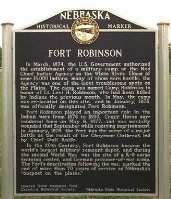
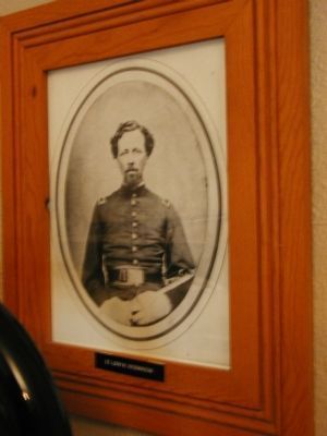
In March, 1874, the U.S. Government authorized the establishment of a military camp at the Red Cloud Indian Agency on the White River. Home of some 13,000 Indians, many of whom were hostile, the Agency was one of the most troublesome spots on the Plains. The camp was named Camp Robinson in honor of Lt. Levi H. Robinson, who had been killed by Indians the previous month. In May, the camp was re-located on this site, and in January, 1878, was officially designated Fort Robinson.
Fort Robinson played an important role in the Indian wars from 1876 to 1890. Crazy Horse surrendered here on May 6, 1877, and was mortally wounded that September while resisting imprisonment. In January, 1879, the Fort was the scene of a major battle as the result of the Cheyenne Outbreak led by Chief Dull Knife.
In the 20th Century, Fort Robinson became the world's largest military remount depot, and during the second World War, was the site of a K-9 corps training center, and German prisoner-of-war camp. The Fort's deactivation following the war, marked the end of more than 70 years of service as Nebraska's "outpost on the plains."
Erected 1997
this page online
Topics and series. This historical marker is listed in these topic lists: Forts and Castles • Military • War, World II • Wars, US Indian. In addition, it is included in the Nebraska State Historical Society series list. A significant historical month for this entry is January 1878.
Location. 42° 39.92′ N, 103° 27.957′ W. Marker is near Crawford, Nebraska, in Dawes County. It is on Highway 20 (U.S. 20), on the right when traveling east. Coordinates are approximate. The Marker is located in Fort Robinson State Park, off U.S. 20 near the old parade grounds on Fort Robinson. Touch for map. Marker is at or near this postal address: 3200 Highway 20, Crawford NE 69339, United States of America. Touch for directions.

Regionally, this marker is in the Nebraska Panhandle. It is also in the American Midwest, in the Corn Belt, on the prairies, on the Great Plains, on the Northern Plains, and specifically on the High Plains. Globally, it is in North America, the Western Hemisphere, the Western World, and the
Photographed by G. Butler (from public internet source), July 17, 2007
2. Fort Robinson Marker
Other nearby markers. At least 8 other markers are within walking distance of this marker: Crazy Horse (within shouting distance of this marker); Adjuncts Office/Guardhouse (within shouting distance of this marker); Cavalry Barracks/Cheyenne Outbreak (about 400 feet away, measured in a direct line); Officers’ Row, 1874-1875 (about 400 feet away); 1909 Brick Barracks (about 700 feet away); The Flight of the Cheyennes (approx. 0.2 miles away); Ft. Robinson (approx. 0.2 miles away); Chief Crazy Horse (approx. 0.2 miles away). Touch for a list and map of all markers in Crawford.
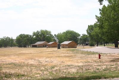
More about this marker. The Nebraska State Historical Society reconstructed the original post guardhouse, scene of the killing of Crazy Horse, in 1967. It is the rightmost building in picture 2.
After Crazy Horse was stabbed he was taken to the post adjutant's office where he died. The Nebraska State Historical Society reconstructed the original post adjutant's office in 1969. It is the center building in picture 2. The stone monument near this building reads, "On this
Photographed by Linda Sue Heist, July 5, 2010
3. Old Parade Ground (1874)
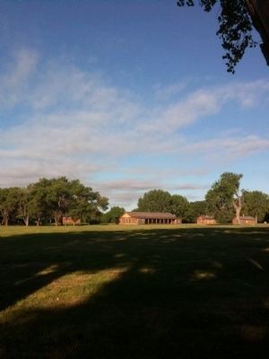
From left to right: Cheyenne Outbreak Barracks, Adjutant's Office and Guardhouse (Crazy Horse was mortally wounded at the Guardhouse and died in the Adjutant's Office). The Adjutant's Office and the Guardhouse are reconstructions based on historical records.
The leftmost building in picture 2 are original barracks reconstructed in 2003 by the Nebraska State Historical Society. On the night of January 9, 1879, imprisoned Northern Cheyennes broke out of this barracks.
Photographed by Jeff Leichsenring, June 30, 2023
4. Fort Robinson Officers' Row
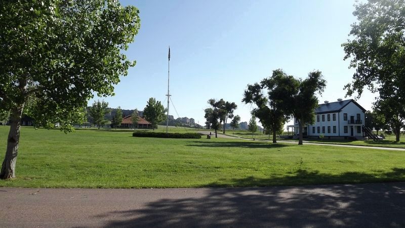
Photographed by Jeff Leichsenring, June 30, 2023
5. Post Headquarters and Parade Grounds
July 22, 2006
6. Lieutenant Levi Robinson, for whom the fort was named
Photographed by Michael Stroud
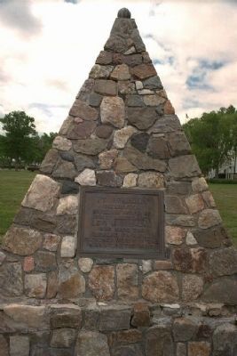
7. Levi Robinson Monument
For whom the Fort was named
Photographed by Michael Stroud
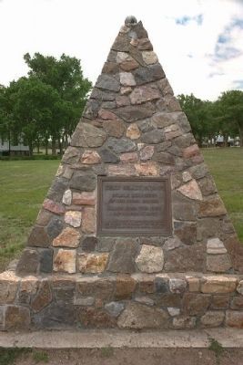
8. Nearby Crazy Horse Monument
A separate Fort Robinson monument marking the murder of Crazy Horse.
Photographed by Michael Stroud
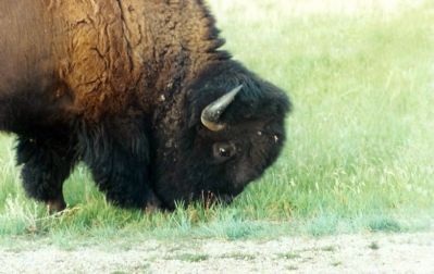
9. A local resident...
Credits. This page was last revised on February 14, 2026. It was originally submitted on January 3, 2008, by Kevin W. of Stafford, Virginia. This page has been viewed 5,254 times since then and 106 times this year. Last updated on May 26, 2021, by Connor Olson of Menomonee Falls, Wisconsin. Photos: 1. submitted on December 20, 2007, by Mike Stroud of Bluffton, South Carolina. 2. submitted on January 3, 2008, by Kevin W. of Stafford, Virginia. 3. submitted on July 12, 2010, by Linda Sue Heist of Lincoln, Nebraska. 4, 5. submitted on July 4, 2023, by Jeff Leichsenring of Garland, Texas. 6. submitted on January 4, 2008, by Kevin W. of Stafford, Virginia. 7, 8, 9. submitted on December 20, 2007, by Mike Stroud of Bluffton, South Carolina. • J. Makali Bruton was the editor who published this page.
