Silver City in Lyon County, Nevada — The American Mountains (Southwest)
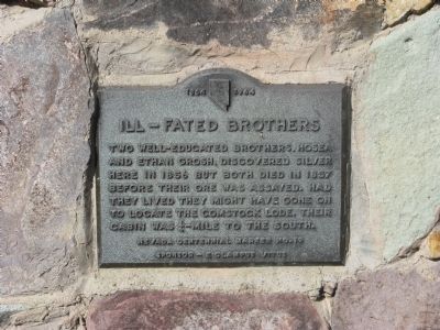
Ill-Fated Brothers - Hosea and Ethan Grosh
Nevada Centennial Marker No.19
| — | 1864 – 1964 | — |
Photographed by Syd Whittle, August 24, 2009
1. Ill-Fated Brothers Marker
Erected 1964 by E Clampus Vitus. (Marker Number 19.)
Topics and series. This historical marker is listed in these topic lists: Industry & Commerce • Settlements & Settlers. In addition, it is included in the E Clampus Vitus series list. A significant historical year for this entry is 1856.
Location. 39° 15.84′ N, 119° 38.46′ W. Marker is in Silver City, Nevada, in Lyon County. It is on Main Street (Nevada Route 342) near Roses Road, on the left when traveling north. Touch for map. Marker is at or near this postal address: 71 Main Street, Silver City NV 89428, United States of America. Touch for directions.

Regionally, this marker is in the Sierra Nevada and in Greater Reno Area. It is also in the American Mountain West. Globally, it is in North America, the Western Hemisphere, the Western World, and the Anglosphere. Historically, it finds itself in what was once New
this page online
Other nearby markers. At least 8 other markers are within 3 miles of this marker, measured as the crow flies: Silver City Schoolhouse (about 500 feet away, measured in a direct line); Devil’s Gate (approx. 0.2 miles away); Johntown (approx. half a mile away); American City (approx. 2 miles away); Jumbo (West Comstock) (approx. 2 miles away); Gold Hill Hotel (approx. 2.1 miles away); Gold Hill Brewery (approx. 2.1 miles away); I.O.O.F. Monument (approx. 2.1 miles away). Touch for a list and map of all markers in Silver City.
Photographed by Syd Whittle, August 24, 2009
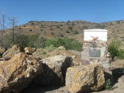
2. Ill-Fated Brothers Marker and Surrounding Terrain
Credits. This page was last revised on May 28, 2021. It was originally submitted on August 26, 2009, by Syd Whittle of Mesa, Arizona. This page has been viewed 1,818 times since then and 64 times this year. Last updated on May 28, 2021, by Matthew J Ebert of Gerlach, NV. Photos: 1, 2. submitted on August 26, 2009, by Syd Whittle of Mesa, Arizona.
