Justiceburg in Garza County, Texas — The American South (West South Central)
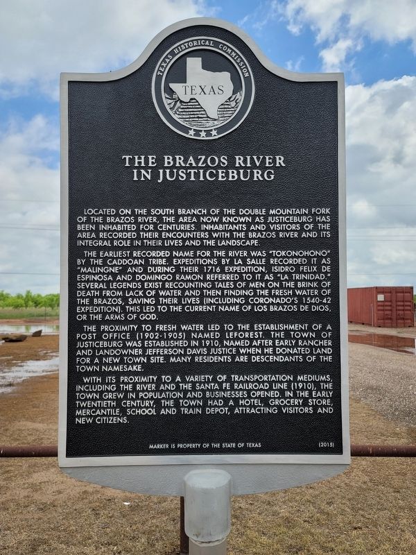
The Brazos River in Justiceburg
Located on the south branch of the Double Mountain fork of the Brazos River, the area now known as Justiceburg has been inhabited for centuries. Inhabitants and visitors of the area recorded their encounters with the Brazos River and its integral role in their lives and the landscape.
The earliest recorded name for the river was “Tokonohono” by the Caddoan Tribe. Expeditions by La Salle recorded it as “Malingne” and during their 1716 expedition, Isidro Felix de Espinosa and Domingo Ramon referred to it as “La Trinidad.” Several legends exist recounting tales of men on the brink of death from lack of water and then finding the fresh water of the Brazos, saving their lives (including Coronado’s 1540-42 expedition). This led to the current name of Los Brazos de Dios, or the arms of God.
The proximity to fresh water led to the establishment of a post office (1902-1905) named Leforest. The town of Justiceburg was established in 1910, named after early rancher and landowner Jefferson Davis Justice when he donated land for a new town site. Many residents are descendants of the town namesake.
With its proximity to a variety of transportation mediums, including the river and the Santa Fe railroad line (1910), the town grew in population and businesses opened. In the early twentieth century, the town had a hotel, grocery store, mercantile, school and train depot, attracting visitors and new citizens.
Marker is the property of the State of Texas
Erected 2015 by Texas Historical Commission. (Marker Number 18288.)
Topics. This historical marker is listed in these topic lists: Settlements & Settlers • Waterways & Vessels. A significant historical year for this entry is 1716.
Location. 33° 2.616′ N, 101° 12.168′ W. Marker is in Justiceburg, Texas, in Garza County. Marker is on U.S. 84, 0.4 miles south of Farm to Market Road 2458, on the right when traveling north. Touch for map. Marker is in this post office area: Justiceburg TX 79330, United States of America. Touch for directions.
Other nearby markers. At least 8 other markers are within 14 miles of this marker, measured as the crow flies. Llano Estacado (approx. 5.3 miles away); Fluvanna (approx. 11.4 miles away); Fluvanna Mercantile Company (approx. 11.4 miles away); Site of First Presbyterian Church of Fluvanna (approx. 11.6 miles away); Former Townsite of Light (approx. 11.7 miles away); Terrace Cemetery Gateway (approx. 13˝ miles away); Terrace Cemetery (approx. 13˝ miles away); Post (approx. 13.8 miles away).
Credits. This page was last revised on May 29, 2021. It was originally submitted on May 29, 2021, by Allen Lowrey of Amarillo, Texas. This page has been viewed 248 times since then and 24 times this year. Photos: 1, 2, 3. submitted on May 29, 2021, by Allen Lowrey of Amarillo, Texas. • J. Makali Bruton was the editor who published this page.


