Orchard Lake in Oakland County, Michigan — The American Midwest (Great Lakes)
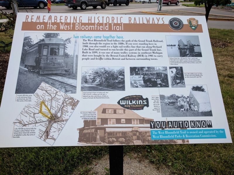
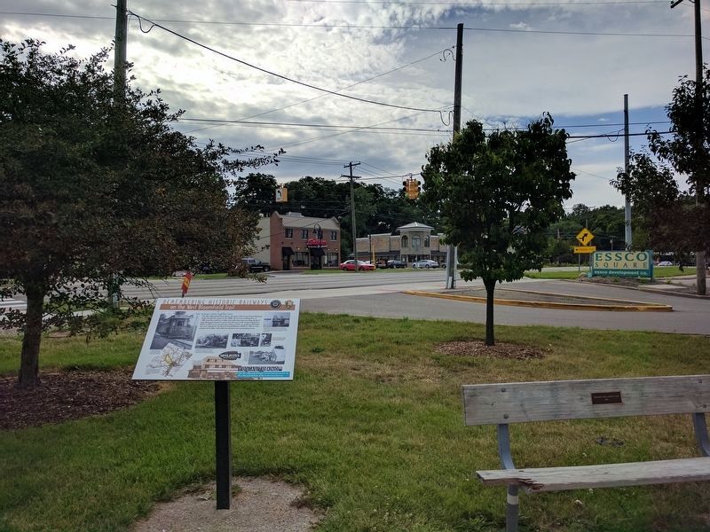
Remembering Historic Railways
on the West Bloomfield Trail
Photographed by Joel Seewald, July 2, 2017
1. Remembering Historic Railways Marker
Two railways came together here.
The West Bloomfield Trail follows the path of the Grand Trunk Railroad, built through the region in the 1880s. If you were standing here in 1900, you also would see a light rail trolley line that ran along Orchard Lake Road and turned to run beside this part of the Grand Trunk line. Built in 1899, it was one of many trolley systems in southeast Michigan that were bought by the Detroit United Railway (DUR) in 1901 to carry people and freight within Detroit and between surrounding towns.
You Auto Know
The West Bloomfield Trail is owned and operated by the West Bloomfield Parks & Recreation Commission.
Erected by Motorcities National Heritage Area, National Park Service.
Topics and series. This historical marker is listed in this topic list: Railroads & Streetcars. In addition, it is included in the MotorCities National Heritage Area series list. A significant historical year for this entry is 1900.
Location. 42° 34.604′ N, 83° 21.722′ W. Marker is in Orchard Lake, Michigan, in Oakland County. It can be reached from Orchard Lake Road 0.2 miles south of Pontiac Trail, on the left when
this page online

Regionally, this marker is in Southeast Michigan and in Greater Detroit. It is also in the American Midwest. Globally, it is in North America, the Western Hemisphere, the Western World, and the Anglosphere. Historically, it finds itself in what was once the Northwest Territory.
Other nearby markers. At least 8 other markers are within walking distance of this marker: Emmendorfer House / Francis A. Emmendorfer (approx. 0.2 miles away); Chief Pontiac (approx. 0.3 miles away); Drawn by Water (approx. 0.4 miles away); Green School Bell (approx. 0.4 miles away); Conglomerate Boulder (approx. 0.4 miles away); Apple Island (approx. 0.4 miles away); The Orchard Lake Museum (approx. half a mile away); Waiting for the Trolleys (approx. half a mile away). Touch for a list and map of all markers in Orchard Lake.
Related marker. Click here for another marker that is related to this marker.
Photographed by Joel Seewald, July 2, 2017
2. Upper Left Image
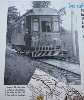
An electric DUR trolley running on the track between Pontiac and Orchard Lake, about 1910. Photo courtesy of Brian Golden.
Photographed by Joel Seewald, July 2, 2017
3. Lower Left Image
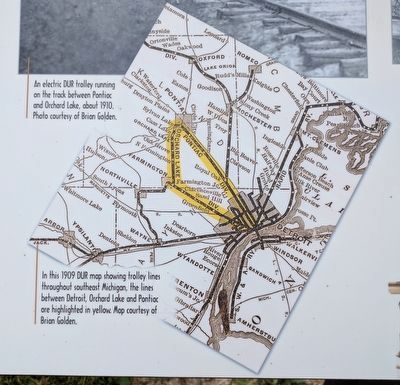
In this 1909 DUR map showing trolley lines throughout southeast Michigan, the lines between Detroit, Orchard Lake and Pontiac are highlighted in yellow. Map courtesy of Brian Golden.
Photographed by Joel Seewald, July 2, 2017
4. Center Left Image
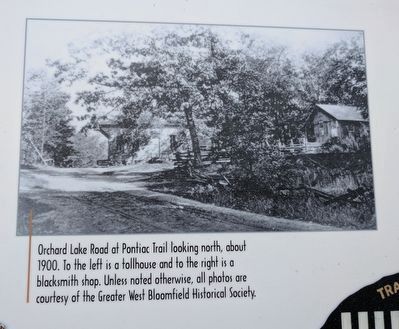
Orchard Lake Road at Pontiac Trail looking north, about 1900. To the left is a tollhouse and to the right is a blacksmith shop. Unless noted otherwise, all photos are courtesy of the Greater West Bloomfield Historical Society.
Photographed by Joel Seewald, July 2, 2017
5. Center Lower Image
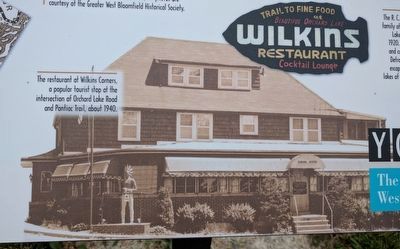
The restaurant at Wilkins Corners, a popular tourist stop at the intersection of Orchard Lake Road and Pontiac Trail, about 1940.
Photographed by Joel Seewald, July 2, 2017
6. Upper Right Image
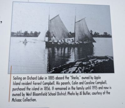
Sailing on Orchard Lake in 1885 aboard the "Sheila," owned by Apple Island resident Forrest Campbell. His parents, Colin and Caroline Campbell, purchased the island in 1856. It remained in the family until 1915 and now is owned by West Bloomfield School District. Photo by Al Butler, courtesy of the McIsaac Collection.
Photographed by Joel Seewald, July 2, 2017
7. Middle Right Images
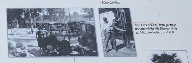
Heavy traffic at Wilkins Corners gas station and water well (far left). Attendants at the gas station clowning (left), about 1930.
Photographed by Joel Seewald, July 2, 2017
8. Remembering Historic Railways Marker
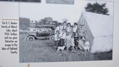
The R. C. Banker family at Walnut Lake, about 1920. Trolleys and cars gave Detroiters an escape to the lakes of Oakland County.
Photographed by Joel Seewald, July 2, 2017
9. Remembering Historic Railways Marker
Credits. This page was last revised on May 30, 2021. It was originally submitted on July 4, 2017, by Joel Seewald of Madison Heights, Michigan. This page has been viewed 799 times since then and 28 times this year. Last updated on May 30, 2021, by J.T. Lambrou of New Boston, Michigan. Photos: 1, 2, 3, 4, 5, 6, 7, 8, 9. submitted on July 4, 2017, by Joel Seewald of Madison Heights, Michigan. • Mark Hilton was the editor who published this page.
