Chaptico in St. Mary's County, Maryland — The American Northeast (Mid-Atlantic)
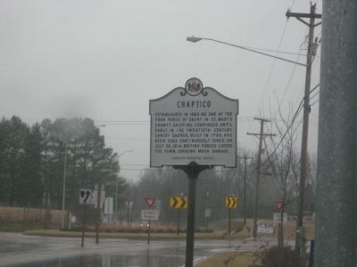
Chaptico
Erected by Maryland Historical Society.
Topics. This historical marker is listed in these topic lists: Churches & Religion • Colonial Era • Industry & Commerce • War of 1812. A significant historical month for this entry is July 1980.
Location. 38° 22.103′ N, 76° 46.943′ W. Marker is in Chaptico, Maryland, in St. Mary's County. Marker is at the intersection of Budds Creek Road (Maryland Route 234) and Chaptico Road (Maryland Route 238), on the right when traveling south on Budds Creek Road. Maker is about 200 feet north of the roundabout at the intersection of Routes 234 and 238. Touch for map. Marker is in this post office area: Chaptico MD 20621, United States of America. Touch for directions.
Other nearby markers. At least 8 other markers are within 6 miles of this marker, measured as the crow flies. A different marker also named Chaptico (about 400 feet away, measured in a direct line); Christ Church King and Queen Parish (approx. 0.2 miles away); Prosperous Port Town (approx. 0.2 miles away); "Deep Falls" (approx. 1˝ miles away); Veterans of Helen Memorial (approx. 3˝ miles away); Forest Hall (approx. 4.9 miles away); Extending the Rail (approx. 5.2 miles away); Tobacco Barns (approx. 5.3 miles away). Touch for a list and map of all markers in Chaptico.
Credits. This page was last revised on June 16, 2016. It was originally submitted on March 28, 2009, by F. Robby of Baltimore, Maryland. This page has been viewed 1,383 times since then and 61 times this year. Photo 1. submitted on March 28, 2009, by F. Robby of Baltimore, Maryland.
