Baxter Springs in Cherokee County, Kansas — The American Midwest (Upper Plains)
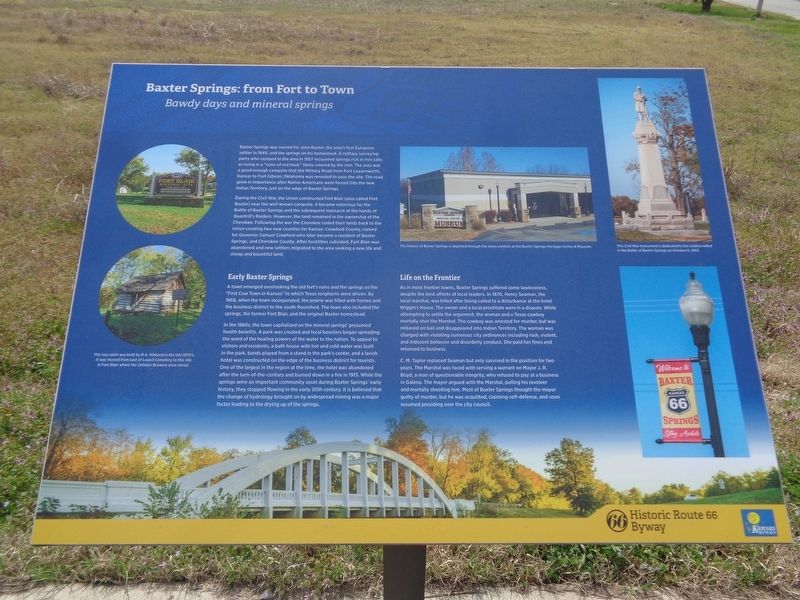
Baxter Springs: from Fort to Town
Bawdy days and mineral springs
Photographed by Jason Voigt, April 6, 2021
1. Baxter Springs: from Fort to Town Marker
During the Civil War, the Union constructed Fort Blair (also called Fort Baxter) near the well-known campsite. It became notorious for the Battle of Baxter Springs and the subsequent massacre at the hands of Quantrill's Raiders. However, the land remained in the ownership of the Cherokee. Following the war the Cherokee ceded their lands back to the Union creating two new counties for Kansas: Crawford County, named for Governor Samuel Crawford who later became a resident of Baxter Springs, and Cherokee County. After hostilities subsided, Fort Blair was abandoned and new settlers
this page online
Early Baxter Springs
A town emerged overlooking the old fort's ruins and the springs as the "First Cow Town in Kansas" to which Texas longhorns were driven. By 1868, when the town incorporated, the prairie was filled with homes and the business district to the south flourished. The town also included the springs, the former Fort Blair, and the original Baxter homestead.
In the 1880s, the town capitalized on the mineral springs' presumed health benefits. A park was created and local boosters began spreading the word of the healing powers of the water to the nation. To appeal to visitors and residents, a bath house with hot and cold water was built in the park, bands played from a stand in the park's center, and a lavish hotel was constructed on the edge of the business district for tourists. One of the largest in the region at the time, the hotel was abandoned after the turn-of-the-century and burned down in a fire in 1913. While the springs were an important community asset during Baxter Springs' early history, they stopped flowing in the early 20th century.
Photographed by Jason Voigt, April 6, 2021
2. Baxter Springs: from Fort to Town Marker
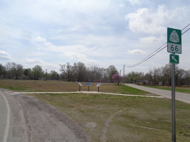
Marker is the middle of the three
Life on the Frontier
As in most frontier towns, Baxter Springs suffered some lawlessness, despite the best efforts of local leaders. In 1870, Henry Seaman, the local marshal, was killed after being called to a disturbance at the hotel Wiggin's House. The owner and a local prostitute were in a dispute. While attempting to settle the argument, the woman and a Texas cowboy mortally shot the Marshal. The cowboy was arrested for murder, but was released on bail and disappeared into Indian Territory. The woman was charged with violating numerous city ordinances including rash, violent, and indecent behavior and disorderly conduct. She paid her fines and returned to business.
C.M. Taylor replaced Seaman but only survived in the position for two years. The Marshal was faced with serving a warrant on Mayor J. R. Boyd, a man of questionable integrity, who refused to pay at a business in Galena. The mayor argued with the Marshal, pulling his revolver and mortally shooting him. Most of Baxter Springs thought the mayor guilty of murder, but he was acquitted, claiming self-defense, and soon resumed presiding over the city council.
Topics. This historical marker is listed in these topic lists: Forts and Castles • Industry & Commerce • Settlements & Settlers • War, US Civil. A significant historical year for this entry is 1849.
Location. 37° 2.042′ N, 94° 44.425′ W. Marker is in Baxter Springs, Kansas, in Cherokee County. It is at the intersection of West 2nd Street and Willow Avenue (Old U.S. 66), on the right when traveling east on West 2nd Street. Touch for map. Marker is at or near this postal address: 522 W 2nd St, Baxter Springs KS 66713, United States of America. Touch for directions.

Regionally, this marker is in Eastern Kansas and specifically in Bleeding Kansas Border War Country. It is also in the American Midwest, in the Corn Belt, on the prairies, and on the Southern Plains. Globally, it is in North America, the Western Hemisphere, the Western World, and the Anglosphere. Historically, it finds itself in what was once New Spain and also the Louisiana Purchase.
Other nearby markers. At least 8 other markers are within walking distance of this marker: Tbe Economic Engines (here, next to this marker); The Earliest Residents (here, next to this marker); Civil War Tour (approx. 0.3 miles away); Baxter Springs Massacre (approx. 0.3 miles away); Baxter Springs Massacre 1863 (approx. 0.3 miles away); Baxter Springs, Kansas (approx. 0.3 miles away); Baxter Springs Massacre Burial Site (approx. 0.4 miles away); Battle of Baxter Springs (approx. half a mile away). Touch for a list and map of all markers in Baxter Springs.
Credits. This page was last revised on May 30, 2021. It was originally submitted on May 30, 2021, by Jason Voigt of Glen Carbon, Illinois. This page has been viewed 716 times since then and 56 times this year. Photos: 1, 2. submitted on May 30, 2021, by Jason Voigt of Glen Carbon, Illinois.
