Weatherford in Parker County, Texas — The American South (West South Central)
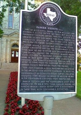
Parker County, C.S.A.
Part of a colonial grant to S.M. Williams and Stephen F. Austin, father of Texas, but with no permanent settlers before 1850, this county was created in 1855 and named for Isaac Parker, its legislative sponsor. By 1860 it had 4,213 people and in 1861 its voters favored secession 535 to 61.
Oliver Loving, a settler, was an official stock raiser, furnishing beef to the Confederacy in the Civil War. He and 18 other men organized a full-time patrol against the frequent, bloody Indian raids. Citizens of adjacent counties took refuge here. In 1864 three local men were charged with treason. One admitted inviting federal General J.G. Blunt to come from the Cherokee nation and give Parker County protection from the Indians.
Gen. John R. Baylor, a local rancher, was an officer in the Arizona-New Mexico campaign to make the Confederacy an ocean-to-ocean nation, and after victories there became Governor of Arizona. He was in the Confederate Congress from 1863 to 1865.
Parker County sent the Confederate army nine companies. Its Company E, 19th Texas Cavalry, served in Parsons' Brigade--which fought over 20 engagements in three years with considerable distinction.
Erected 1964 by State Historical Survey Committee. (Marker Number 3941.)
Topics. This historical marker is listed in this topic list: War, US Civil. A significant historical year for this entry is 1850.
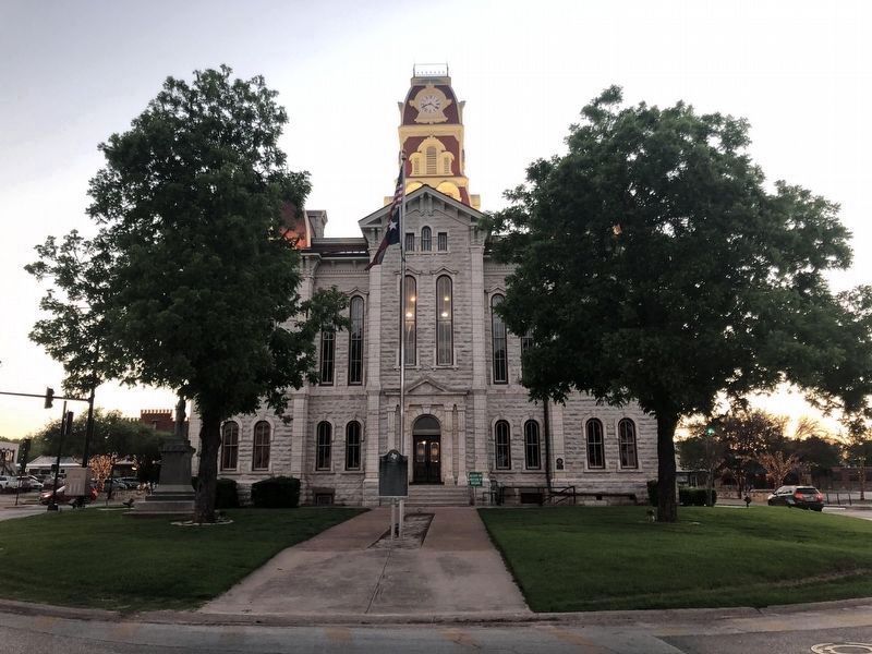
Location. 32° 45.537′ N, 97° 47.822′ W. Marker is in Weatherford, Texas, in Parker County. Marker is at the intersection of Forth Worth Highway (U.S. 180) and South Main Street (Texas Highway 171) when traveling east on Forth Worth Highway. Touch for map. Marker is at or near this postal address: One Courthouse Square, Weatherford TX 76086, United States of America. Touch for directions.
Other nearby markers. At least 8 other markers are within walking distance of this marker. Parker County Confederate Veterans Memorial (a few steps from this marker); Parker County Courthouse (a few steps from this marker); Weatherford (within shouting distance of this marker); Merchants and Farmers State Bank (within shouting distance of this marker); Citizens National Bank (about 300 feet away, measured in a direct line); Weatherford Post Office (about 300 feet away); Franco-Texan Land Company Building (about 500 feet away); 1933 Weatherford City Hall (about 600 feet away). Touch for a list and map of all markers in Weatherford.
Additional keywords. Parker County, C.S.A.
Credits. This page was last revised on June 2, 2021. It was originally submitted on April 10, 2012, by Zacharias Beau T of Alpine, Texas. This page has been viewed 1,116 times since then and 68 times this year. Last updated on June 2, 2021, by Ruth VanSteenwyk of Aberdeen, South Dakota. Photos: 1. submitted on April 10, 2012, by Zacharias Beau T of Alpine, Texas. 2. submitted on June 2, 2021, by Ruth VanSteenwyk of Aberdeen, South Dakota. • J. Makali Bruton was the editor who published this page.

