Joy in Livingston County, Kentucky — The American South (East South Central)
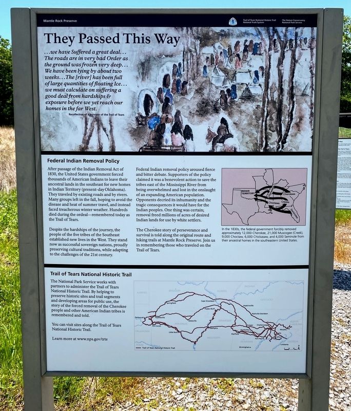
They Passed This Way
Mantle Rock Preserve
"...we have Suffered a great deal...The roads are in very bad Order as the ground was frozen very deep...We have been lying by about two weeks...The [river] has been full of large quantities of floating Ice...we must calculate on suffering a good deal from hardships & exposure before we yet reach our homes in the far West."
- Recollection of a survivor of the Trail of Tears.
Federal Indian Removal Policy
After the passage of the Indian Removal Act of 1830, the United States government forced thousands of American Indians to leave their ancestral lands in the southeast for new homes in Indian Territory (present-day Oklahoma). They traveled by existing roads and by rivers. Many groups left in the fall, hoping to avoid the disease and heats of summer travel, and instead faced treacherous winter weather. Hundreds died during the ordeal - remembered today as the Trail of Tears.
Despite the hardships of the journey, the people of the five tribes of the Southeast established new lives in the West. They stand now as successful sovereign nations, proudly preserving cultural traditions, while adapting to the challenges of the 21st century.
Federal Indian removal policy aroused fierce and bitter debate. Supporters of the policy claimed it was a benevolent action to save the tribes east of the Mississippi River from being overwhelmed and lost in the onslaught of an expanding American population. Opponents decried its inhumanity and the tragic consequences it would have for the Indian peoples. One thing was certain; removal freed millions of acres of desired Indian lands for use by white settlers.
The Cherokee story of perseverance and survival is told along the original route and hiking trails at Mantle Rock Preserve. Join us in remembering those who traveled on the Trail of Tears.
Caption:
In the 1830s, the federal government forcibly removed approximately 12,000 Cherokee, 21,000 Muscogee (Creek), 9,000 Choctaw, 6,000 Chickasaw, and 4,000 Seminole from their ancestral homes in the southeastern United States.
Trail of Tears National Historic Trail
The National Park Service works with partners to administer the Trail of Tears National Historic Trail. By helping to preserve historic sites and trail segments and developing areas for public use, the story of the forced removal of the Cherokee people and other American Indian tribes is remembered and told.
You can visit sites along the Trail of Tears National Historic Trail.
Learn more at www.nps.gov/trte
Erected by Trail of Tears National Historic Trail - National Park Service - The Nature Conservancy
.
Topics and series. This historical marker is listed in this topic list: Native Americans. In addition, it is included in the Trail of Tears series list.
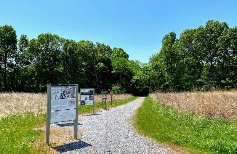
Location. 37° 21.512′ N, 88° 25.302′ W. Marker is in Joy, Kentucky, in Livingston County. Marker is on Kentucky Route 133, on the left when traveling north. The marker is located at the parking lot and trailhead for Mantle Rock Nature Preserve. Touch for map. Marker is in this post office area: Hampton KY 42047, United States of America. Touch for directions.
Other nearby markers. At least 8 other markers are within walking distance of this marker. Exploring Mantle Rock (here, next to this marker); Walk in Their Footsteps… (about 300 feet away, measured in a direct line); Mantle Rock (1/2 Mile) (approx. 0.2 miles away); Protect / Transform / Inspire (approx. 0.2 miles away); A Changed Landscape (approx. 0.3 miles away); The Real Story of Mantle Rock (approx. 0.3 miles away); Witness to History (approx. 0.3 miles away); A Winter Camp (approx. half a mile away). Touch for a list and map of all markers in Joy.
More about this marker. The Mantle Rock Nature Preserve is owned and operated by The Nature Conservancy, and contains a 2.75-mile walking trail. A portion of the trail follows an old road trace used by the Cherokee during the winter of 1838-1839. The National Park Service helped restore this portion of the trail by erecting interpretive exhibits along the old road trace.
Credits. This page was last revised on June 8, 2021. It was originally submitted on June 4, 2021, by Shane Oliver of Richmond, Virginia. This page has been viewed 188 times since then and 29 times this year. Photos: 1, 2, 3. submitted on June 4, 2021, by Shane Oliver of Richmond, Virginia. • J. Makali Bruton was the editor who published this page.


