Pineville in Rapides Parish, Louisiana — The American South (West South Central)
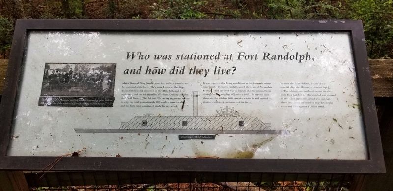
Who was Stationed at Fort Randolph
And how did they live
Major General Kirby Smith chose five artillery batterie to be stationed at the forts. They were known as the Siege Train Battalion and consisted of the 26th, 27th and 31st regiments, and the 8th Battalion of Heavy Artillery and the 2nd Field Battery. The 5th and 7th cavalry regiments served nearby. In total approximately 800 soldiers were on duty, and the forts were considered ready for any attack.
It was reported that living conditions at the fort that winter were harsh. Excessive rainfall caused the town of Alexandria to flood. And the cold was so intense that the ground froze during the first ten days of January 1865. To survive such elements, the soldiers built wooden cabins in and around the circular earthwork enclosures of the forts.
To assist the forts' defense, a Confederate ironclad ship, the Missouri, arrived on April 4. The Missouri was anchored across the river from Fort Randolph. This ironclad was covered in two thick layers or railroad iron and had three large guns on board to help defend the river and forts against Union attacks.
Topics. This historical marker is listed in these topic lists: Forts and Castles • War, US Civil.
Location. 31° 19.409′ N, 92° 26.897′ W. Marker is in Pineville, Louisiana, in Rapides Parish. Marker can be reached from Riverfront Street, one mile north of Main Street (Business U.S. 165). Touch for map. Marker is at or near this postal address: 135 Riverfront Street, Pineville LA 71360, United States of America. Touch for directions.
Other nearby markers. At least 8 other markers are within walking distance of this marker. Why was Fort Randolph Built? (about 300 feet away, measured in a direct line); How was Fort Randolph Built? (about 300 feet away); Desertion and the end of the War (about 500 feet away); The Red River Campaign (approx. 0.2 miles away); Bailey's Dam (approx. 0.2 miles away); The Dam Works (approx. 0.2 miles away); Welcome to Fort Buhlow (approx. ¼ mile away); Deserting soldiers and the end of the war (approx. ¼ mile away). Touch for a list and map of all markers in Pineville.
Credits. This page was last revised on June 5, 2021. It was originally submitted on June 5, 2021, by Cajun Scrambler of Assumption, Louisiana. This page has been viewed 125 times since then and 11 times this year. Photos: 1, 2. submitted on June 5, 2021, by Cajun Scrambler of Assumption, Louisiana.

