Safety Harbor in Pinellas County, Florida — The American South (South Atlantic)
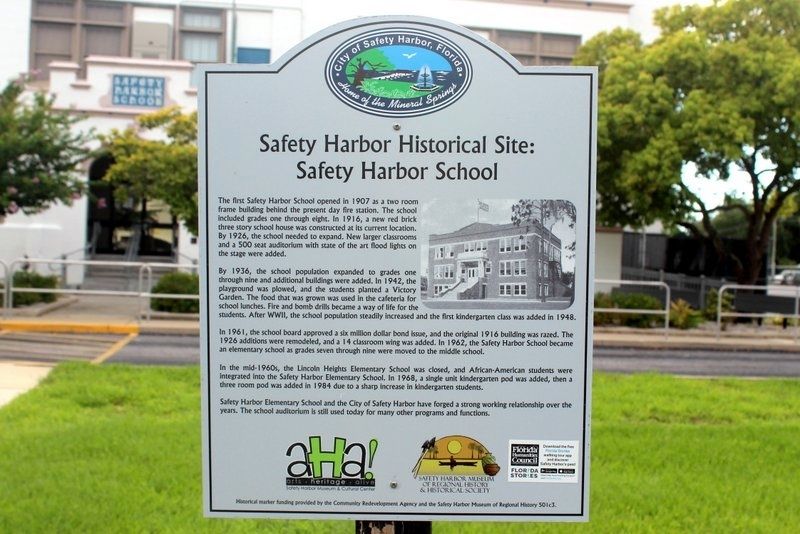
Safety Harbor Historical Site: Safety Harbor School
Photographed by Tim Fillmon, June 15, 2019
1. Safety Harbor Historical Site: Safety Harbor School Marker
By 1936, the school population expanded to grades one through nine and additional buildings were added. In 1942, the playground was plowed, and the students planted a Victory Garden. The food that was grown was used in the cafeteria for school lunches. Fire and bomb drills became a way of life for the students. After WWII, the school population steadily increased and the first kindergarten class was added in 1948.
In 1961, the school board approved a six million dollar bond issue, and the original 1916 building was razed. The 1926 additions were remodeled, and a 14 classroom wing was added. In 1962, the Safety Harbor School became an elementary school as grades seven through nine were moved to the middle school.
In the mid-60s, the
this page online
Safety Harbor Elementary School and the City of Safety Harbor have forged a strong working relationship over the years. The school auditorium is still used today for many other programs and functions.
Erected by Community Redevelopment Agency and the Safety Harbor Museum of Regional History.
Topics. This historical marker is listed in these topic lists: Architecture • Education • Settlements & Settlers. A significant historical year for this entry is 1907.
Location. 27° 59.698′ N, 82° 41.538′ W. Marker is in Safety Harbor, Florida, in Pinellas County. It is on 5th Avenue North just north of 5th Street North, on the left when traveling north. Touch for map. Marker is at or near this postal address: 535 5th Avenue North, Safety Harbor FL 34695, United States of America. Touch for directions.

Regionally, this marker is on Florida’s Gulf Coast and on Tampa
Photographed by Tim Fillmon, June 15, 2019
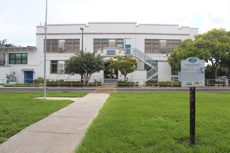
2. Safety Harbor Historical Site
Safety Harbor Elementary
Click for more information.
Click for more information.
Other nearby markers. At least 8 other markers are within walking distance of this marker: Safety Harbor Historical Site: First Dedicated Library (approx. ¼ mile away); Safety Harbor Historical Site: 135 4th Avenue North (approx. ¼ mile away); Safety Harbor Historical Site: 136 4th Ave. N. Safety Harbor: "The 1908 Gingerbread House" (approx. ¼ mile away); Safety Harbor Herald (approx. 0.3 miles away); Safety Harbor Historical Site: The Hotel Frances (approx. 0.3 miles away); Safety Harbor Historical Site: Baranoff Oak Tree (approx. 0.3 miles away); “The Baranoff Oak” (approx. 0.3 miles away); Safety Harbor Historical Site: First Town Hall (approx. 0.3 miles away). Touch for a list and map of all markers in Safety Harbor.
Credits. This page was last revised on August 25, 2025. It was originally submitted on June 6, 2021, by Tim Fillmon of Webster, Florida. This page has been viewed 1,290 times since then and 98 times this year. Photos: 1, 2. submitted on June 6, 2021, by Tim Fillmon of Webster, Florida.
