Newport in Campbell County, Kentucky — The American South (East South Central)
The Civil War in Northern Kentucky
Inscription.
Cincinnati was threatened by full-scale Confederate attack only once during the Civil War. On August 29, 1862, a Confederate army under General Kirby Smith defeated a poorly trained Union force at Richmond, Kentucky. Three days later Lexington fell without a fight. Smith marched north toward Covington, Newport and Cincinnati. Capture of any of the three cities would have given the South a tremendous psychological boost — as well as access to important supplies.
General Lew Wallace was given responsibility for defending the three cities from the "active, daring and powerful enemy." Wallace placed the three cities under martial law, closed all businesses and called for volunteers. He planned to defend the cities from the hills south of Covington and Newport. Ultimately his 72,000 Union volunteers proved too formidable a foe for the 10,000 Confederate soldiers. After several skirmishes the invading force broke camp and turned toward Louisville.
Captions:
First panel, left to right:
• Citizens respond to the call for volunteers (September 1862). Within a few days over 72,000 volunteers answered the call to defend Cincinnati, Covington and Newport. Residents of all three cities as well as people living on farms in the surrounding areas flooded recruiting centers like this one pictured in Harper's Weekly.
• The declaration of martial law as it appeared in the Cincinnati Enquirer, September 2, 1862. Newspaper notice courtesy of the Cincinnati Historical Society.
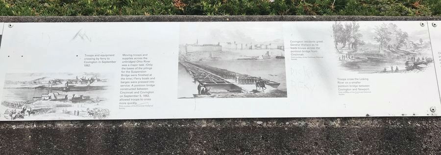
Second panel, left to right:
• Troops and equipment crossing by ferry to Covington in September 1862. Moving troops and supplies across the unbridged Ohio River was a major task. (Only the bases of the pilings for the Suspension Bridge were finished at the time.) Ferry boats and barges were pressed into service. A pontoon bridge constructed between Cincinnati and Covington on September 5, 1862, allowed troops to cross more quickly. Print courtesy of the Cincinnati Historical Society
• Covington residents greet General Wallace as he leads troops across the pontoon bridge from Cincinnati. Print courtesy of the Cincinnati Historical Society
• Troops cross the Licking River on a smaller pontoon bridge between Covington and Newport. Print courtesy of the Cincinnati Historical Society
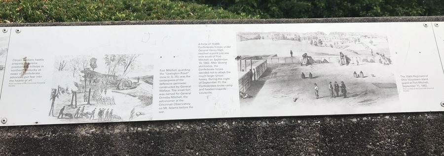
Third panel, left to right:
• Citizen soldiers hastily prepare defensive positions on hilltops in northern Kentucky as news of Confederate advances put fear into the hearts of all. Print courtesy of the Cincinnati Historical Society
• Fort Mitchell, guarding the "Lexington
Road" (now U.S. 25), was the centerpiece of the defensive perimeter constructed by General Wallace. The small fort was named for General Ormsby Mitchell, the astronomer at the Cincinnati Observatory on Mt. Adams before the war. A force of 10,000 Confederate troops under General Henry Hath reached a point just one mile south of Fort Mitchell on September 10, 1862. After several skirmishes, the Confederate forces decided not to attack the much larger Union forces. During the night of September 11, the Confederates broke camp and headed toward Louisville.
• The 104th Regiment of Ohio Volunteers stand guard at Fort Mitchell, September 11, 1862. Print courtesy of the Cincinnati Historical Society
Topics. This historical marker is listed in these topic lists: Bridges & Viaducts • Forts and Castles • War, US Civil. A significant historical month for this entry is September 1862.
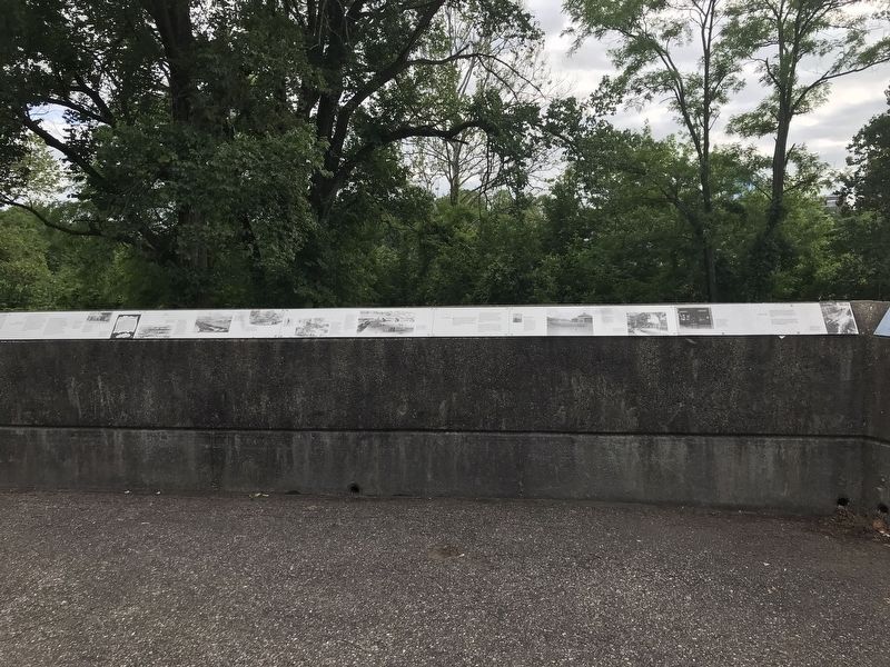
Location. 39° 5.543′ N, 84° 30.149′ W. Marker is in Newport, Kentucky, in Campbell County. Marker can be reached from Riverboat Row, on the right when traveling south. Marker is on the retaining wall surrounding the Taylor Park overlook. Touch for map. Marker is at or near this postal address: 100 Riverboat Row, Newport KY 41071, United States of America. Touch for directions.
Other nearby markers. At least 8 other markers are within walking distance of this marker. Flood Walls (here, next to this marker); Defending the Valley (here, next to this marker); Cincinnati Skyline Pre-1865
(here, next to this marker); Fort Thomas (here, next to this marker); A New Perspective: 1865-1900 (here, next to this marker); Skyscrapers and a Stadium: 1900-1972 (here, next to this marker); Floods and Flood Walls (a few steps from this marker); Newport Barracks (a few steps from this marker). Touch for a list and map of all markers in Newport.
Credits. This page was last revised on June 11, 2021. It was originally submitted on June 6, 2021, by Duane and Tracy Marsteller of Murfreesboro, Tennessee. This page has been viewed 306 times since then and 59 times this year. Photos: 1, 2, 3. submitted on June 6, 2021, by Duane and Tracy Marsteller of Murfreesboro, Tennessee. 4. submitted on June 11, 2021, by Duane and Tracy Marsteller of Murfreesboro, Tennessee.


