Newport in Campbell County, Kentucky — The American South (East South Central)
Skyscrapers and a Stadium: 1900-1972
Inscription.
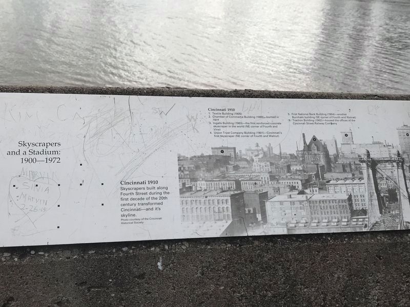
Cincinnati 1910
Skyscrapers built along Fourth Street during the first decade of the 20th century transformed Cincinnati and its skyline. Photo courtesy of the Cincinnati Historical Society
[Photograph]
Cincinnati 1910 1. Textile building (1905) 2. Chamber of Commerce building (1889) burned in 1911 3. Ingalls Building (1903) the first reinforced concrete skyscraper in the world (NE corner of Fourth and Vine) 4. Union Trust Company Building (1901) Cincinnati's first skyscraper (NE corner of Fourth and Walnut) 5. First National Bank Building (1904) another Burnham building (SE corner of Fourth and Walnut) 6. Traction Building (1902) housed the offices of the Cincinnati Street Railway Company
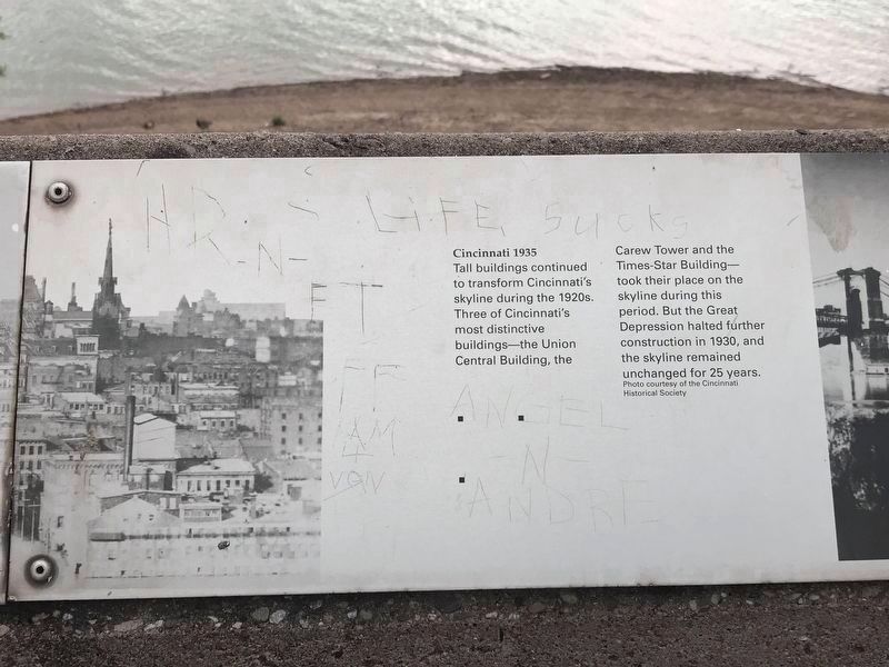
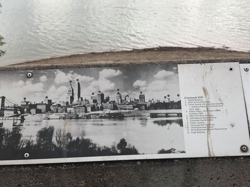
Cincinnati 1935
Tall buildings continued to transform Cincinnati's skyline during the 1920s. Three of Cincinnati's most distinctive buildings the Union Central Building, Carew Tower and the Times-Star Building took their place on the skyline during this period. But the Great Depression halted further construction in 1930, and the skyline remained unchanged for 25 years. Photo courtesy of the Cincinnati Historical Society
[Photograph]
Cincinnati 1935 1. Textile Building 2. Dixie Terminal Building 3. Union Central Life Insurance building tallest building in Cincinnati from 1913-1930 4. Carew Tower Cincinnati's tallest building (1930-) 5. Fifth Third Bank Building 6. First National Bank Building 7. Cincinnati Gas & Electric 8. Public Landing 9. Cincinnati Bell Telephone 10. Christ Episcopal Church 11. Christ Episcopal Church Parish House 12. Pugh Building
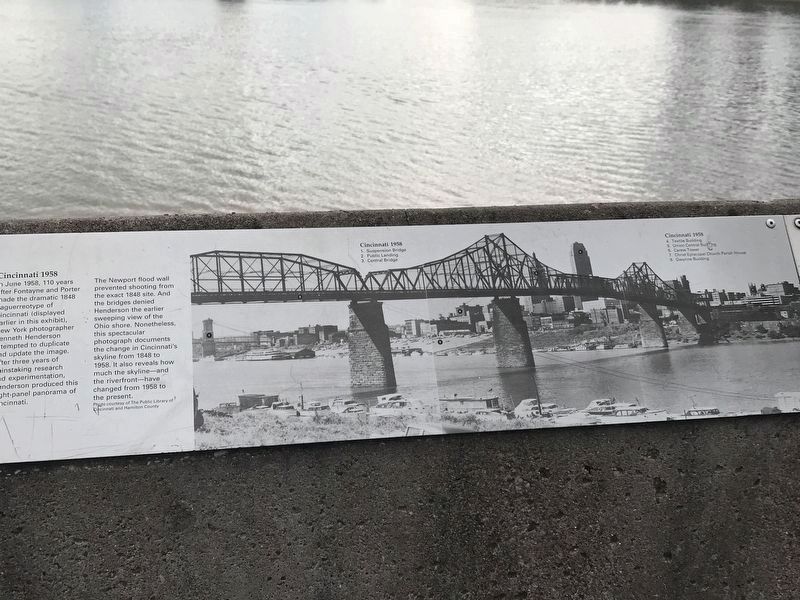
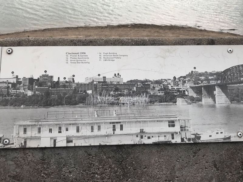
Cincinnati 1958
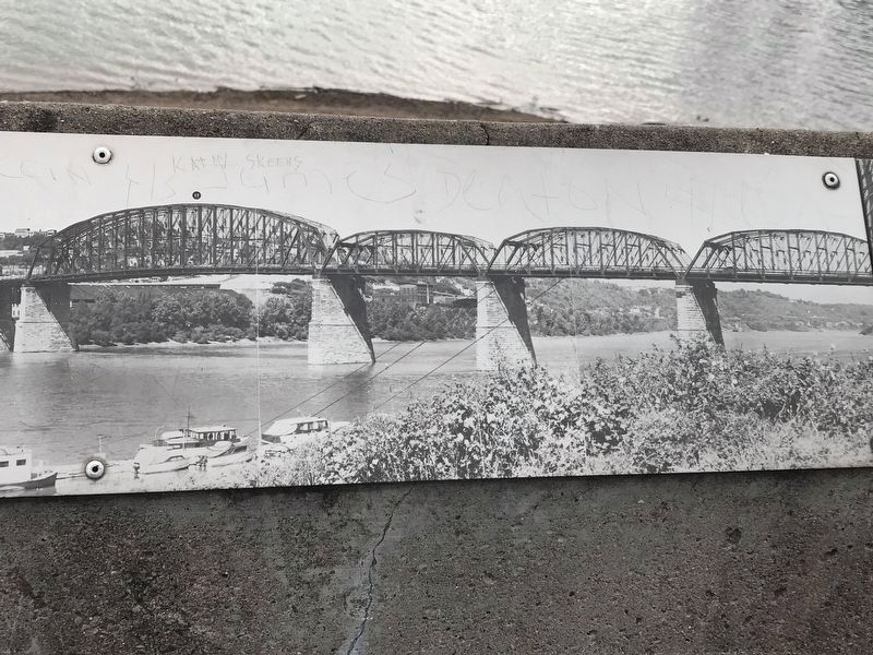
In June 1958, 110 years after Fontayne and Porter made the dramatic 1848 daguerreotype of Cincinnati (displayed earlier in this exhibit), New York photographer Kenneth Henderson attempted to duplicate and update the image. After three years of painstaking research and experimentation, Henderson produced this eight-panel panorama of Cincinnati.
The Newport flood wall prevented shooting from the exact 1848 site. And the bridges denied Henderson the earlier sweeping view of the Ohio shore. Nonetheless, this spectacular photograph documents the change in Cincinnati's skyline from 1848 to 1958. It also reveals how much the skyline and the riverfront have changed from 1958 to the present. Photo courtesy of The Public Library of Cincinnati and Hamilton County
[Photograph]
Cincinnati 1958 1.Suspension Bridge 2. Public Landing 3. Central Bridge 4. Textile Building 5. Union Central Building 6. Carew Tower
7. Christ Episcopal Church Parish House 8. Gwynne Building 9. (skipped) 10. Procter & Gamble 11. Phelps Apartments 12. Anna Louisa Inn 13. Times Star Building 14. Pugh Building 15. American Book Company 16. Rookwood Pottery 17. L&N Bridge
Topics. This historical marker is listed in these topic lists: Architecture • Industry & Commerce • Settlements & Settlers • Sports.
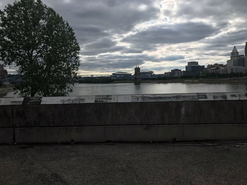
Location. 39° 5.546′ N, 84° 30.149′ W. Marker is in Newport, Kentucky, in Campbell County. Marker can be reached from Riverboat Row, on the right when traveling south. Marker is on the retaining wall surrounding the Taylor Park overlook. Touch for map. Marker is at or near this postal address: 100 Riverboat Row, Newport KY 41071, United States of America. Touch for directions.
Other nearby markers. At least 8 other markers are within walking distance of this marker. A New Perspective: 1865-1900 (here, next to this marker); Cincinnati Skyline Pre-1865 (here, next to this marker); The Civil War in Northern Kentucky (here, next to this marker); Flood Walls (here, next to this marker); Floods and Flood Walls (here, next to this marker); Fort Thomas (a few steps from this marker); Defending the Valley (a few steps from this marker); Newport Barracks (within shouting distance of this marker). Touch for a list and map of all markers in Newport.
More about this marker. Despite the title, there was/were no panel(s) depicting a stadium or the Cincinnati skyline in 1972.
Credits. This page was last revised on July 15, 2021. It was originally submitted on June 7, 2021, by Duane and Tracy Marsteller of Murfreesboro, Tennessee. This page has been viewed 211 times since then and 22 times this year. Photos: 1, 2, 3, 4, 5, 6. submitted on June 7, 2021, by Duane and Tracy Marsteller of Murfreesboro, Tennessee. 7. submitted on June 11, 2021, by Duane and Tracy Marsteller of Murfreesboro, Tennessee.
