Newport in Perry County, Pennsylvania — The American Northeast (Mid-Atlantic)
The Canal Era
— Newport Heritage Park —
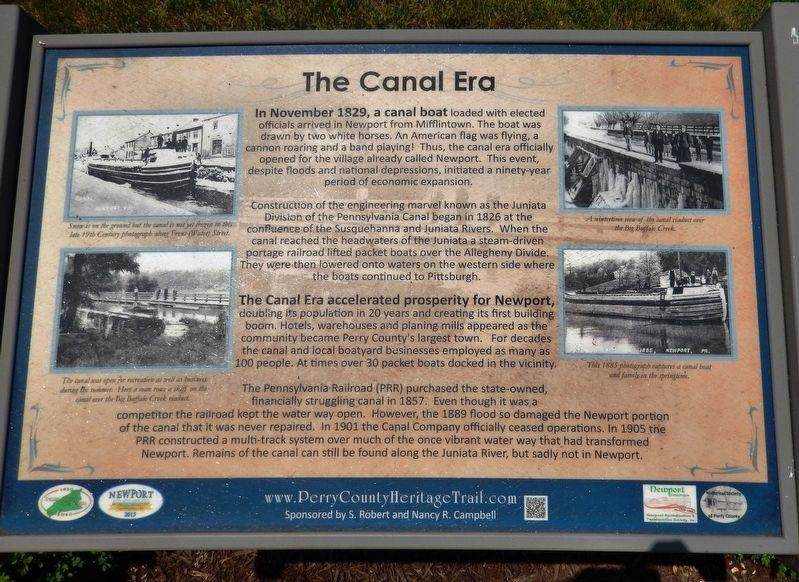
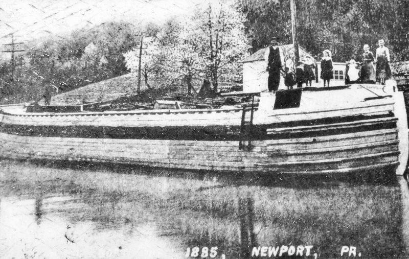
In November 1829, a canal boat loaded with elected officials arrived in Newport from Mifflintown. The boat was drawn by two white horses. An American flag was flying, a cannon roaring and a band playing! Thus, the canal era officially opened for the village already called Newport. This event, despite floods and national depressions, initiated a ninety-year period of economic expansion.
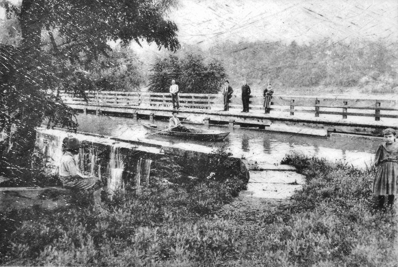
Construction of the engineering marvel known as the Juniata Division of the Pennsylvania Canal began in 1826 at the confluence of the Susquehanna and Juniata Rivers. When the canal reached the headwaters of the Juniata a steam-driven portage railroad lifted packet boats over the Allegheny Divide. They were then lowered onto waters on the western side where the boats continued to Pittsburgh.
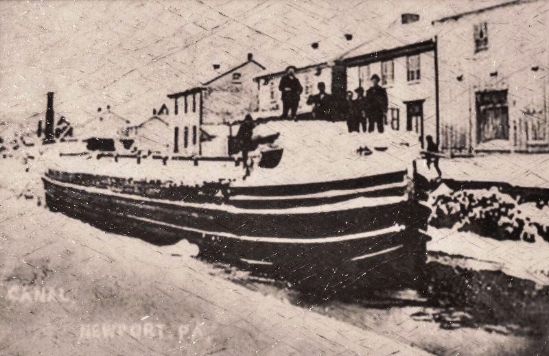
The Canal Era accelerated prosperity for Newport, doubling its population in 20 years and creating its first building boom. Hotels, warehouses and planing mills appeared as the community became Perry County's largest town. For decades the canal and local boatyard businesses employed as many as 100 people. At times over 30 packet boats docked in the vicinity.
The Pennsylvania Railroad (PRR) purchased the state-owned, financially struggling canal in 1857. Even though it was a competitor the railroad kept the water way open. However, the 1889 flood so damaged the Newport portion of the canal that it was never repaired. In 1901 the Canal Company officially ceased operations. In 1905 the PRR constructed a multi-track system over much of the once vibrant water way that had transformed Newport. Remains of the canal can still be found along the Juniata River, but sadly not in Newport.
Erected 2020 by Historical Society of Perry County.
Topics and series. This historical marker is listed in these topic lists: Industry & Commerce • Railroads & Streetcars • Waterways & Vessels. In addition, it is included in the Pennsylvania Canal, and the Perry County Heritage Trail in Pennsylvania. series lists. A significant historical month for this entry is November 1829.
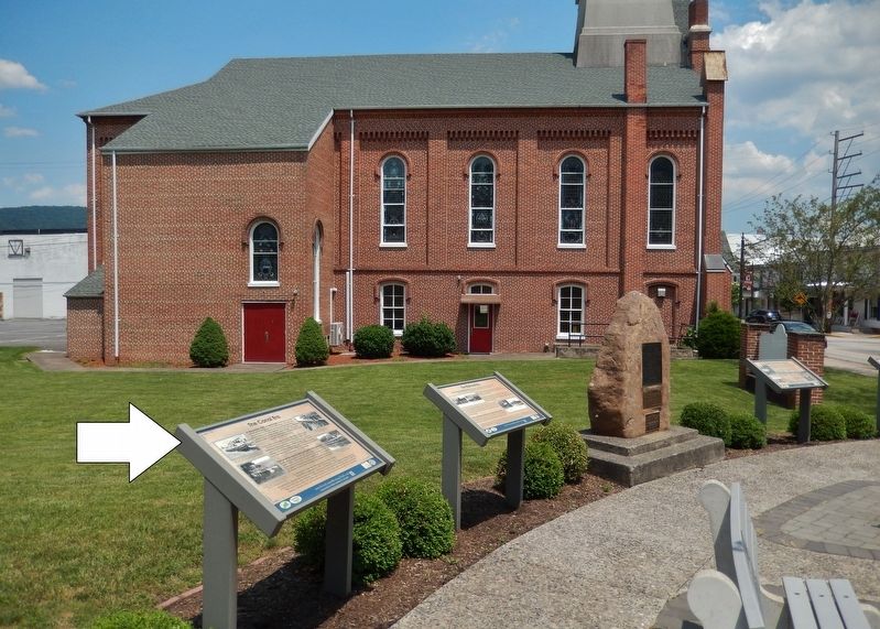
Location. 40° 28.609′ N, 77° 7.964′ W. Marker is in Newport, Pennsylvania, in Perry County. Marker is at the intersection of Market Street (Pennsylvania Route 34) and 4th Street (Pennsylvania Route 849) on Market Street. Marker is located in Newport Heritage Park at the northeast corner of the intersection. Touch for map. Marker is in this post office area: Newport PA 17074, United States of America. Touch for directions.
Other nearby markers. At least 8 other markers are within walking distance of this marker. The Railroad Era (here, next to this marker); The Settlement of Newport (here, next to this marker); Newport Heritage Park (here, next to this marker); St. Paul’s Lutheran Church
(here, next to this marker); Newport Historic District (here, next to this marker); The Industrial and Manufacturing Era (a few steps from this marker); Floods! (a few steps from this marker); Newport Fugitive Slave Rescue (a few steps from this marker). Touch for a list and map of all markers in Newport.
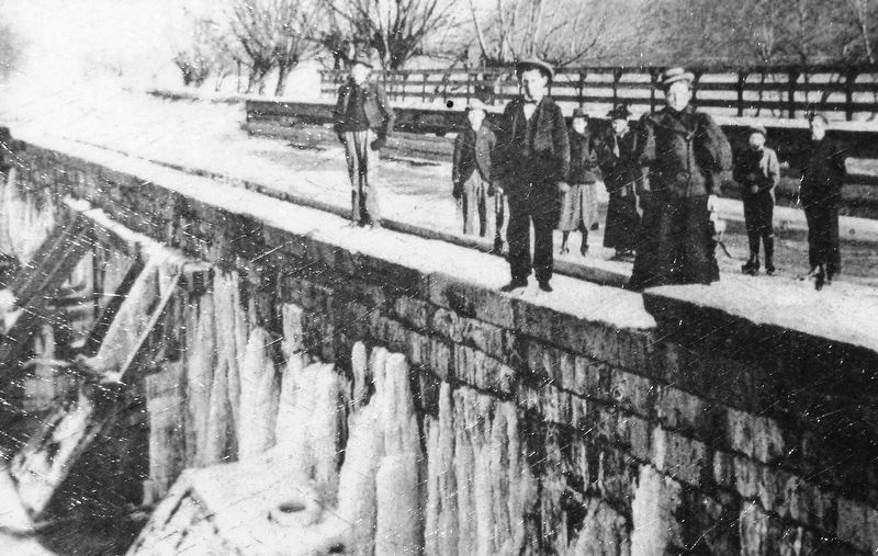
Regarding The Canal Era. The Juniata Division of the Pennsylvania Canal was one of the five sections of the Pennsylvania Main Line of Public Works. It ran from the Eastern Division canal basin at Duncan's Island, 127 miles to the west to Hollidaysburg, where it met the Allegheny Portage Railroad. Completed in 1832, it was sold to the Pennsylvania Railroad in 1857. 86 locks were needed to handle the vertical lift of 584 feet from end to end. It had 25 aqueducts to cross tributaries of the Juniata River.
Related markers. Click here for a list of markers that are related to this marker. Newport Heritage Park
Also see . . .
1. The Juniata Division of the Pennsylvania Canal. PA Canal website entry:
The success of the Erie Canal in New York was one impetus to the development of plans for a canal system in Pennsylvania. Another was the economic demand
for a waterway access to Philadelphia from western Pennsylvania for the products of Pennsylvania’s farming, timber and manufacturing industries. Finally, on July 4, 1828, ground was broken for a canal system that would later be known as the “Main Line Canal System”. Ultimately the Main Line Canal ran from Columbia, PA to Pittsburgh, PA with the 37 mile long Allegheny Portage Railroad in place between Hollidaysburg and Johnstown for crossing the Allegheny Mountain (Submitted on June 10, 2021, by Cosmos Mariner of Cape Canaveral, Florida.)
2. Juniata Division Canal. The Juniata Division of the Pennsylvania Canal was one of the five sections of the Pennsylvania Main Line of Public Works. It ran from the Eastern Division canal basin at Duncan's Island, 127 miles to the west to Hollidaysburg, where it met the Allegheny Portage Railroad. Completed in 1832, it was sold to the Pennsylvania Railroad in 1857. 86 locks were needed to handle the vertical lift of 584 feet from end to end. It had 25 aqueducts to cross tributaries of the Juniata River. (Submitted on June 10, 2021, by Cosmos Mariner of Cape Canaveral, Florida.)
Credits. This page was last revised on April 13, 2023. It was originally submitted on June 10, 2021, by Cosmos Mariner of Cape Canaveral, Florida. This page has been viewed 373 times since then and 51 times this year. Photos: 1, 2, 3, 4, 5, 6. submitted on June 10, 2021, by Cosmos Mariner of Cape Canaveral, Florida.
