Farmersville in Montgomery County, Ohio — The American Midwest (Great Lakes)
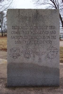
Farmersville War Memorial
Photographed by William Fischer, Jr., February 14, 2009
1. Farmersville War Memorial Marker
Topics. This historical marker and memorial is listed in these topic lists: Heroes • Military • Patriots & Patriotism.
Location. 39° 40.659′ N, 84° 26.937′ W. Marker is in Farmersville, Ohio, in Montgomery County. It can be reached from Farmersville Gratis Road. Marker is in Farmersville-Jackson Township Joint Recreation Park, 14440 Farmersville-Gratis Road, at the flag pole next to the park administration building. Touch for map. Marker is in this post office area: Farmersville OH 45325, United States of America. Touch for directions.

Regionally, this marker and memorial is in the Dayton Metro and in the Miami Valley. It is also in the American Midwest and in the Corn Belt. Globally, it is in North America, the Western Hemisphere, the Western World, and the Anglosphere. Historically, it finds itself in what was once the Haudenosaunee (Iroquois) Confederacy, the territory of the Mississippian Culture, and the Northwest Territory.
Other nearby markers. At least 8 other markers are within 5 miles of this marker, measured as the crow flies: Winter Zellar (Zero) Swartsel (about 400 feet away, measured in a direct line); Farmersville Fire Department Memorial (approx. 1.4 miles away); Slifers Presbyterian Church (approx. 3.2 miles away); Veterans Memorial (approx. 3.3 miles away); Germantown Dam (approx. 3.7 miles away); a different marker also named Veterans Memorial (approx. 4.9 miles away); Germantown (approx. 4.9 miles away); Memorial (approx. 5 miles away). Touch for a list and map of all markers in Farmersville.
this page online
Photographed by William Fischer, Jr., February 14, 2009
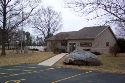
2. Farmersville War Memorial
At flag pole to left of building.
Photographed by William Fischer, Jr., February 14, 2009
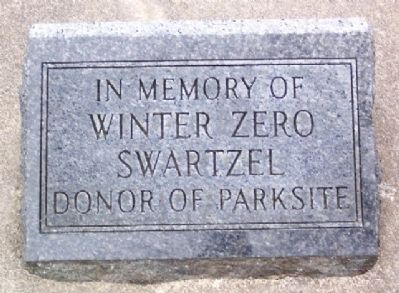
3. Winter Zero Swartzel Marker
In Memory of Winter Zero Swartzel, Donor of Parksite
Photographed by William Fischer, Jr., February 14, 2009
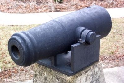
4. Small Cannon at Farmersville War Memorial
Credits. This page was last revised on June 16, 2016. It was originally submitted on April 1, 2009, by William Fischer, Jr. of Reynoldsburg, Ohio. This page has been viewed 1,010 times since then and 20 times this year. Photos: 1, 2, 3, 4. submitted on April 1, 2009, by William Fischer, Jr. of Reynoldsburg, Ohio. • Bill Pfingsten was the editor who published this page.
