Near Delta in Clay County, Alabama — The American South (East South Central)
Home Sweet Home
Photographed by Mark Hilton, June 16, 2021
1. Home Sweet Home Marker
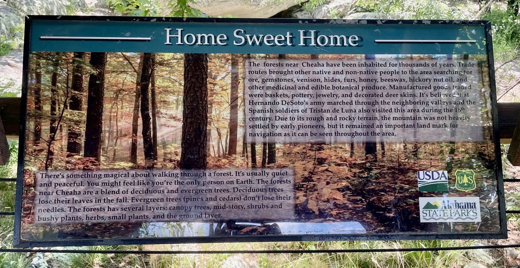
The forests near Cheaha have been inhabited for thousands of years. Trade routes brought other native and non-native people to the area searching for ore, gemstones, venison, hides, furs, honey, beeswax, hickory nut oil, and other medicinal and edible botanical produce. Manufactured goods traded were baskets, pottery, jewelry, and decorated deer skins. It's believed that Hernando DeSoto's army marched through the neighboring valleys and the Spanish soldiers of Tristan de Luna also visited this area during the 16th century. Due to its rough and rocky terrain, the mountain was not heavily settled by early pioneers, but it remained an important land mark for navigation as it can be seen throughout the area.
There's something magical about walking through a forest. It's usually quiet and peaceful. You might feel like you're the only person on Earth. The forests near Cheaha are a blend of deciduous and evergreen trees. Deciduous trees lose their leaves in the fall. Evergreen trees (pines and cedars) don't lose their needles. The forests has several layers: canopy trees, mid-story, shrubs and bushy plants, herbs,
this page online
Erected by Forest Service, USDA, Alabama State Parks.
Topics. This historical marker is listed in these topic lists: Exploration • Industry & Commerce • Settlements & Settlers.
Location. 33° 29.725′ N, 85° 48.468′ W. Marker is near Delta, Alabama, in Clay County. It can be reached from Alabama State Road 281 (Alabama Route 281). Located within Cheaha State Park, in the Talladega National Forest. Entrance fee charged. Touch for map. Marker is at or near this postal address: 19644 AL-281, Delta AL 36258, United States of America. Touch for directions.

Regionally, this marker is in East Alabama. It is also in the American South and specifically in the Deep South. Globally, it is in North America, a Gulf of Mexico state, the Western Hemisphere, the Western World, and the Anglosphere. Historically, it finds itself in what was once the original Cherokee Nation, the territory of the Mississippian Culture, one of the Confederate States of America, and the Antebellum South.
Other nearby markers. At least 8 other markers are within
Photographed by Mark Hilton, June 16, 2021
2. Home Sweet Home Marker

Public domain
3. Hernando de Soto / Tristán de Luna y Arellano
Credits. This page was last revised on October 22, 2024. It was originally submitted on June 17, 2021, by Mark Hilton of Montgomery, Alabama. This page has been viewed 494 times since then and 36 times this year. Photos: 1, 2, 3. submitted on June 17, 2021, by Mark Hilton of Montgomery, Alabama.
