High Point in Guilford County, North Carolina — The American South (South Atlantic)
The Little Red Schoolhouse
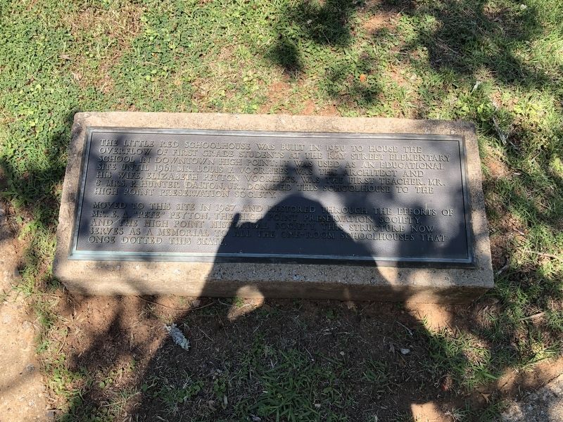
The Little Red Schoolhouse was built in 1930 to house the overflow of first grade students at the Ray Street Elementary School in downtown High Point; it was used as an educational site until 1961. Mr. Louis F. Voorhees was the architect, and his wife, Elizabeth Peyton Voorhees, was the first teacher. Mr. & Mrs. P. Hunter Dalton, Jr., donated this schoolhouse to the High Point Preservation Society.
Moved to this site in 1987 and restored through the efforts of Mr. E.A. "Pete" Peyton, the High Point Preservation Society, and the High Point Historical Society. This structure now serves as a memorial to all the one-room schoolhouses that once dotted this state.
Erected by High Point Museum.
Topics. This historical marker is listed in these topic lists: Architecture • Education. A significant historical year for this entry is 1930.
Location. 35° 58.794′ N, 79° 59.511′ W. Marker is in High Point, North Carolina, in Guilford County. It can be reached from the intersection of East Lexington Avenue and McGuinn Drive, on the right when traveling west. Touch for map. Marker is at or near this postal address: 1859 E
this page online

Regionally, this marker is in the Piedmont and specifically in Piedmont Triad. It is also in the American South and specifically in the Upper South. Globally, it is in North America, the Western Hemisphere, the Western World, and the Anglosphere. Historically, it finds itself in what was once the territory of the Mississippian Culture, one of the original Thirteen Colonies, one of the Confederate States of America, and the Antebellum South.
Other nearby markers. At least 8 other markers are within walking distance of this marker: The Blacksmith Shop (a few steps from this marker); The Haley House (within shouting distance of this marker); The Hoggat House (within shouting distance of this marker); Oldest Building in High Point (within shouting distance of this marker); Quatercentenary Tree (within shouting distance of this marker); Oldest Colonial Trail (within shouting distance of this marker); a different marker also named Haley House (within shouting distance of this marker); High Point University (approx. half a mile away). Touch for a list and map
Photographed by Devry Becker Jones (CC0), June 17, 2021
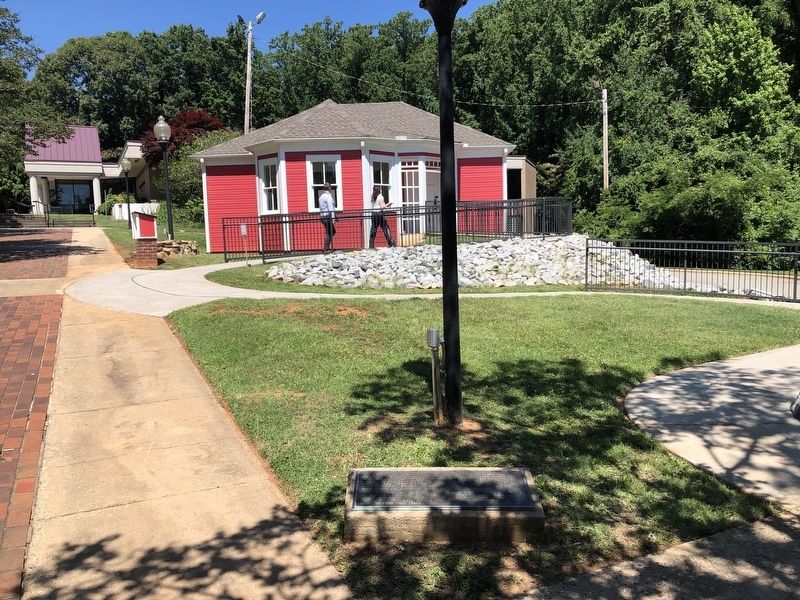
2. The Little Red Schoolhouse and namesake marker
Other markers no longer nearby. The Plank Road (was a few steps from this marker but has been permanently removed); a different marker also named Little Red Schoolhouse (was about 500 feet away, measured in a direct line but has been replaced with another marker now near it).
Related marker. Click here for another marker that is related to this marker. This marker has replaced the linked marker which had slightly different content.
Credits. This page was last revised on June 19, 2021. It was originally submitted on June 19, 2021, by Devry Becker Jones of Washington, District of Columbia. This page has been viewed 390 times since then and 45 times this year. Photos: 1, 2. submitted on June 19, 2021, by Devry Becker Jones of Washington, District of Columbia.
