New Lebanon in Montgomery County, Ohio — The American Midwest (Great Lakes)
Charles F. Shimp
Photographed by William Fischer, Jr., February 14, 2009
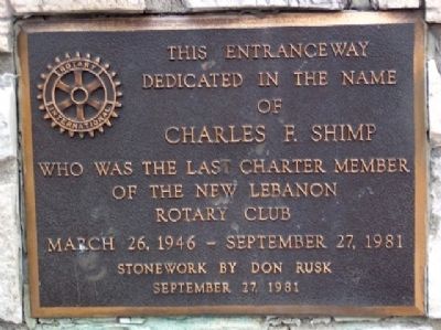
1. Charles F. Shimp Marker
dedicated in the name
of
Charles F. Shimp
who was the last charter member
of the New Lebanon
Rotary Club
March 26, 1946 - September 27, 1981
Stonework by Don Rusk
September 27, 1981
Erected 1981 by New Lebanon Rotary Club.
Topics and series. This historical marker is listed in these topic lists: Charity & Public Work • Fraternal or Sororal Organizations. In addition, it is included in the Rotary International series list. A significant historical month for this entry is March 1880.
Location. 39° 44.544′ N, 84° 24.313′ W. Marker is in New Lebanon, Ohio, in Montgomery County. It is on Fuls Road, on the right when traveling south. Marker is at entrance to Don Rusk Park, across Fuls Road from Dixie Middle School. Touch for map. Marker is at or near this postal address: 320 S Fuls Road, New Lebanon OH 45345, United States of America. Touch for directions.

Regionally, this marker is in the Dayton Metro and in the Miami Valley. It is also in the American Midwest and in the Corn Belt. Globally, it is in North America, the Western Hemisphere, the Western World, and the Anglosphere. Historically,
this page online
Other nearby markers. At least 8 other markers are within 8 miles of this marker, measured as the crow flies: Dayton Western Turnpike Milestone (approx. ¼ mile away); Veterans Memorial (approx. 2.9 miles away); Slifers Presbyterian Church (approx. 3 miles away); Farmersville Fire Department Memorial (approx. 4.3 miles away); Farmersville War Memorial (approx. 5 miles away); Winter Zellar (Zero) Swartsel (approx. 5.1 miles away); Twin Township (approx. 7 miles away); Germantown Dam (approx. 7.2 miles away).
Photographed by William Fischer, Jr., February 14, 2009
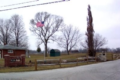
2. Charles F. Shimp Marker
Looking west.
Credits. This page was last revised on January 21, 2020. It was originally submitted on April 2, 2009, by William Fischer, Jr. of Reynoldsburg, Ohio. This page has been viewed 1,008 times since then and 19 times this year. Photos: 1, 2. submitted on April 2, 2009, by William Fischer, Jr. of Reynoldsburg, Ohio. • Kevin W. was the editor who published this page.
