Coloma in El Dorado County, California — The American West (Pacific Coastal)
Site of Coloma’s Law Offices
Photographed by Joseph Alvarado, January 21, 2023
1. Site of Coloma’s Law Offices Marker
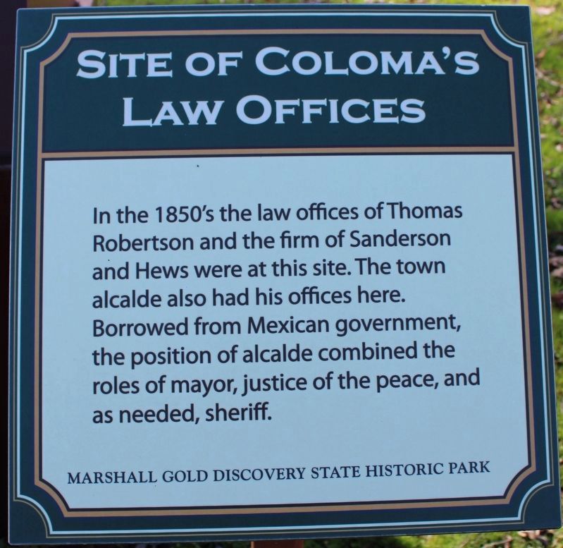
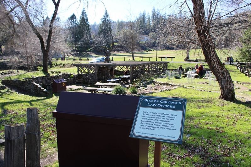
In the 1850s, the law offices of Thomas Robertson and the firm of Sanderson and Hews were at this site. The town alcalde also had his office here. Borrowed from Mexican government, the position of alcalde combined the roles of mayor, justice of the peace, and as needed, sheriff.
Erected by Marshall Gold Discovery State Historic Park.
Topics. This historical marker is listed in these topic lists: Government & Politics • Industry & Commerce • Law Enforcement. A significant historical year for this entry is 1850.
Location. 38° 48.014′ N, 120° 53.466′ W. Marker is in Coloma, California, in El Dorado County. It is on Coloma Road (California Route 49) south of Mt Murphy Road, on the right when traveling south. Marker is located within the boundaries of the Marshall Gold Discovery State Historic Park at the west end of the Beer Garden Picnic Area. Touch for map. Marker is in this post office area: Coloma CA 95613, United States of America. Touch for directions.

Regionally, it is in North America, on the Ring of Fire, on the Pacific Rim, in the Western Hemisphere, in the Western World, and in the Anglosphere.
this page online
Other nearby markers. At least 8 other markers are within walking distance of this marker: Metropolitan Saloon and Bowling Alley (here, next to this marker); Beer Garden (a few steps from this marker); a different marker also named Weller House (a few steps from this marker); What Happened To All The Buildings? (a few steps from this marker); Site of Adams and Company Express (within shouting distance of this marker); Site of Doctor Taylor's Store (within shouting distance of this marker); Coloma Post Office (within shouting distance of this marker); Site of Hook and Ladder House No. 1 (within shouting distance of this marker). Touch for a list and map of all markers in Coloma.
Other markers no longer nearby. Weller House (was a few steps from this marker but has been replaced with another marker now near it); Site of Wintermantel’s Miner’s Hotel (was within shouting distance of this marker but has been permanently removed); Winters’ Hotel (was within shouting distance of this marker but has been permanently removed); a different
Photographed by Syd Whittle, March 17, 2009
2. Coloma’s Law Offices Marker
Also see . . .
1. Marshall Gold Discovery State Historic Park. California State Parks website entry (Submitted on June 1, 2024, by Larry Gertner of New York, New York.)
2. Marshall Gold Discovery State Historic Park Site Map. Mapping locations of historic sites and buildings in Coloma. (Submitted on April 2, 2009, by Syd Whittle of Mesa, Arizona.)
3. Thomas Robertson. Find A Grave website entry:
Thomas Robertson is buried at the Coloma Pioneer Cemetery. (Submitted on April 2, 2009, by Syd Whittle of Mesa, Arizona.)
Additional commentary.
1. Thomas Robertson
Thomas Robertson became the first judge of El Dorado County, and also a member of the state legislature. It is noted that at least 50 people are buried at the Coloma Pioneer Cemetery after being sentenced to hang by Judge Thompson. He was also one of the founders of the El Dorado County Fair.
— Submitted April 2, 2009, by Syd Whittle of Mesa, Arizona.
Photographed by Joseph Alvarado, January 21, 2023
3. Site of Coloma’s Law Offices Marker
Photographed by Syd Whittle, March 17, 2009
4. Coloma’s Law Offices Marker
Credits. This page was last revised on June 1, 2024. It was originally submitted on April 2, 2009, by Syd Whittle of Mesa, Arizona. This page has been viewed 1,553 times since then and 22 times this year. Photos: 1. submitted on January 31, 2023, by Joseph Alvarado of Livermore, California. 2. submitted on April 2, 2009, by Syd Whittle of Mesa, Arizona. 3. submitted on January 31, 2023, by Joseph Alvarado of Livermore, California. 4. submitted on April 2, 2009, by Syd Whittle of Mesa, Arizona.
