King and Queen Court House in King and Queen County, Virginia — The American South (Mid-Atlantic)
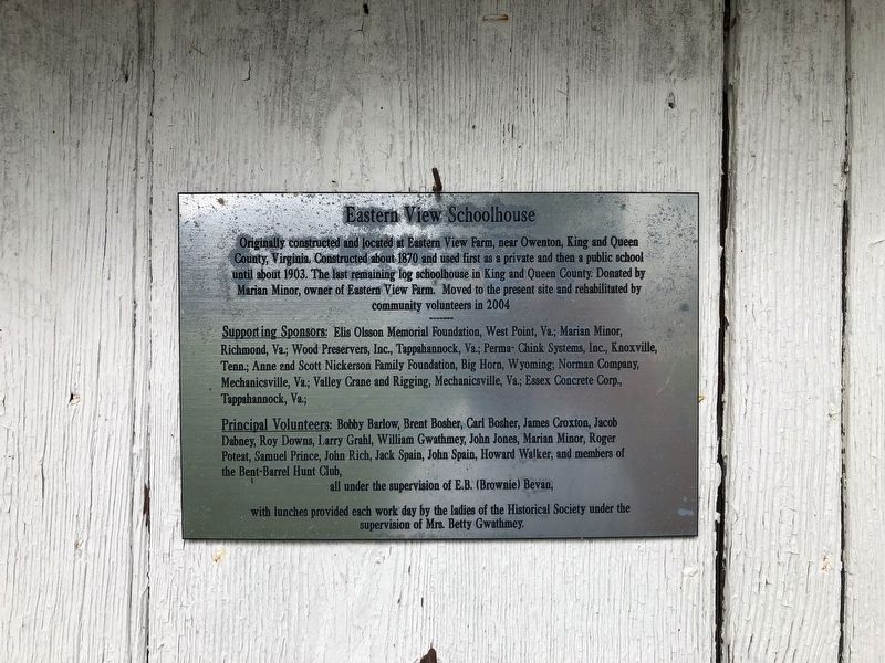
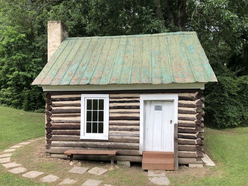
Eastern View Schoolhouse
Topics. This historical marker is listed in this topic list: Education. A significant historical year for this entry is 1870.
Location. 37° 40.142′ N, 76° 52.695′ W. Marker is in King and Queen Court House, Virginia, in King and Queen County. Marker is on Court House Landing Road (Virginia Route 655) 0.1 miles south of Allens Circle (Virginia Route 681), on the right when traveling south. Touch for map. Marker is at or near this postal address: 167 Court House Landing Rd, King and Queen Court House VA 23085, United States of America. Touch for directions.
Other nearby markers. At least 8 other markers are within 4 miles of this marker, measured as the crow flies. Carriage House (a few steps from this marker); County Clerks Office Site (within shouting distance of this marker); Trice Mill Stones (within shouting distance of this marker); King and Queen County Confederate Monument (within shouting distance of this marker); World Wars I and II Memorial (within shouting distance of this marker); James Horace Carter Lynched (approx. 0.2 miles away); Newington (approx. 0.9 miles away); Mattapony Church (approx. 3.4 miles away). Touch for a list and map of all markers in King and Queen Court House.
Credits. This page was last revised on June 27, 2021. It was originally submitted on June 27, 2021, by Devry Becker Jones of Washington, District of Columbia. This page has been viewed 149 times since then and 24 times this year. Photos: 1, 2. submitted on June 27, 2021, by Devry Becker Jones of Washington, District of Columbia.

