Restoration of the Edge Hill Service Station
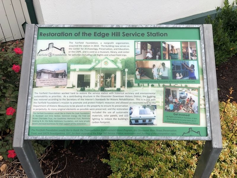
The Fairfield Foundation, a non-profit organization, acquired the station in 2010. The building now serves as the Center for Archaeology, Preservation, and Education, or the CAPE, and is used as a museum, library, and center for activities including Lab Nights and school field trips.
The Fairfield Foundation worked hard to restore the service station with historical accuracy and environmental sustainability as priorities. As a contributing structure in Gloucester Downtown Historic District, the building was restored according to the Secretary of the Interior's Standards for Historic Rehabilitation. This is in line with the Fairfield Foundation's mission to promote and protect historic resources and allowed an easement held by the Department of Historic Resources to be placed on the property to ensure its preservation in perpetuity. As many original elements as possible were preserved, and the restoration included the use of sustainable materials, solar panels, and LED lighting to reduce the building's carbon footprint.
Erected by The Fairfield Foundation.
Topics. This historical marker is listed in these
this page online
Location. 37° 24.754′ N, 76° 31.23′ W. Marker is in Gloucester, Virginia, in Gloucester County. It is on Main Street (Business U.S. 17) just west of John Clayton Memorial Highway (Virginia Route 14), on the right when traveling west. Touch for map. Marker is at or near this postal address: 6783 Main St, Gloucester VA 23061, United States of America. Touch for directions.

Regionally, this marker is on the Middle Peninsula and in the Hampton Roads Metropolitan Area. It is also in the American South, specifically in the Upper South, in the Tidewater, in the Chesapeake Bay Region, and on the Eastern Seaboard. Globally, it is in the North Atlantic Region, North America, the Western Hemisphere, the Western World, and the Anglosphere. Historically, it finds itself in what was once the territory of the Mississippian Culture, one of the original Thirteen Colonies, one of the Confederate States of America, and the Antebellum South.
Other nearby markers. At least 8 other markers are within walking distance of this
Credits. This page was last revised on June 27, 2021. It was originally submitted on June 27, 2021, by Devry Becker Jones of Washington, District of Columbia. This page has been viewed 306 times since then and 15 times this year. Photos: 1, 2, 3, 4. submitted on June 27, 2021, by Devry Becker Jones of Washington, District of Columbia.
