
Marker Logo
THE HISTORICAL
MARKER DATABASE
“Bite-Size Bits of Local, National, and Global History”
Mathews in Mathews County, Virginia — The American South (Mid-Atlantic)
 

Thomas Hunter (Rosenwald) School


Thomas Hunter (Rosenwald) School Marker image. Click for full size.
Photographed by Devry Becker Jones (CC0), June 26, 2021
1. Thomas Hunter (Rosenwald) School Marker
Inscription. African Americans formed the Mathews Educational League in 1923 and raised $9,900 to build a four-room school here in 1926-1927. Donations came mainly from the black community, with additional contributions from white residents, the county school board, and the Julius Rosenwald Fund. This fund, established by the president of Sears, Roebuck, and Co., and inspired by the work of Booker T. Washington, helped build more than 5,000 schools and supporting structures for black students between 1917 and 1932. Named for Thomas Hunter, a former slave, this school was accredited during the 1939-1940 session and moved into a new brick building here in 1953. County schools were desegregated in 1969.
 
Erected 2018 by Department of Historic Resources. (Marker Number ND-17.)
 
Topics and series. This historical marker is listed in these topic lists: African AmericansEducation. In addition, it is included in the Rosenwald Schools, and the Virginia Department of Historic Resources (DHR) series lists. A significant historical year for this entry is 1923.
 
Location. 37° 26.164′ N, 76° 19.623′ W. Marker is in Mathews, Virginia, in Mathews
Paid Advertisement
Click or scan to see
this page online
County. It is on Church Street (Virginia Route 611) just south of Put-In-Creek Road, on the left when traveling north. Touch for map. Marker is in this post office area: Mathews VA 23109, United States of America. Touch for directions.

Regionally, this marker is on the Middle Peninsula and in the Hampton Roads Metropolitan Area. It is also in the American South, specifically in the Upper South, in the Tidewater, in the Chesapeake Bay Region, and on the Eastern Seaboard. Globally, it is in the North Atlantic Region, North America, the Western Hemisphere, the Western World, and the Anglosphere. Historically, it finds itself in what was once the territory of the Mississippian Culture, one of the original Thirteen Colonies, one of the Confederate States of America, and the Antebellum South.

Other nearby markers. At least 8 other markers are within walking distance of this marker: Mathews County Courthouse Square (approx. 0.3 miles away); Captain Sally L. Tompkins, C.S.A. (approx. 0.3 miles away); Mathews County Confederate Monument (approx. 0.3 miles away); Civil War In Mathews County (approx. 0.3 miles away); Fort Cricket Hill
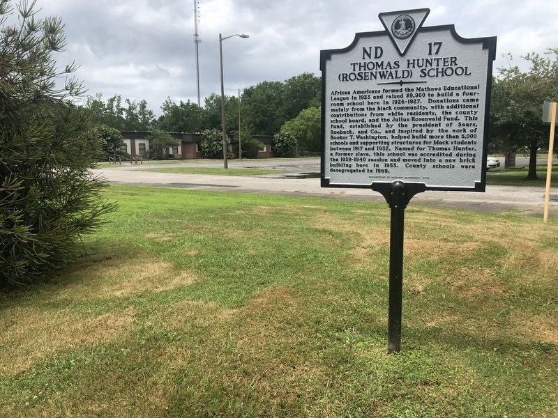
Thomas Hunter (Rosenwald) School Marker image. Click for full size.
Photographed by Devry Becker Jones (CC0), June 26, 2021
2. Thomas Hunter (Rosenwald) School Marker
(approx. 0.3 miles away); Tompkins Cottage Museum (approx. 0.4 miles away); Tompkins Cottage, circa 1820 (approx. 0.4 miles away); Veterans Memorial (approx. 0.4 miles away). Touch for a list and map of all markers in Mathews.
 
 
Credits. This page was last revised on June 27, 2021. It was originally submitted on June 27, 2021, by Devry Becker Jones of Washington, District of Columbia. This page has been viewed 877 times since then and 38 times this year. Photos:   1, 2. submitted on June 27, 2021, by Devry Becker Jones of Washington, District of Columbia.

m=176022

CeraNet Cloud Computing sponsors the Historical Marker Database.
This website earns income from purchases you make after using our links to Amazon.com. We appreciate your support.
Paid Advertisement
Jul. 24, 2026
