Beacon Hill in Boston in Suffolk County, Massachusetts — The American Northeast (New England)
Beacon Hill
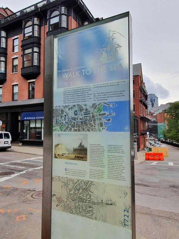
The Norman B. Leventhal Walk to the Sea
The Walk to the Sea encompasses four centuries of Boston history. Beginning at the State House on Beacon Hill, overlooking Boston's ancient Common, the Walk passes among historic landmarks and skyscrapers. The Walk crosses ground that, centuries earlier, was not ground at all but an active harbor. Boston's history is tied to the sea, whose smells and sounds once pervaded the town. The Walk from summit to sea, spanning one mile and descending a hundred feet, brings that history to life.
Mayor Thomas Menino dedicated the Norman B. Leventhal Walk to the Sea in 2008. For more information, explore The Norman B. Leventhal Map Center at the Boston Public Library (www.maps.bpl.org).
Boston was born here, on the eastern slope of Beacon Hill, though early settlements skirted is steep terrain. In 1625, Reverend William Blaxton, refuges from a failed colony, settled here alone.
Five years later, Blaxton invited some of the hundreds of Puritans recently arrived in the Massachusetts Bay to share his peninsula with its excellent springs. By 1634, hundreds of Puritans had usurped most of Blaxton’s land, leaving him with only 50 acres. He sold most of that land to the growing town for Boston's Common. Here, residents pastured their livestock, punished transgressors, and attended public assemblies.
Also in 1634, John Winthrop, governor of the Massachusetts Bay Colony, ordered a beacon placed atop the tallest peak of the original Trimount, giving Beacon Hill its name. He intended the beacon to warn of hostile ships, particularly the ships of King Charles I of England, who wished to reclaim the colony from Puritan control.
After the American Revolution, Beacon Hill became central to Boston’s rapid growth. The hilltop was carted away for fill, smoothing the way for new development. As portrayed at right, an elegant new State House replaced John Hancock’s estate, and wealthy insiders bought up Beacon Hill to sell as house lots. Within a few decades, gracious townhouses lined the new streets of Beacon Hill, and Boston Common became a park.
Reverse:
The Freedom Trail & The Black Heritage Trail
The Walk to the Sea intersects two other historic trails through Boston, the Freedom Trail and the Black Heritage Trail.
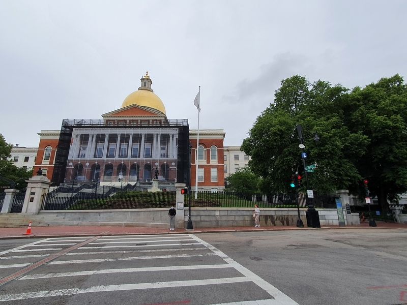
Here, at Beacon Street, the red line of The Freedom Trail® passes in front of the Massachusetts State House on its way to 16 national historic landmarks relating to the American Revolution. The trail begins here at the Boston Common. It passes through the old North End, where legendary patriots such as Paul Revere plotted to foil the British military strategy, and goes on to Bunker Hill and "Old Ironsides," the U.S.S. Constitution.
The
Black Heritage Trail begins here across from the State House at the memorial to the Massachusetts 54th Regiment of Civil War fame. The trail leads to the west side of Beacon Hill, where Boston's vibrant nineteenth-century African-American community thrived. There, fugitive slaves found support and refuge on their way to freedom and leaders of the black
community, such as Lewis Hayden, worked to support the abolitionist cause.
Erected by City of Boston.
Topics. This historical marker is listed in these topic lists: Colonial Era • Settlements & Settlers. A significant historical year for this entry is 2008.
Location. 42° 21.468′ N, 71° 3.79′ W. Marker is in Boston, Massachusetts, in Suffolk County. It is in Beacon Hill. Marker is at the intersection of Beacon Street and Park Street, on the left when traveling east on Beacon Street. Touch for map. Marker is in this post office area: Boston MA 02108, United States of America. Touch for directions.
Other nearby markers. At least 8 other markers are within walking distance of this marker. General Joseph Hooker (a few steps from this marker); Arrival of the Frigate Arbella (within shouting distance of this marker); Memorial to Robert Gould Shaw and the Massachusetts 54th Regiment (within shouting distance of this marker); Grand Army of the Republic in Massachusetts (within shouting distance of this marker); The Monument (within shouting distance of this marker); Mary Dyer (within shouting distance of this marker); The Sculptor (within shouting distance of this marker); Chester Harding House (within shouting distance of this marker). Touch for a list and map of all markers in Boston.
Credits. This page was last revised on January 30, 2023. It was originally submitted on June 29, 2021, by J. Makali Bruton of Accra, Ghana. This page has been viewed 271 times since then and 35 times this year. Photos: 1, 2. submitted on June 29, 2021, by J. Makali Bruton of Accra, Ghana.

