
Vincennes in Knox County, Indiana — The American Midwest (Great Lakes)
Lincoln Memorial Bridge
Photographed by Shane Oliver, June 19, 2021
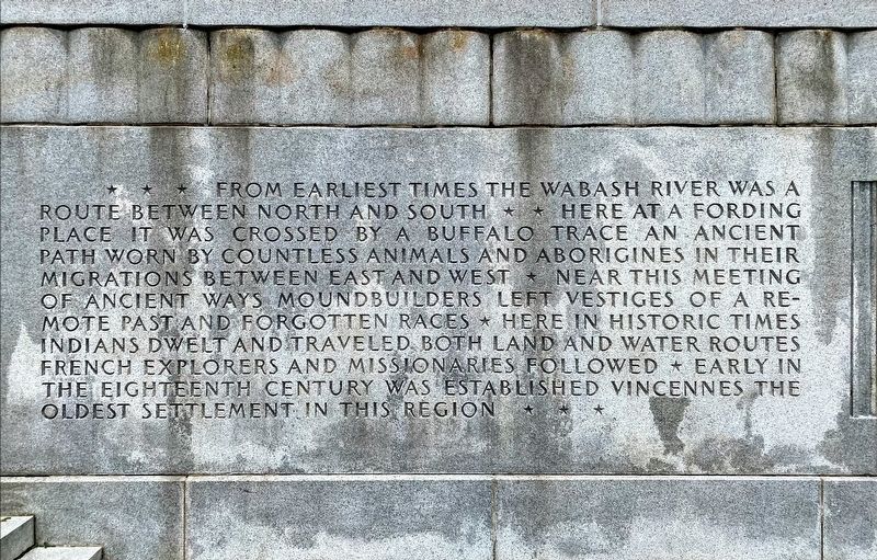
1. Lincoln Memorial Bridge Marker
First Panel
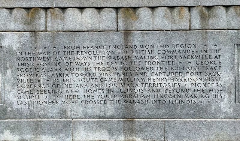
From France, England won this region. In the War of the Revolution the British Commander in the Northwest came down the Wabash, making Fort Sackville at this crossing of ways the key to the frontier. George Rogers Clark with his troops followed the Buffalo Trace from Kaskaskia toward Vincennes and captured Fort Sackville. By this route came William Henry Harrison, first Governor of Indiana and Louisiana Territories. Pioneers came seeking new homes in Illinois and beyond the Mississippi. Here the youth Abraham Lincoln, making his last pioneer move, crossed the Wabash into Illinois.
The
this page online
Erected 1932.
Topics. This historical marker is listed in these topic lists: Bridges & Viaducts • Colonial Era • War, US Revolutionary.
Location. 38° 40.801′ N, 87° 32.046′ W. Marker is in Vincennes, Indiana, in Knox County. It is on Vigo Street (Indiana Route 441), on the left when traveling west. Marker is located at the Lincoln Memorial Bridge, on the grounds of George Rogers Clark National Historical Park. Touch for map. Marker is in this post office area: Vincennes IN 47591, United States of America. Touch for directions.

Regionally, this
Photographed by Shane Oliver, June 19, 2021
2. Lincoln Memorial Bridge Marker
Second Panel
Other nearby markers. At least 8 other markers are within walking distance of this marker: Memorial Bridge Approach (a few steps from this marker); Patriotism of Charles Gratiot (within shouting distance of this marker); Site of Ferry Landing (within shouting distance of this marker); U.S.S. Vincennes (within shouting distance of this marker); Vincennes in the American Revolution (about 300 feet away, measured in a direct line); The Old Cathedral “French and Indian” Cemetery (about 300 feet away); Gold Star Honor Roll (about 300 feet away); Patrick Henry Square (about 300 feet away). Touch for a list and map of all markers in Vincennes.
Photographed by Shane Oliver, June 19, 2021
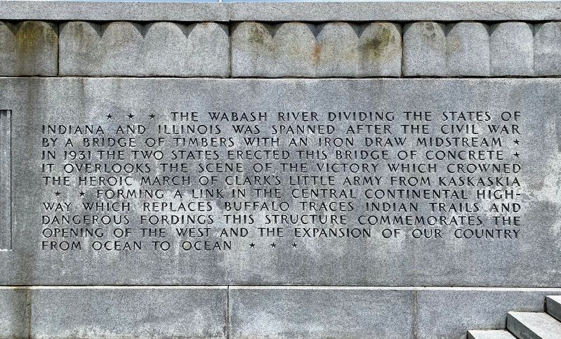
3. Lincoln Memorial Bridge Marker
Third Panel
Photographed by Shane Oliver, June 19, 2021
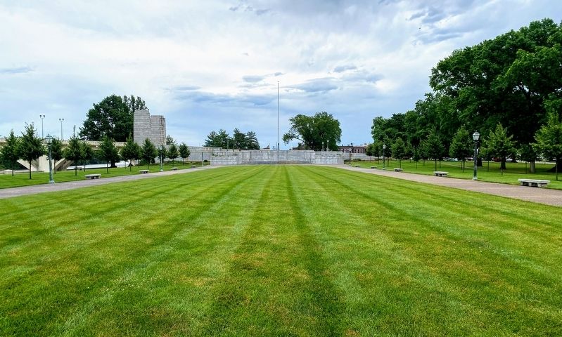
4. View of the Lincoln Memorial Bridge from the George Rogers Clark Memorial
The marker can be seen in the center of the bridge, just underneath the flagpole.
Photographed by Shane Oliver, June 19, 2021
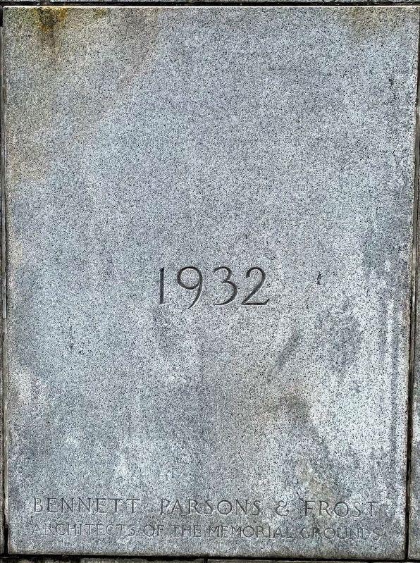
5. Lincoln Memorial Bridge Cornerstone
The cornerstone contains the year the bridge was dedicated (center), and the architectural firm who designed the bridge (bottom).
Photographed by Shane Oliver, June 19, 2021
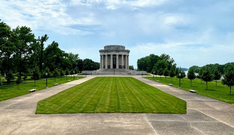
6. George Rogers Clark Memorial as seen from the Lincoln Memorial Bridge
Credits. This page was last revised on July 6, 2021. It was originally submitted on June 30, 2021, by Shane Oliver of Richmond, Virginia. This page has been viewed 590 times since then and 24 times this year. Photos: 1, 2, 3, 4, 5, 6. submitted on June 30, 2021, by Shane Oliver of Richmond, Virginia. • Bill Pfingsten was the editor who published this page.
