Near Arcadia in Oklahoma County, Oklahoma — The American South (West South Central)
Rock of Ages
Historic Route 66 Site
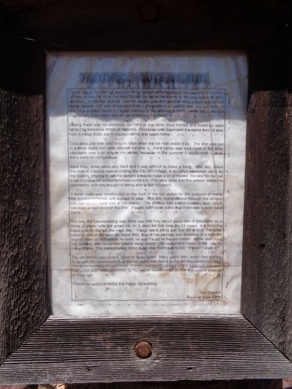
Seeing there was no electricity out here at that time, most homes and buildings were lighted by kerosene lamps or lanterns. Kerosene was dispensed the same way oil was, from a metal drum, put in your container and taken home.
Cold soda pop was sold only on days when the ice man made it by. The pop was put in a large metal box with chipped ice over it. Hard candy was sold most of the time; chocolate was sold only in the winter, because in the summer it would melt - since there were no refrigerators.
Back then, times were very hard and it was difficult to make a living. One day, about the time Al Capone was terrorizing the City of Chicago, a so-called salesman came by the station, offering to sell the owners a way to make a lot of money, literally, for he had a set of plates for a counterfeit ten-dollar bill. The story goes that the people yielded to temptation, with the thought of being able to get rich quick.
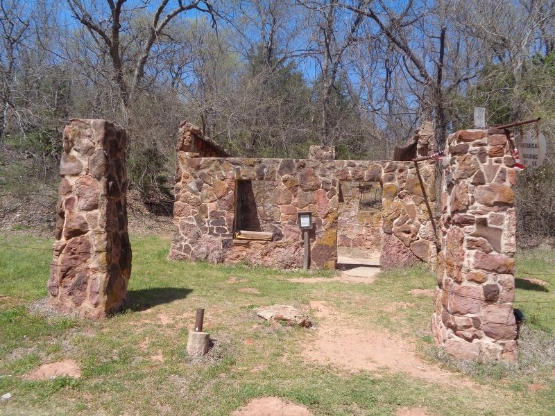
A small room was constructed on the back of the old station for the purpose of hiding the printing materials and a place to work. The only entrance was through the window you see on the back wall of the station. The window had a solid wooden door, which was kept closed most of the time. People didn't even know that there was a room back there.
The way the counterfeiting was done that they would press one of the plates on a piece of paper with the green ink on it, then let that side dry 24 hours, and print the black side of the bill the next day. Things went along just fine for a time, but while passing one of the fake ten-dollar bills, one of the persons was arrested, and with the identification on him where he lived, he was traced to the old station. While searching the building, the counterfeit plates were found. So ended this crime spree, like so many others. The person being taken to jail who overheard to say, "It wasn't worth it!"
The old station was closed, never to open again. Many years later, which had nothing to do with the counterfeiting, a murder victim was found in the old abandoned building. Police were unable to determine whether he was killed here or the body just dumped. The victim was never identified for he had no identification
on him and no one seemed to know him.
Please be careful entering this fragile old building.
Erected by the owners of Rock of Ages farm.
Topics and series. This historical marker is listed in these topic lists: Industry & Commerce • Law Enforcement. In addition, it is included in the U.S. Route 66 series list.
Location. 35° 39.615′ N, 97° 16.428′ W. Marker is near Arcadia, Oklahoma, in Oklahoma County. Marker is on East Danforth Road (State Highway 66) 0.4 miles west of North Choctaw Road, on the right when traveling west. Marker is on a roadside pullout in front of the ruins of the station. Touch for map. Marker is in this post office area: Arcadia OK 73007, United States of America. Touch for directions.
Other nearby markers. At least 8 other markers are within 3 miles of this marker, measured as the crow flies. Paul McCartney (approx. 1.4 miles away); Run of '89 East Boundary (approx. 1˝ miles away); Washington Irving's Camp (approx. 2˝ miles away); a different marker also named Washington Irving's Camp (approx. 2˝ miles away); Tuton's Drugstore (approx. 2.9 miles away); Route 66 (approx. 2.9 miles away); Beverly and Karl White (approx. 2.9 miles away); Everybody Had One (approx. 2.9 miles away). Touch for a list and map of all markers in Arcadia.
Regarding Rock of Ages. While the place has no official name, it has been called "Rock O' Ages", "Ruins of an old Conaco station" and the "Old Rock Filling Station". It is seen while driving on old Route 66 between Luther and Arcadia. Sometimes it is easy to miss because of the high speed limit.
Credits. This page was last revised on July 2, 2021. It was originally submitted on June 2, 2021, by Jason Voigt of Glen Carbon, Illinois. This page has been viewed 510 times since then and 87 times this year. Last updated on July 2, 2021, by Kevin L Burden of Oklahoma City, Oklahoma. Photos: 1, 2. submitted on June 2, 2021, by Jason Voigt of Glen Carbon, Illinois. • J. Makali Bruton was the editor who published this page.

