Truckee in Nevada County, California — The American West (Pacific Coastal)
First Permanent Emigrant Trail Markers
Photographed by Carey Pearce, PGP NSGW, November 3, 2017
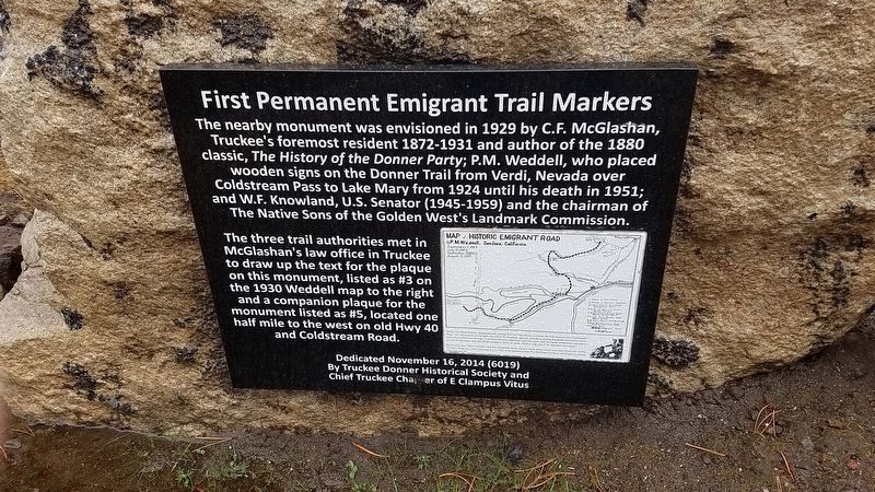
1. First Permanent Emigrant Trail Markers Marker
The three trail authorities met in McGlashan’s law office in Truckee to draw up the text for the plaque on this monument, listed as #3 on the map to the right and a companion plaque for the monument listed as #5, located one half mile to the west on old Hwy 40 and Coldstream Road
Erected 2014 by E Clampus Vitus.
Topics and series. This historical marker is listed in this topic list: Landmarks. In addition, it is included in the E Clampus Vitus series list. A significant historical year for this entry is 1929.
Location. 39° 19.533′ N, 120° 13′ W. Marker is in Truckee, California, in Nevada County. It is on Donner Pass Road, on the left when traveling west. Touch for map. Marker is at or near
this page online

Regionally, this marker is in the Sierra Nevada. It is also in the American Mountain West. Globally, it is in North America, on the Ring of Fire, on the Pacific Rim, in the Western Hemisphere, in the Western World, and in the Anglosphere. Historically, it finds itself in what was once New Spain and also Mexico’s Alta California.
Other nearby markers. At least 8 other markers are within 2 miles of this marker, measured as the crow flies: The Emigrant Trail (here, next to this marker); The Gateway Cabin (approx. 0.2 miles away); a different marker also named The Emigrant Trail (approx. 0.7 miles away); Donner Party (approx. 0.8 miles away); A Monument to Pioneer Families (approx. 0.8 miles away); Schallenberger Cabin Site (approx. 0.8 miles away); a different marker also named Donner Party (approx. 0.9 miles away); Rocking Stone (approx. 1½ miles away). Touch for a list and map of all markers in Truckee.
Related markers. Click here for a list of markers that are related to this marker.
Credits. This page was last revised on April 2, 2026. It was originally submitted on July 2, 2021, by James King of San Miguel, California. This page has been viewed 515 times since then and 51 times this year. Photo 1. submitted on July 2, 2021, by James King of San Miguel, California. • Syd Whittle was the editor who published this page.
Editor’s want-list for this marker. Distance photo of marker and surroundings • Can you help?
