
Near Churchill in Chippewa County, Minnesota — The American Midwest (Upper Plains)
Lac qui Parle Mission

Photographed by Connor Olson, June 29, 2021
1. Lac qui Parle Mission Marker
The Lac qui Parle Mission opened in 1835, a time when Dakota people remained in control of the region and their lives. The missionaries and their families were guests in a land that did not belong to them. The station closed in 1854, the year after the Treaty of Traverse des Sioux was ratified, leaving Dakota people a fragment of their homelands as a reservation within the United States.
This exhibit was begun in 2013-14 by students in a public history course at Gustavus Adolphus College, St. Peter, in collaboration with the Nicollet County Historical Society. It was finished in 2016
this page online
Other Places, Other Stories
The Lac qui parle is part of a larger story. We encourage you to visit other places like the Lac qui parle Historical Society, the Chippewa County Historical Society, the Upper and Lower Sioux Agency Historic Sites, Historic Fort Snelling, Traverse des Sioux, the Renville County Historical Society, and the Pond-Dakota Mission Park.
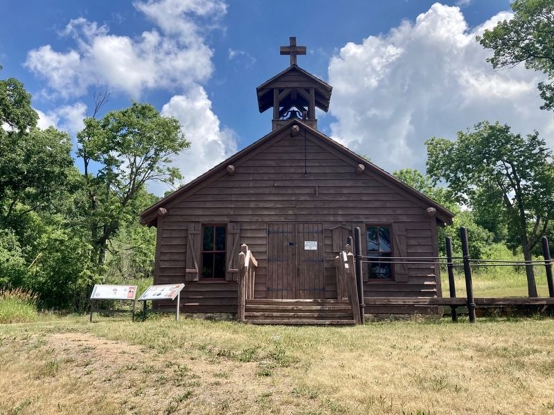
Caption: Artist's conception of the original church at Lac qui parle by Wyn Greene, 1964.
Erected 2016 by Gustavus Adolphus College; Nicollet County Historical Society; Minnesota Historical Society.
Topics. This historical marker is listed in these topic lists: Charity & Public Work • Indigenous Peoples and Communities • Religion & Religious Structures. A significant historical year for this entry is 1835.
Location. 45° 1.38′ N, 95° 52.074′ W. Marker is near Churchill, Minnesota, in Chippewa County. It is on 140th Avenue Northwest (County Road 32) near 1st Street
Photographed by Connor Olson, June 29, 2021
2. Lac qui Parle Mission Marker

Regionally, this marker is in Southwest Minnesota. It is also in the American Midwest, in the Corn Belt, and on the Great Plains. Globally, it is in North America, the Western Hemisphere, the Western World, and the Anglosphere. Historically, it finds itself in what was once Rupert’s Land, the territory of the Mississippian Culture, and the Louisiana Purchase.
Other nearby markers. At least 8 other markers are within walking distance of this marker: Lac qui Parle Mission & Fort Renville (a few steps from this marker); Williamson Cabin (within shouting distance of this marker); Acculturation & Autonomy (within shouting distance of this marker); Missionaries at Lac qui Parle (about 300 feet away, measured in a direct line); Dakotas at Lac qui Parle (about 300 feet away); The ABCFM (about 300 feet away); Huggins Cabin (about 300 feet away); The Dakota (about 300 feet away). Touch for a list and map of all markers in Churchill.
Credits. This page was last revised on December 11, 2024. It was originally submitted on July 4, 2021, by Connor Olson of Menomonee Falls, Wisconsin. This page has been viewed 585 times since then and 39 times this year. Photos: 1, 2. submitted on July 4, 2021, by Connor Olson of Menomonee Falls, Wisconsin. • Mark Hilton was the editor who published this page.
