Belknap Lookout in Grand Rapids in Kent County, Michigan — The American Midwest (Great Lakes)
Sixth Street Bridge
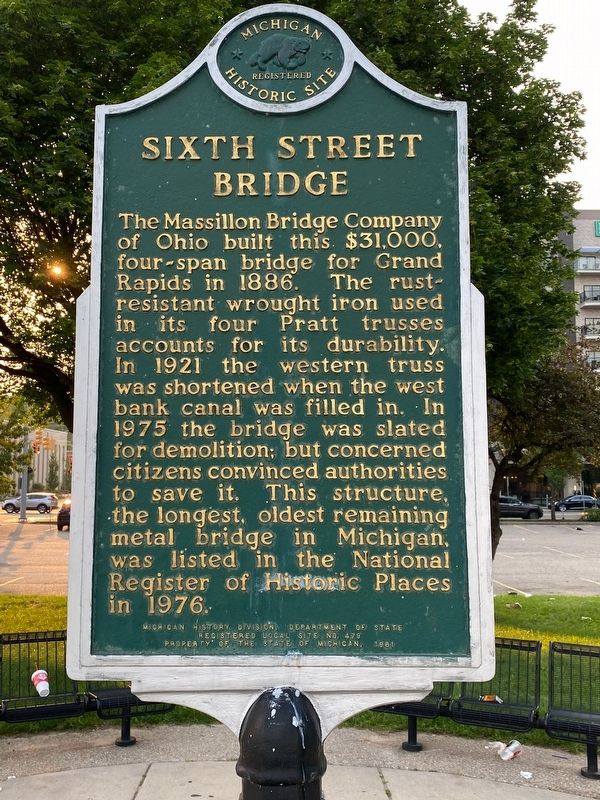
Photographed by J.T. Lambrou, July 4, 2021
1. Sixth Street Bridge Marker
Erected 1981 by Michigan History Division, Department of State. (Marker Number L0479.)
Topics and series. This historical marker is listed in this topic list: Bridges & Viaducts. In addition, it is included in the Michigan Historical Commission series list. A significant historical year for this entry is 1986.
Location. 42° 58.585′ N, 85° 40.395′ W. Marker is in Grand Rapids, Michigan, in Kent County. It is in Belknap Lookout. It is at the intersection of 6th Street Northwest and Monroe Avenue Northwest, on the right when traveling east on 6th Street Northwest. Located in the Sixth Street Park. Touch for map. Marker
this page online

Regionally, this marker is in West Michigan. It is also in the American Midwest. Globally, it is in North America, the Western Hemisphere, the Western World, and the Anglosphere. Historically, it finds itself in what was once the Northwest Territory.
Other nearby markers. At least 8 other markers are within walking distance of this marker: Adulation: The Future of Science (approx. 0.4 miles away); The Grand River (approx. 0.4 miles away); Great Flood of 1904 (approx. 0.4 miles away); La Grande Vitesse (approx. half a mile away); Village of Grand Rapids (approx. half a mile away); First Baptist Mission Station (approx. half a mile away); Mayor Lyman S. Parks (approx. half a mile away); German-English Schoolhouse (approx. half a mile away). Touch for a list and map of all markers in Grand Rapids.
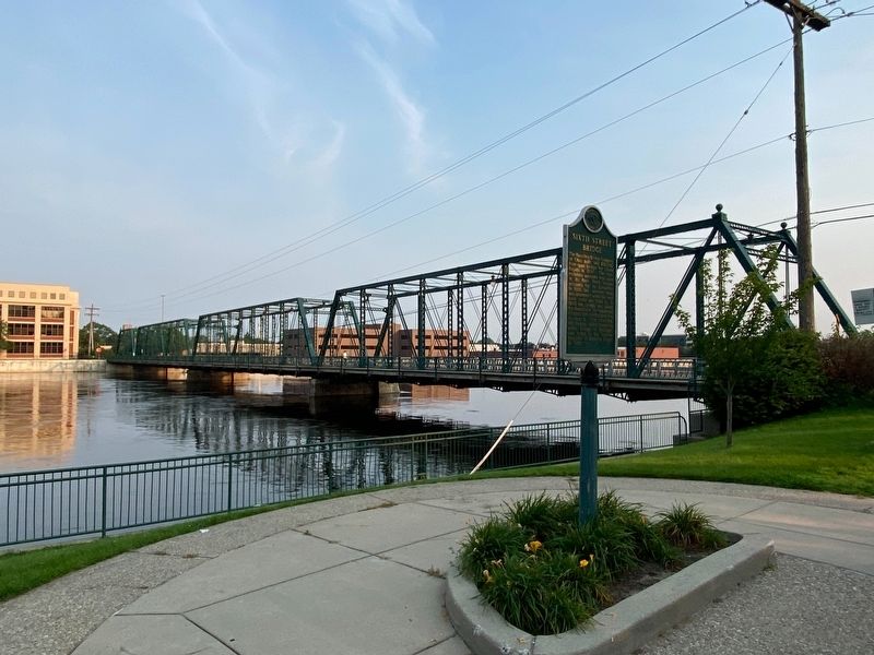
Photographed by J.T. Lambrou, July 4, 2021
2. Sixth Street Bridge Marker
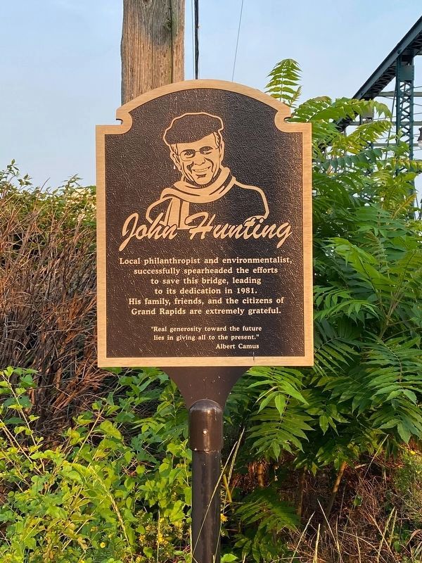
Photographed by J.T. Lambrou, July 4, 2021
3. John Hunting - Spearheaded efforts to save the bridge.
Credits. This page was last revised on August 6, 2023. It was originally submitted on July 5, 2021, by J.T. Lambrou of New Boston, Michigan. This page has been viewed 486 times since then and 52 times this year. Photos: 1, 2, 3. submitted on July 5, 2021, by J.T. Lambrou of New Boston, Michigan. • Mark Hilton was the editor who published this page.
