Near Kings Mountain in Cleveland County, North Carolina — The American South (South Atlantic)
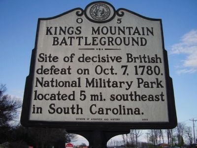
Kings Mountain Battleground
Erected 2000 by Division or Archives and History. (Marker Number O-5.)
Topics and series. This historical marker is listed in this topic list: War, US Revolutionary. In addition, it is included in the North Carolina Division of Archives and History series list. A significant historical year for this entry is 1780.
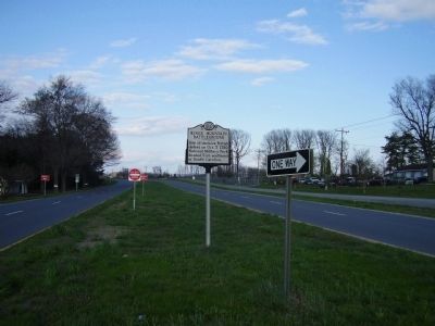
Location. 35° 10.985′ N, 81° 24.997′ W. Marker is near Kings Mountain, North Carolina, in Cleveland County. Marker is at the intersection of South Battleground Avenue (U.S. 29) and Battleground Road (State Highway 216), in the median on South Battleground Avenue. Touch for map. Marker is at or near this postal address: 1842 South Battleground Avenue, Kings Mountain NC 28086, United States of America. Touch for directions.
Other nearby markers. At least 8 other markers are within 4 miles of this marker, measured as the crow flies. Patrick Ferguson (approx. 2.1 miles away); Cornwallis (approx. 2.2 miles away); North Carolina / South Carolina (approx. 2.2 miles away); Frederick Hambright (approx. 2.3 miles away in South Carolina); James Williams at Kings Mountain / The Battle of Kings Mountain (approx. 2.3 miles away in South Carolina); October 6, 1780 (approx. 2.6 miles away in South Carolina); Route of March (approx. 2.8 miles away in South Carolina); "Huzzah for Liberty!" (approx. 3.3 miles away in South Carolina).
Credits. This page was last revised on June 24, 2021. It was originally submitted on April 4, 2009, by Stanley and Terrie Howard of Greer, South Carolina. This page has been viewed 1,528 times since then and 30 times this year. Photos: 1, 2. submitted on April 4, 2009, by Stanley and Terrie Howard of Greer, South Carolina. • Craig Swain was the editor who published this page.

