Near Walterboro in Colleton County, South Carolina — The American South (South Atlantic)
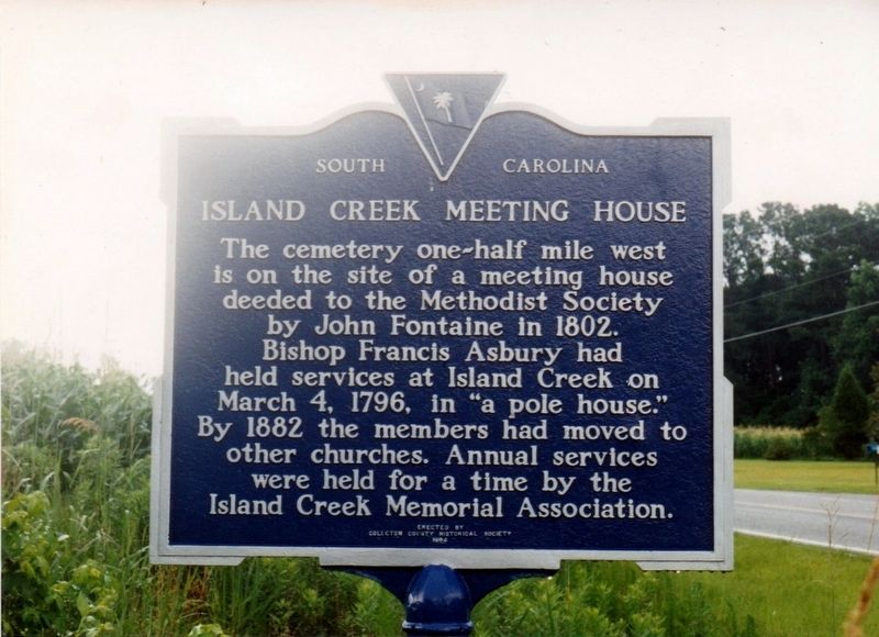
Island Creek Meeting House
Erected 1964 by Colleton County Historical Society. (Marker Number 15-5.)
Topics. This historical marker is listed in these topic lists: Cemeteries & Burial Sites • Churches & Religion • Settlements & Settlers. A significant historical date for this entry is March 4, 1796.
Location. 33° 0.125′ N, 80° 38.22′ W. Marker is near Walterboro, South Carolina, in Colleton County. Marker is at the intersection of Jeffries Highway (U.S. 15) and Pleasant Grove Road, on the left when traveling north on Jeffries Highway. Touch for map. Marker is in this post office area: Walterboro SC 29488, United States of America. Touch for directions.
Other nearby markers. At least 8 other markers are within 6 miles of this marker, measured as the crow flies. Training the Tuskegee Airmen (approx. 4.3 miles away); Prisoner Of War Camp and Camouflage School (approx. 5.9 miles away); Walterboro Army Air Field (approx. 5.9 miles away); The Tuskegee Airman of World War II (approx. 5.9 miles away); Walterboro Army Airfield (approx. 5.9 miles away); The Tuskegee Airmen (approx. 5.9 miles away); The Beacon (approx. 5.9 miles away); a different marker also named Walterboro Army Airfield (approx. 5.9 miles away). Touch for a list and map of all markers in Walterboro.
Credits. This page was last revised on July 6, 2021. It was originally submitted on July 6, 2021, by Tim Fillmon of Webster, Florida. This page has been viewed 188 times since then and 20 times this year. Photo 1. submitted on July 6, 2021, by Tim Fillmon of Webster, Florida.
Editor’s want-list for this marker. A wide view photo of the marker and the surrounding area in context. • Can you help?
