Charlestown in Boston in Suffolk County, Massachusetts — The American Northeast (New England)
Three Centuries of Use & Transformation
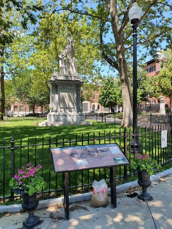
Charlestown Training Field / Winthrop Square
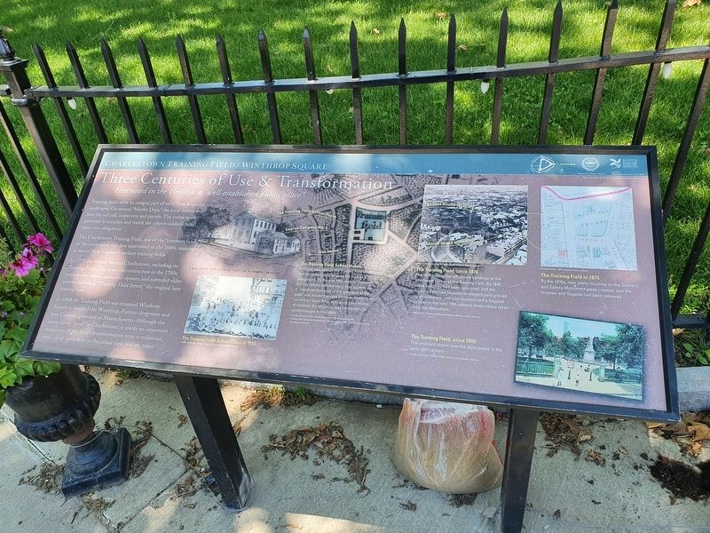
Three Centuries of Use & Transformation
First noted in the 1640s as a “well-established public place.”
Training fields were an integral part of early New England landscapes. On annual “Muster Days,” the local militia met here for roll call, inspection and parade. The entire town gathered to socialize and watch the citizen-soldiers fulfill their civic obligation.
The Charlestown Training Field, one of the "common lands” of the settlement, was first mentioned in the 1640s, making it one of New England's earliest training fields.
In 1775 the British burned Charlestown, including its Training Field. The town's reconstruction in the 1780s created new streets, lanes and squares, and extended older streets, including "Training Field Street," the original lane leading here.
In 1848 the Training Field was renamed Winthrop Square to honor John Winthrop, Puritan clergyman and first Colonial governor of Massachusetts. Although the name never “took" in Charlestown, it marks an important transition in the field's transformation from a utilitarian, semi-rural open field to the urban park you see today.
Captions:
The Training Field School House
A school was built on the Training Field in 1827, and the schoolchildren used the area as a playground. By the mid-19th century, however, the city fathers derided the school building as a "needless destroyer of the symmetry of the park" and moved it across Common Street to its current location. After educating generations of children, the structure was converted into condominiums in the 1960s.
From An Account of the Second Re-union of the Graduates of the Training Field School in Charlestown held January 18, 1882, Boston Public Library, Charlestown Branch
View from the Bunker Hill Monument, Historic New England
The Training Field, circa 1870
The 1838 map to the left shows buildings at the southwest corner of the Training Field. By 1848, these buildings had been relocated, and the Training Field had become an elegant park graced by an elaborate cast-iron fountain and a flagpole as seen in the later 19th century photo above taken from the Monument.
1838 map by Thomas Gamaliel Bradford; Boston Public Library
Bromley Atas 1875, Boston Public Library
The Training Field in 1875
By the 1870s, new paths focusing on the Soldiers and Sailors Monument were created, and the fountain and flagpole had been removed.
The Training Field School Class of 1910
Cutler Collection, Boston Public Library, Charlestown Branch
The Training Field, circa 1910
This postcard shows how the park looked in the early 20th century.
Friends
Collection, Boston Public Library, Charlestown Branch
Erected by Boston Parks & Recreation.
Topics. This historical marker is listed in these topic lists: Parks & Recreational Areas • War, US Revolutionary. A significant historical date for this entry is January 18, 1882.
Location. 42° 22.461′ N, 71° 3.59′ W. Marker is in Boston, Massachusetts, in Suffolk County. It is in Charlestown. Marker is at the intersection of Common Street and Adams Street, on the left when traveling east on Common Street. Touch for map. Marker is in this post office area: Charlestown MA 02129, United States of America. Touch for directions.
Other nearby markers. At least 8 other markers are within walking distance of this marker. American Soldiers Killed June 17, 1775 (within shouting distance of this marker); The Training Field's Struggle for Survival (within shouting distance of this marker); Massachusetts Gate (about 600 feet away, measured in a direct line); The Freedom Trail (about 600 feet away); Connecticut Gate (about 600 feet away); South-East Corner of the Redoubt (about 700 feet away); Deacon Larkin House (about 700 feet away); John Hurd House (about 700 feet away). Touch for a list and map of all markers in Boston.
Credits. This page was last revised on January 30, 2023. It was originally submitted on July 11, 2021, by J. Makali Bruton of Accra, Ghana. This page has been viewed 99 times since then and 24 times this year. Photos: 1, 2. submitted on July 11, 2021, by J. Makali Bruton of Accra, Ghana.

