Near Reedsport in Douglas County, Oregon — The American West (Northwest)
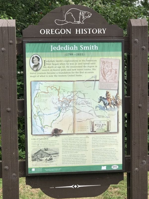
Jedediah Smith
(1799-1831)
A life of Exploration
After three years in the Rocky Mountains, Jedediah Smith led trapping expeditions to California in 1826 and 1827. Both times he was ordered to leave by Mexican authorities.
On the second expedition, Smith purchased more than 300 horses. Unable to cross the Sierras with their large herd, Smith's party drove them to the Pacific coast, then north into Oregon. The large party would have made a substantial environmental impact and likely angered the native people whose lands they passed through. Disagreements about trade and differing notions of property and trespass probably also led to conflict.
On July 13, 1828, Smith's party camped near the mouth of Smith River. A skirmish erupted between the trappers and local Native Americans, the Quuiich (L Umpqua). Smith and three others escaped and made their way on foot north along the Oregon coast. Tillamook Native Americans delivered the trappers to the British Hudson's Bay Company at Fort Vancouver, which sent out an expedition to investigate, accompanied by Smith. They recovered some of their horses and beaver pelts, and more important for us today, Smith's travel journals.
Jedediah Smith returned to the Rocky Mountains from his California ventures with little profit but a wealth of knowledge about the West, unrivaled by any other Euro-American. After a season trapping in Montana, Smith retired to St. Louis and began leading freight wagons across the Santa Fe Trail. In May 1831, he rode ahead to search for water and was killed by Comanche warriors.
caption:
Top right: John C. Fremont's 1848 map was one of the first accurate depictions of the West. Information in Jedediah Smith's journals, this and similar maps helped shape the course of America's westward expansion.
Bottom left: Villages similar to this Quuiich winter village were common along Jedediah Smith's journey up the Oregon Coast.
Erected by The Oregon Community Foundation • Oregon Travel Experience.
Topics and series. This historical marker is listed in this topic list: Exploration. In addition, it is included in the Oregon Beaver Boards series list. A significant historical date for this entry is July 13, 1828.
Location. 43° 42.757′ N, 124° 5.978′ W. Marker is near Reedsport, Oregon, in Douglas County. Marker is on Oregon Coast Highway
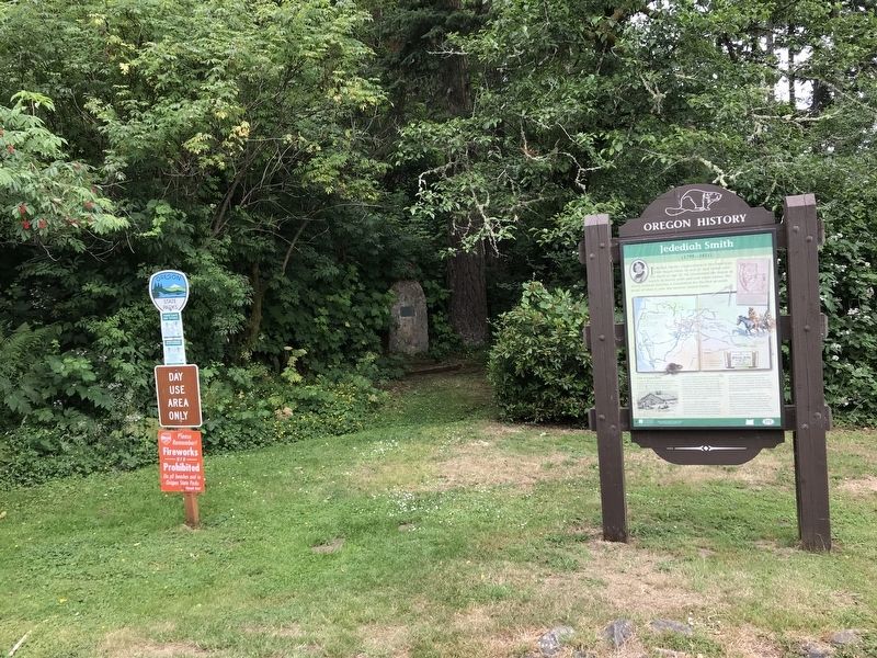
(U.S. 101) 0.1 miles south of Lower Smith River Road, on the right when traveling south. Marker is in Tide Ways Island Memorial Park. Touch for map. Marker is in this post office area: Reedsport OR 97467, United States of America. Touch for directions.
Other nearby markers. At least 7 other markers are within 9 miles of this marker, measured as the crow flies. Smith, Jackson & Sublette Umpqua Memorial (approx. half a mile away); What is a Steam Donkey? (approx. 0.7 miles away); History of Local Steam Donkey (approx. 0.7 miles away); Gardiner (approx. 1.2 miles away); U.S.C.G. Station, Umpqua River, 1939 (approx. 6 miles away); Umpqua River Lighthouse (approx. 6.1 miles away); Brandy Bar (approx. 8.7 miles away).
Related marker. Click here for another marker that is related to this marker. This link is to the original Jedediah Smith historical marker that was replaced by this one.

Photographed By Bob Zybach, June 14, 2023
3. Tide Ways Island Memorial Park
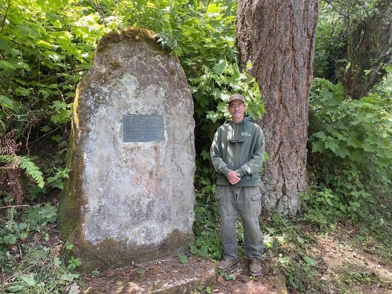
This monument is a short distance from the Jedediah Smith marker and was placed in August, 1934. Dale Hanson is standing next to it for scale. In addition to the title and date, the bronze plaque says it was "Donated by Wm. & Jennie D. Chamberlain in memory of their children Baby, Marjorie, Merle, Barbara, and Doane." Note that "Tide Ways Island" has since been renamed "Bolon Island."

Photographed By Duane and Tracy Marsteller, June 29, 2021
4. ide Ways Island Memorial Park
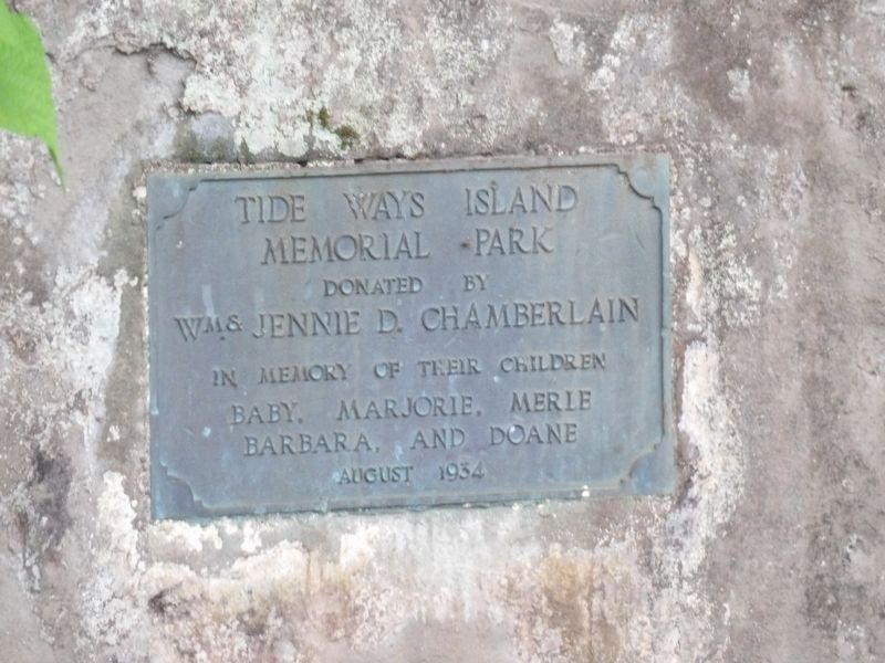
This plaque is on a stone behind the historical marker. It reads,
Tide Ways Island Memorial Park
Donated by Wm. & Jennie D. Chamberlain
in memory of their children
Baby, Marjorie, Merle, Barbara, and Doane
August 1934
Credits. This page was last revised on December 5, 2023. It was originally submitted on July 11, 2021, by Duane and Tracy Marsteller of Murfreesboro, Tennessee. This page has been viewed 306 times since then and 54 times this year. Photos: 1, 2. submitted on July 11, 2021, by Duane and Tracy Marsteller of Murfreesboro, Tennessee. 3. submitted on November 27, 2023, by Bob Zybach of Creswell, Oregon. 4. submitted on July 11, 2021, by Duane and Tracy Marsteller of Murfreesboro, Tennessee.

