Dinwiddie in Dinwiddie County, Virginia — The American South (Mid-Atlantic)
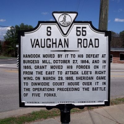
Vaughan Road
Erected 1968 by Virginia Historic Landmarks Commission. (Marker Number S-55.)
Topics and series. This historical marker is listed in this topic list: War, US Civil. In addition, it is included in the Virginia Department of Historic Resources (DHR) series list. A significant historical month for this entry is March 1867.
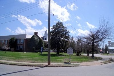
Location. 37° 4.903′ N, 77° 34.941′ W. Marker is in Dinwiddie, Virginia, in Dinwiddie County. Marker is at the intersection of Carson Road and Boydton Plank Road (U.S. 1), on the left when traveling west on Carson Road. Touch for map. Marker is in this post office area: Dinwiddie VA 23841, United States of America. Touch for directions.
Other nearby markers. At least 8 other markers are within 2 miles of this marker, measured as the crow flies. The War of 1812 / Winfield Scott (approx. 0.3 miles away); Dinwiddie Confederate Monument (approx. 0.4 miles away); Early Education in Dinwiddie County (approx. 0.4 miles away); Dinwiddie Court House (approx. 0.4 miles away); Battle of Dinwiddie Court House (approx. 0.4 miles away); Scott's Law Office (approx. half a mile away); Dinwiddie Courthouse (approx. half a mile away); Southside High School (approx. 1.8 miles away). Touch for a list and map of all markers in Dinwiddie.
Also see . . .
1. CWSAC Battle Summary. Boydton Plank Road (Burgess’ Mill). (Submitted on April 6, 2009, by Bernard Fisher of Richmond, Virginia.)
2. CWSAC Battle Summary. Dinwiddie Court House. (Submitted on April 6, 2009, by Bernard Fisher of Richmond, Virginia.)
Credits. This page was last revised on June 16, 2016. It was originally submitted on April 6, 2009, by Bernard Fisher of Richmond, Virginia. This page has been viewed 1,247 times since then and 56 times this year. Photos: 1, 2. submitted on April 6, 2009, by Bernard Fisher of Richmond, Virginia.

