Near Ocracoke in Carteret County, North Carolina — The American South (South Atlantic)
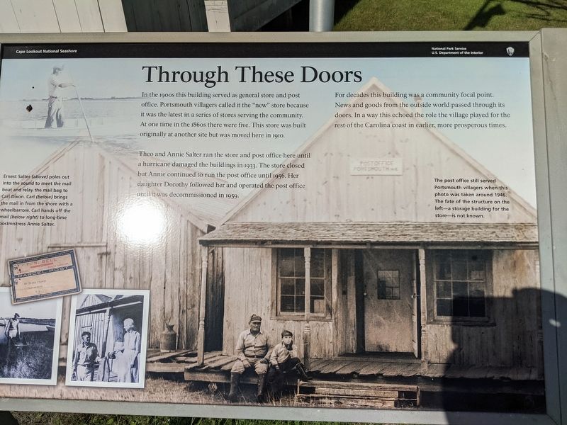
Through These Doors
Cape Lookout National Seashore
Photographed by Sean C Bath, July 13, 2021
1. Portsmouth post office marker
Theo and Annie Salter ran the store and post office here until a hurricane damaged the buildings in 1933. The store closed but Annie continued to run the post office until 1956. Her daughter Dorothy followed her and operated the post office until it was decommissioned in 1959.
For decades this building was a community focal point. News and goods from the outside world passed through its doors. In a way this echoed the role the village played for the rest of the Carolina coast in earlier, more prosperous times.
(captions)
The post office still served Portsmouth villagers when this photo was taken around 1946. The fate of the structure on the left—a storage building for the store—is not known.
Ernest Salter (above) poles out into the sound to meet the mail boat and relay the mail bag to Carl Dixon. Carl (below) brings the mail in from the shore with a wheelbarrow. Carl hands off the mail (below right) to long time postmistress Annie Salter.
Erected by National
this page online
Topics. This historical marker is listed in these topic lists: Communications • Settlements & Settlers.
Location. 35° 4.191′ N, 76° 3.83′ W. Marker is near Ocracoke, North Carolina, in Carteret County. It can be reached from an unnamed road. Located in front of the post office building at the center of Portsmouth Village where multiple trails cross. Touch for map. Marker is in this post office area: Ocracoke NC 27960, United States of America. Touch for directions.

Regionally, this marker is in the Coastal Plain, on the Crystal Coast, and on the Outer Banks. It is also in the American South, specifically in the Upper South, in the Tidewater, and on the Eastern Seaboard. Globally, it is in the North Atlantic Region, North America, the Western Hemisphere, the Western World, and the Anglosphere. Historically, it finds itself in what was once the territory of the Mississippian Culture, one of the original Thirteen Colonies, one of the Confederate States of America, and the Antebellum South.
Other nearby markers. At least 8 other markers are within 6 miles of this marker, measured as the crow flies: Methodist Church (about 700 feet away, measured in a direct line); Exploring Portsmouth (approx. 0.2 miles away); Remembering Our Ancestors (approx. 0.2 miles away); Springer’s Point Preserve (approx. 5 miles away); Growing More Resilient (approx. 5.1 miles away); Ocracoke’s Silent Sentinel (approx. 5.1 miles away); A Light for Ocracoke Inlet (approx. 5.2 miles away); Living at the Light (approx. 5.2 miles away). Touch for a list and map of all markers in Ocracoke.
More about this marker. Portsmouth Island is accessible only by boat, which can be chartered from Ocracoke, NC.
Also see . . .
1. Portsmouth Village. Cape Lookout National Seashore. National Park Service (Submitted on July 15, 2021.)
2. Visiting Portsmouth Village. Cape Lookout National Seashore. National Park Service. (Submitted on July 15, 2021.)
3. Portsmouth, North Carolina. Wikipedia. (Submitted on July 15, 2021.)
Credits. This page was last revised on April 5, 2025. It was originally submitted on July 14, 2021, by Sean C Bath of Silver Spring, Maryland. This page has been viewed 383 times since then and 19 times this year. Photo 1. submitted on July 14, 2021, by Sean C Bath of Silver Spring, Maryland. • Bernard Fisher was the editor who published this page.
Editor’s want-list for this marker. Wide shot of marker and its surroundings. • Can you help?
