Arch Cape in Clatsop County, Oregon — The American West (Northwest)
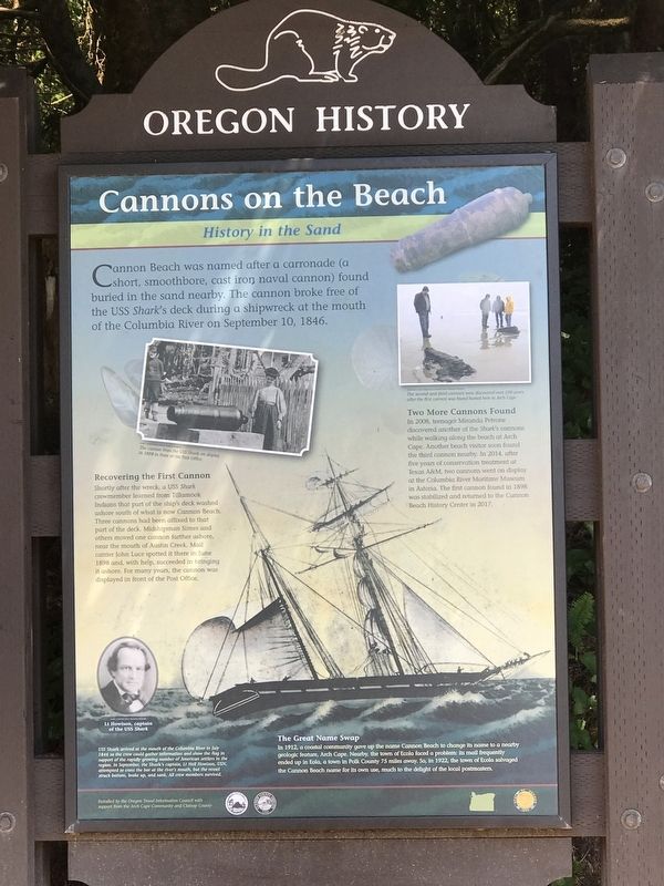
Cannons on the Beach
History in the Sand
Recovering the First Cannon
Shortly after the wreck, a USS Shark crewmember learned from Tillamook Indians that part of the ship's deck washed ashore south of what is now Cannon Beach. Three cannons had been affixed to that part of the deck. Midshipman Simes and others moved one cannon farther ashore, near the mouth of Austin Creek. Mail carrier John Luce spotted it there in June 1898 and, with help, succeeded in bringing it ashore. For many years, the cannon was displayed in front of the Post Office.
Two More Cannons Found
In 2008, teenager Miranda Petrone discovered another of the Shark's cannons while walking along the beach at Arch Cape. Another beach visitor soon found the third cannon nearby. In 2014, after five years of conservation treatment at Texas A&M, two cannons went on display at the Columbia River Maritime Museum in Astoria. The first cannon found in 1898 was stabilized and returned to the Cannon Beach History Center in 2017.
The Great Name Swap
In 1912, a coastal community gave up the name Cannon Beach to change its name to a nearby geologic feature, Arch Cape. Nearby, the town of Ecola faced a problem: its mail frequently ended up in Eola, a town in Polk County 75 miles away. So, in 1922, the town of Ecola salvaged the Cannon Beach name for its own use, much to the delight of the local postmasters.
Captions
(top left) The cannon from the USS Shark on display in 1898 in front of the Post Office.
(top right) The second and third cannons were discovered over 100 years after the first cannon was found buried here in Arch Cape.
(bottom left) Lt. Howison, captain of the USS Shark.
(background) USS Shark arrived at the mouth of the Columbia River in July 1846 so the crew could gather information and show the flag in support of the rapidly growing number of American settlers in the region. In September, the Shark's captain, Lt. Neil Howison, USN, attempted to cross the bar at the river's mouth, but the vessel struck bottom, broke up, and sank. All crew members survived.
Erected by Oregon Travel Information Council.
Topics and series. This historical marker is listed in these topic lists: Disasters • Waterways & Vessels. In addition, it is included in the Oregon Beaver Boards series list. A significant historical year for this entry is 1846.
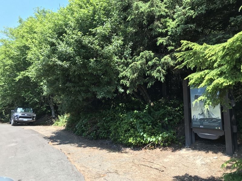
Location. 45° 49.226′ N, 123° 57.641′ W. Marker is in Arch Cape, Oregon, in Clatsop County. Marker is on Oregon Coast Highway (U.S. 101) north of Carnahan Road North, on the right when traveling north. Marker is in a pullout on the highway's northbound side. Touch for map. Marker is at or near this postal address: 79729 US-101, Arch Cape OR 97102, United States of America. Touch for directions.
Other nearby markers. At least 8 other markers are within 6 miles of this marker, measured as the crow flies. Arch Cape Carronade (a few steps from this marker); Cannon Beach (within shouting distance of this marker); In Harmony with Nature (approx. 5.2 miles away); Roosevelt Elk (approx. 5.2 miles away); Oswald West (approx. 5.2 miles away); Neahkahnie Mountain (approx. 5.2 miles away); a different marker also named Oswald West (approx. 5.3 miles away); Safety and Beauty (approx. 5.3 miles away). Touch for a list and map of all markers in Arch Cape.
Credits. This page was last revised on July 14, 2021. It was originally submitted on July 14, 2021, by Duane and Tracy Marsteller of Murfreesboro, Tennessee. This page has been viewed 197 times since then and 15 times this year. Photos: 1, 2. submitted on July 14, 2021, by Duane and Tracy Marsteller of Murfreesboro, Tennessee.

