Near Selby in Walworth County, South Dakota — The American Midwest (Upper Plains)
You are now on the 100° Meridian
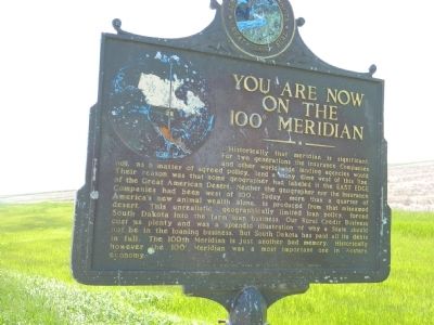
Photographed by Beverly Pfingsten, June 6, 2011
1. You are now on the 100 Meridian Marker
Erected 1956 by The First National Bank of Selby and State Highway Commission. (Marker Number 55.)
Topics and series. This historical marker is listed in these topic lists: Industry & Commerce • Landmarks. In addition, it is included
this page online
Location. 45° 26.957′ N, 100° 0′ W. Marker is near Selby, South Dakota, in Walworth County. It is on 134th Street (U.S. 12) close to 309th Avenue, on the left when traveling west. Touch for map. Marker is in this post office area: Selby SD 57472, United States of America. Touch for directions.

Regionally, this marker is in East River. It is also in the American Lewis & Clark Corridor, on the prairies, and on the Northern Plains. Globally, it is in North America, the Western Hemisphere, the Western World, and the Anglosphere. Historically, it finds itself in what was once Rupert’s Land and also the Louisiana Purchase.
Other nearby markers. At least 6 other markers are within 7 miles of this marker, measured as the crow flies: Bangor (approx. 1.9 miles away); a different marker also named Bangor (approx. 2 miles away); Walworth County, South Dakota Veterans Memorial (approx. 4.3 miles away); The Mickelson Governors (approx. 4.9 miles away); Hiddenwood Park (approx. 6.7 miles away); City of Java, South Dakota (approx.
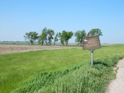
Photographed by Beverly Pfingsten, June 6, 2011
2. You are now on the 100° Meridian Marker
Credits. This page was last revised on July 16, 2021. It was originally submitted on July 18, 2011, by Bill Pfingsten of Bel Air, Maryland. This page has been viewed 1,072 times since then and 47 times this year. Last updated on July 16, 2021. Photos: 1, 2. submitted on July 18, 2011, by Bill Pfingsten of Bel Air, Maryland. • Mark Hilton was the editor who published this page.
