Near Ocracoke in Carteret County, North Carolina — The American South (South Atlantic)
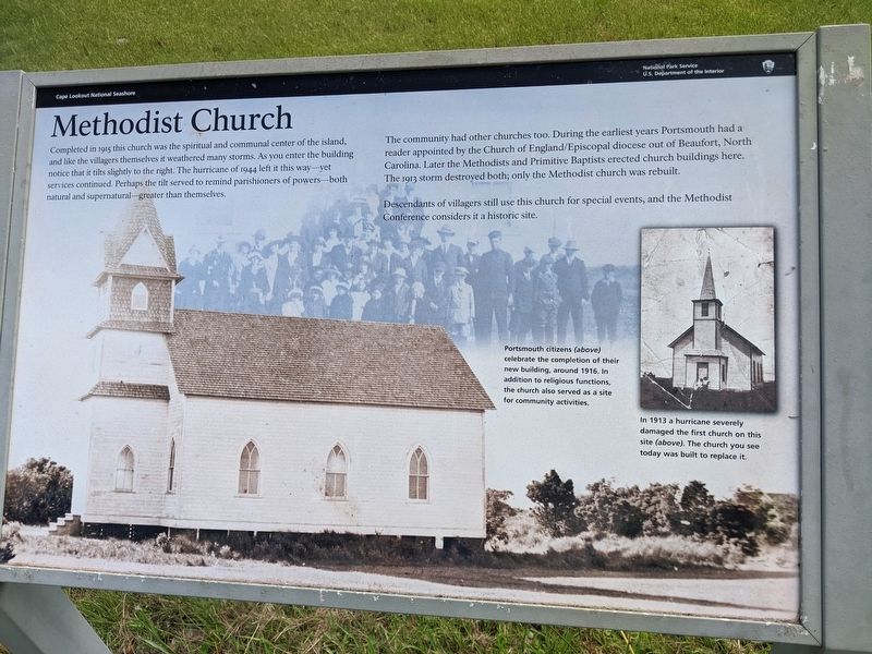
Methodist Church
Cape Lookout National Seashore
Photographed by Sean C Bath, July 13, 2021
1. Methodist Church Marker
The community had other churches too. During the earliest years Portsmouth had a reader appointed by the Church of England/Episcopal diocese out of Beaufort, North Carolina. Later the Methodists and Primitive Baptists erected church buildings here. The 1913 storm destroyed both; only the Methodist church was rebuilt.
Descendants of villagers still use this church for special events, and the Methodist Conference considers it a historic site.
(captions)
Portsmouth citizens (above) celebrate the completion of their new building around 1916 in addition to religious functions. the church also served as a site for community activities.
In 1913 a hurricane severely damaged the first church on this site (above). The church you see today
this page online
Erected by National Park Service, U.S. Department of the Interior.
Topics. This historical marker is listed in these topic lists: Disasters • Religion & Religious Structures • Settlements & Settlers. A significant historical year for this entry is 1915.
Location. 35° 4.165′ N, 76° 3.703′ W. Marker is near Ocracoke, North Carolina, in Carteret County. It can be reached from an unnamed road. Marker is on Portsmouth Island, accessible only by boat. A boat can be chartered in nearby Ocracoke, NC. Touch for map. Marker is in this post office area: Ocracoke NC 27960, United States of America. Touch for directions.

Regionally, this marker is in the Coastal Plain, on the Crystal Coast, and on the Outer Banks. It is also in the American South, specifically in the Upper South, in the Tidewater, and on the Eastern Seaboard. Globally, it is in the North Atlantic Region, North America, the Western Hemisphere, the Western World, and the Anglosphere. Historically, it finds itself in what was once the territory of the Mississippian Culture, one of the original Thirteen Colonies, one of the Confederate States of America, and the Antebellum South.
Other nearby markers. At least 8 other markers are within 5 miles of this marker, measured as the crow flies: Through These Doors (about 700 feet away, measured in a direct line); Exploring Portsmouth (approx. 0.3 miles away); Remembering Our Ancestors (approx. 0.3 miles away); Springer’s Point Preserve (approx. 5 miles away); Growing More Resilient (approx. 5.1 miles away); Ocracoke’s Silent Sentinel (approx. 5.1 miles away); A Light for Ocracoke Inlet (approx. 5.1 miles away); Living at the Light (approx. 5.1 miles away). Touch for a list and map of all markers in Ocracoke.
More about this marker. The marker is in front of the church, about a half mile southeast of the Haulover Point, the village access dock.
Also see . . .
1. Portsmouth Village. Cape Lookout National Seashore. National Park Service (Submitted on July 17, 2021.)
2. Visiting Portsmouth Village. Cape Lookout National Seashore. National Park Service. (Submitted on July 17, 2021.)
3. Portsmouth, North Carolina. Wikipedia (Submitted on July 17, 2021.)
Additional keywords. Portsmouth Island
Credits. This page was last revised on April 5, 2025. It was originally submitted on July 16, 2021, by Sean C Bath of Silver Spring, Maryland. This page has been viewed 405 times since then and 34 times this year. Photo 1. submitted on July 16, 2021, by Sean C Bath of Silver Spring, Maryland. • Bernard Fisher was the editor who published this page.
Editor’s want-list for this marker. Wide shot of marker and its surroundings. • Can you help?
