Hole-In-The-Mountain
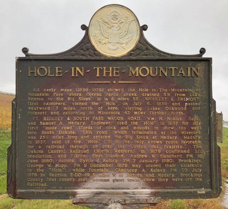
All early maps (1838-1879) showed the Hole-in-The-Mountain or Mountain Pass where Coteau Perce creek drained SW from Lake Benton to the Big Sioux. It is 8 miles SE. Nicollet & Fremont, first explorers, visited the "Hole" on July 6, 1838 and passed westward 3 miles north of here, visiting Lakes Oakwood and Poinsett and returning to Minnesota 43 miles further north.
Ft. Ridgely & South Pass Wagon Road. Wm. H. Nobles, Supt. and Samuel A. Medary, Engineer, used the "Hole" in 1857 for this first made road (fords of rock and mounds to show the way) into South Dakota. This road, which terminated at the Missouri,
was 254 miles long and crossed the Big Sioux at Medary. Medary in 1857, said of the "Hole." "It is the only known route favorable for a railroad through or over the Coteau des Prairies." The Dakota Central Railroad (North Western) in 1879 confirmed his prediction, and Elkton, first Ivanhoe, Andrew W. Blanchard PM 16 June 1880; Aurora, Byron J. Kelsey, PM 7 January 1880; Brookings, George W. Hopp, PM 9 December 1879 may accord their existence to the "Hole" while Fountain, Chauncey A. Kelsey PM 30 July 1878 in Section 2-110-49 5 miles N of Aurora and Medary. Brookings County first county seat, became ghost towns since they were off the Railroad.
Erected 1956 by
Topics and series. This historical marker is listed in this topic list: Settlements & Settlers. In addition, it is included in the South Dakota State Historical Society Markers series list. A significant historical date for this entry is January 7, 1880.
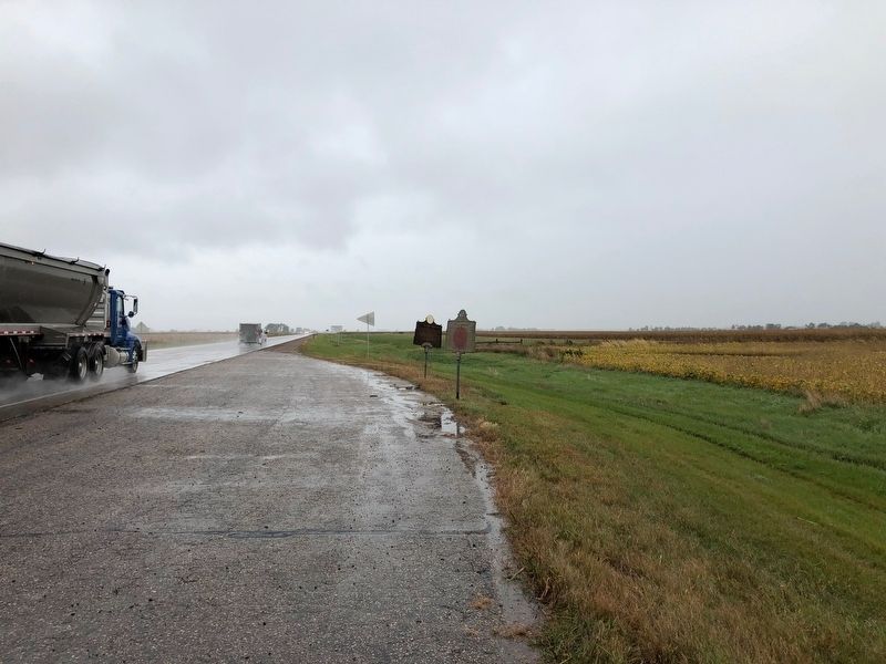
Location. 44° 16.125′ N, 96° 27.339′ W. Marker is near Elkton, South Dakota, in Brookings County. Marker is on Highway 14, half a mile east of 487th Ave, on the right when traveling west. Touch for map. Marker is at or near this postal address: 48766 US-14, Elkton SD 57026, United States of America. Touch for directions.
Other nearby markers. At least 7 other markers are within 16 miles of this marker, measured as the crow flies. You are now Entering South Dakota (here, next to this marker); Brookings County / Moody County (approx. 8.2 miles away); In Honor Of Those Who Served (approx. 8.3 miles away in Minnesota); Geology of the Lake Benton Region (approx. 8.3 miles away in Minnesota); Wakpaipaksan Okodakiciye (approx. 15.3 miles away); Dakota Akicita Wokisye / Dakota Soldiers Memorial (approx. 15.3 miles away); Flandreau Christian Indian Community (approx. 15.3 miles away).
Credits. This page was last revised on July 17, 2021. It was originally submitted on October 9, 2019, by Ruth VanSteenwyk of Aberdeen, South Dakota. This page has been viewed 336 times since then and 39 times this year. Last updated on July 17, 2021. Photos: 1, 2. submitted on October 9, 2019, by Ruth VanSteenwyk of Aberdeen, South Dakota. • Devry Becker Jones was the editor who published this page.

