Watertown in Codington County, South Dakota — The American Midwest (Upper Plains)
Watertown
and Vicinity
Photographed by Ruth VanSteenwyk, December 31, 2015
1. Watertown Marker
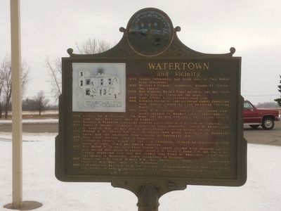
1835 Joseph LaFramboise had trade post at Two Woods Lake (Chanopa.
1838 Nicollet & Fremont , explorers, visited SE Codington County.
1840 Rev. Stephen Return Riggs enroute, Lac Qui Parle to Ft. Pierre, traversed the area.
1856 Capt. Alfred Sully surveyed the road site.
1858 Kintzing Prichette, Special Indian Agent, counciled with Yankton Indians at Lake Kampeska (Shining Shell).
1860 Capt. W.M. Gardner, 2nd U.S. Inf. passed Kampeska enroute Ft. Randall to Ft. Abercrombie.
1862 Lt. Col. Wm. R. Marshall, 7th Minn. Inf. pursued and captured fugitive Indians near Goose Nest Lake west of Kampeska.
1869 Sisseton & Wahpeton triangular reserve established with S point at Lake Kampeska.
1871 James P. Warner, itinerant trapper, at Lake Kampeska. David D. Keeler also at Lake in 1872 as was Joel B. Montgomery first permanent settler.
1873 Winona & St. Peters RR Co., to secure land grant laid rails to Kampeska outlet and ran excursion from Chicago on September 15th.
1874 First postal service, Gary to Kampeska.
1877 Codington County, named for Rev. G.S. Codington, created by legislature from parts of Grant, Clark
this page online
1878 Mrs. Oliver H. Tarbell, first white woman in county, arrived with husband April 4th and settled east shore Kampeska. Kemp P.O., Oscar P. Kemp, P.M. Est. March 28th. County organized July 19th and county seat fixed at Kampeska near outlet, but moved to Watertown, newly established in October.
1879 Watertown P.O. Frank Howard P.M. Est. March 28; Kemp P.O. discontinued April 14 and Kemp aptd. P.M. Watertown.
1880 Commissioners set May 20th for election on incorporation of Watertown and an unanimous vote being reported duly incorporated town on July 5th.
Erected 1956 by Chamber of Commerce, Mellette House Foundation and State Highway Commission. (Marker Number 191.)
Topics and series. This historical marker is listed in this topic list: Settlements & Settlers. In addition, it is included in the South Dakota State Historical Society Markers series list. A significant historical year for this entry is 1835.
Location. 44° 53.426′ N, 97° 7.412′ W. Marker is in Watertown, South Dakota, in Codington County. It is at the intersection of 9th Ave. SW and 3rd St. SW, on the right when traveling west on 9th Ave.
Photographed by Ruth VanSteenwyk, December 31, 2015
2. Watertown Marker

Regionally, this marker is in East River. It is also in the American Midwest, in the Lewis & Clark Corridor, in the Corn Belt, on the prairies, and on the Northern Plains. Globally, it is in North America, the Western Hemisphere, the Western World, and the Anglosphere. Historically, it finds itself in what was once Rupert’s Land and also the Louisiana Purchase.
Other nearby markers. At least 8 other markers are within walking distance of this marker: Town Clock History (approx. half a mile away); Post Office & Auditorium (approx. 0.7 miles away); 34th Signal Company Memorial (approx. ¾ mile away); Company H. Monument (approx. ¾ mile away); Codington County Vietnam Veterans Memorial (approx. ¾ mile away); Codington County Courthouse (approx. ¾ mile away); Dedicated to Freeman Thayer Post Number 59 (approx. ¾ mile away); Codington County Veterans Memorial (approx. ¾ mile away). Touch for a list and map of all markers in Watertown.
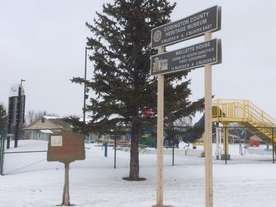
Also see . . . Codington County Heritage Museum. This link go to the museum just down the street. (Submitted on December 31, 2015, by Ruth VanSteenwyk of Aberdeen, South Dakota.)
Credits. This page was last revised on July 17, 2021. It was originally submitted on December 31, 2015, by Ruth VanSteenwyk of Aberdeen, South Dakota. This page has been viewed 852 times since then and 40 times this year. Last updated on July 17, 2021. Photos: 1, 2. submitted on December 31, 2015, by Ruth VanSteenwyk of Aberdeen, South Dakota. • Bill Pfingsten was the editor who published this page.
