Scarsdale in Plaquemines Parish, Louisiana — The American South (West South Central)
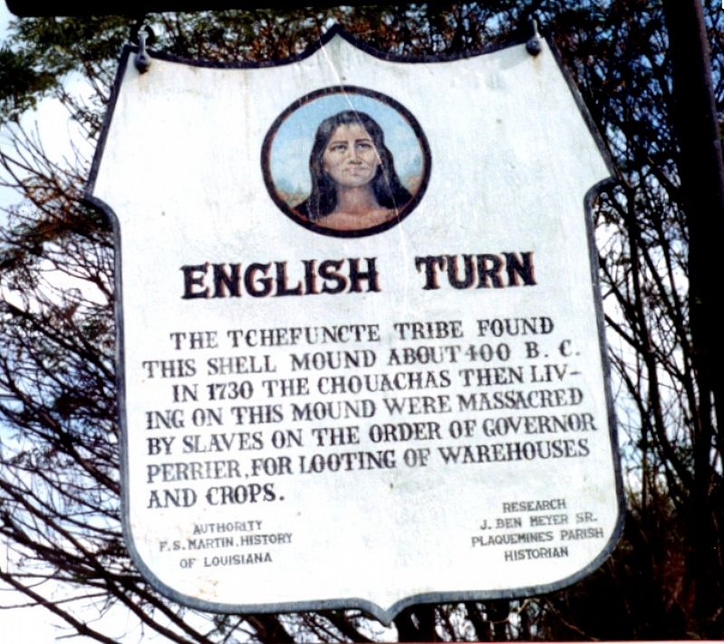
English Turn
Authority of F.S. Martin, History of Louisiana
Research: J. Ben Meyer, Sr. Plaquemines Parish Historian
Erected by Plaquemines Historical Society.
Topics. This historical marker is listed in these topic lists: Native Americans • Settlements & Settlers. A significant historical year for this entry is 1730.
Location. 29° 49.952′ N, 89° 57.593′ W. Marker is in Scarsdale, Louisiana, in Plaquemines Parish. Marker is on Scarsdale Road, 1.3 miles east of River Road (State Highway 39), on the right when traveling east. About a mile south (downriver) of the Belle Chasse - English Turn ferry landing on the east bank of the Mississippi River is the Scarsdale Road, a lightly used farm road perpendicular to highway 39. To get to the marker turn east from LA. 39 and travel just over a mile. The road crosses a bridge and back levee. Just over that back levee to the right (on your south side) before making the turn you will see a slight rise (the old shell midden) with this marker on it. This midden is on the banks of the canal. Touch for map . Marker is at or near this postal address: 898 Scarsdale Rd, Braithwaite LA 70040, United States of America. Touch for directions.
Other nearby markers. At least 8 other markers are within 6 miles of this marker, measured as the crow flies. Bellechasse Plantation (approx. 2.1 miles away); Mary Plantation (approx. 3.1 miles away); a different marker also named English Turn (approx. 3.2 miles away); Plaquemines Parish (approx. 3.3 miles away); Fort St. Leon (approx. 3.7 miles away); a different marker also named Plaquemines Parish (approx. 4˝ miles away); Jefferson Parish (approx. 5.3 miles away); Woodlawn High School and the Struggle for Racial Equality (approx. 5.9 miles away).
More about this marker. The marker has been there since the 1960s so it is rather battered.
Regarding English Turn. In 1730 Louisiana Governor Perrier, fearing the native American tribes and the large number of bslaves would work together to overpower and kill the white colonists, decided to let the Indians know they could not trust each other.
Perrier ordered 80 slaves to attack and massacre a small peaceful Chaouachas (often spelled Chawasha) Indian tribe that was located just below New Orleans. The tribe had been moved from their village on the West bank in present day Belle Chasse, property that would become the "(French) King's Concession," to the east bank behind the farmland being cultivated by colonists...the shell middens located in the marsh. The Indians lived by hunting and gathering mostly shell fish and killing local wildlife so they were among the poorest of the Indian tribes. They had always been friendly to the French and supported them as best they could within their means by providing a few braves when asked.
The Chaouachas village was a particularly attractive target for Perier's plan in that they were neglected by most of the other tribes with better resources, they were geographically distantly separated from all but their sister tribe the Washa Indians which had moved to the Jefferson Parish marshes shortly before and they were becoming a nuisance to the nearby land owners who objected to the Chaouachas killing their game and taking food. Another reason this tribe was expendable was that it was the only tribe located south of New Orleans. In the event of a partnership with slaves and Indians, Perrier did not want the city to be surrounded on all sides or have his only evacuation route, the Mississippi River, obstructed by the Chaouachas.
When the slaves attacked the village, most of the braves had gone foraging for food leaving only a few women and children in the village. Reports were that least seven Indians were killed and the rest escaped into the marsh. The remnants of the Chaouachas tribe seemingly split up after the massacre. Some moved to other shell middens farther south while some moved to join the Washa tribe near what is now Bayou Goula, La. Those that joined the Washa's were soon assassinated by that tribe. Those that moved to other shell middens likely died from hurricanes or floods or got assimilated into the local population in generations to follow.
Additional keywords. Scarsdale, midden, Plaquemines
Credits. This page was last revised on July 28, 2021. It was originally submitted on July 18, 2021, by Rod Lincoln of Picayune,, Mississippi. This page has been viewed 314 times since then and 47 times this year. Photo 1. submitted on July 18, 2021, by Rod Lincoln of Picayune,, Mississippi. • Mark Hilton was the editor who published this page.
