Near Silverton in San Juan County, Colorado — The American Mountains (Southwest)
Wealth of Mining History
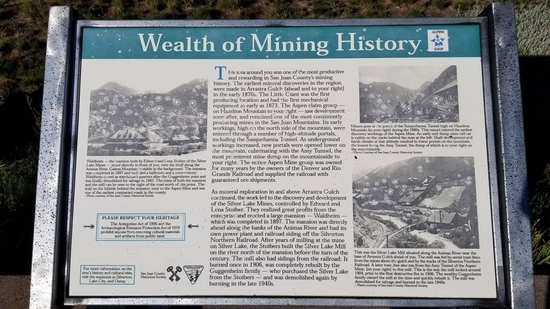
This area around you was one of the most productive and rewarding in San Juan County's mining history. The earliest mineral discoveries in the region were made in Arrastra Gulch (ahead and to your right) in the early 1870s. The Little Giant was the first producing location and had the first mechanical equipment as early as 1873. The Aspen claim group - on Hazelton Mountain to your right - saw development soon after, and remained one of the most consistently producing mines in the San Juan Mountains. Its early workings, high on the north side of the mountain, were entered through a number of high-altitude portals, including the Susquehanna Tunnel. As underground workings increased, new portals were opened lower on the mountain, culminating with the Amy Tunnel, the most prominent mine dump on the mountainside to your right. The entire Aspen Mine group was owned for many years by the owners of the Denver and Rio Grande Railroad and supplied the railroad with guaranteed ore shipments.
As mineral exploration in and above Arrastra Gulch continued, the work led to the discovery and development of the Silver Lake Mines, controlled by Edward and Lena Stoiber. They realized great profits from the enterprise and erected a large mansion - Waldheim which was completed in 1897. The mansion was directly ahead along the banks of the Animas River and had its own power plant and railroad siding off the Silverton Northern Railroad. After years of milling at the mine on Silver Lake, the Stoibers built the Silver Lake Mill on the river north of the mansion before the turn of the century. The mill also had sidings from the railroad. It burned once in 1906, was completely rebuilt by the Guggenheim family - who purchased the Silver Lake from the Stoibers - and was demolished again by burning in the late 1940s.
Captions
1. Waldheim - the mansion built by Edward and Lena Stoiber of the Silver Lake Mines stood directly in front of you, over the bluff along the - Animas River. Galena Mountain is visible in the background. The mansion was completed in 1897 and included a ballroom and a conservatory. Waldheim served as watchman's quarters after the Guggenheim years and was finally demolished for salvage in 1945. The ruins of both the mansion and the mill can be seen to the right of the road north of this point. The trail on the hillside behind the mansion went to the Aspen Mine and was one of the earliest contracted roads in the county.
- Photo courtesy of San Juan County Historical Society
2. Miners pose at the portal of the Susquehanna Tunnel high on Hazelton Mountain (to your right) during the 1880s. This tunnel entered the earliest discovery workings of the Aspen Mine. An early
end-dump mine rail car is visible on the tracks behind the man at the left. Shaft development and harsh climate at that altitude resulted in lower portals on the mountain, the lowest being the Amy Tunnel, the dump of which is to your right on the mountainside.
- Photo Courtesy of San Juan County Historical Society
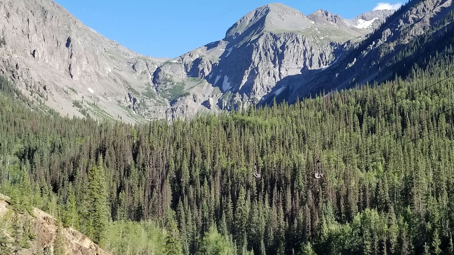
3. This was the Silver Lake Mill situated along the Animas River near the base of Arrastra Gulch ahead of you. The mill was fed by aerial tram lines from the mines above the gulch and by the tracks of the Silverton Northern Railroad. A later tram line also ran from the Amy Tunnel of the Aspen Mine, (on your right) to this mill. This is the way the mill looked around 1904, prior to the first destructive fire in 1906. The wealthy Guggenheim family owned the mill at the time and quickly rebuilt it. The mill was demolished for salvage and burned in the late 1940s.
- Photo courtesy of San Juan County Historical Society
Please Respect Your Heritage
The Antiquities Act of 1906 and the Archaeological Resource Protection Act of 1979 prohibit anyone from removing cultural materials and artifacts from public land.
Erected by San Juan County Historical Society, U.S. Department of the Interior - Bureau of Land Management.
Topics. This historical marker is listed in these topic lists: Industry & Commerce • Railroads & Streetcars. A significant historical year for this entry is 1873.
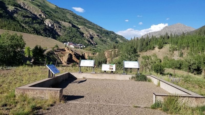
Location. 37° 49.44′ N, 107° 38.078′ W. Marker is near Silverton, Colorado, in San Juan County. Marker is on County Highway 2, 0.4 miles west of County Highway 52, on the right when traveling east. The marker is located next to several other markers at a small parking lot on the south side of the road. Touch for map. Marker is in this post office area: Silverton CO 81433, United States of America. Touch for directions.
Other nearby markers. At least 8 other markers are within 2 miles of this marker, measured as the crow flies. Tailings Ponds Reclamation (here, next to this marker); Mayflower Mill (here, next to this marker); Mayflower Mill Tailing Ponds (here, next to this marker); Arrastra Gulch (approx. half a mile away); San Juan County Memorial (approx. 1˝ miles away); Silverton Northern Caboose 1005 (approx. 1.6 miles away); S.R.R. Caboose (approx. 1.6 miles away); San Juan County Historical Society Museum (approx. 1.6 miles away). Touch for a list and map of all markers in Silverton.
Also see . . . Alpine Loop. Colorado Department of Transportation website entry:
The Alpine Loop is truly a backcountry experience. Make sure someone knows your travel plans and do your homework before you start your trip. Make sure you have plenty of water, food and fuel to make it to your destination. Electronics and wireless devises DO NOT work in most places on the Alpine Loop. It is recommended that you download or print hard copy maps prior to your trip. The Alpine Loop Backcountry Byway is a rugged 4x4 road that winds through the spectacular scenery of the San Juan Mountains, connecting Lake City, Silverton, and Ouray. The Alpine Loop byway traverses passes up to 12,800 feet while showcasing old mines, ghost towns, natural wonders, beautiful wildflowers, and abundant wildlife. Alpine Loop is an avenue for exploring nature and history amidst thrilling views and stunning geography. Tackling the loop in its entirety is easily an all-day experience event. However, the main loop is only part of the experience; miles of designated side routes allow visitors to either take a short tour or extend their trip to multiple days. For more information, please contact the Gunnison Field Office.(Submitted on July 21, 2021, by James Hulse of Medina, Texas.)
Credits. This page was last revised on May 8, 2023. It was originally submitted on July 21, 2021, by James Hulse of Medina, Texas. This page has been viewed 170 times since then and 24 times this year. Photos: 1, 2, 3, 4. submitted on July 21, 2021, by James Hulse of Medina, Texas.


