Marker Logo HMdb.org THE HISTORICAL
MARKER DATABASE
“Bite-Size Bits of Local, National, and Global History”
Elmore in Ottawa County, Ohio — The American Midwest (Great Lakes)
 

Israel Harrington and Elmore


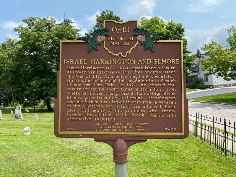
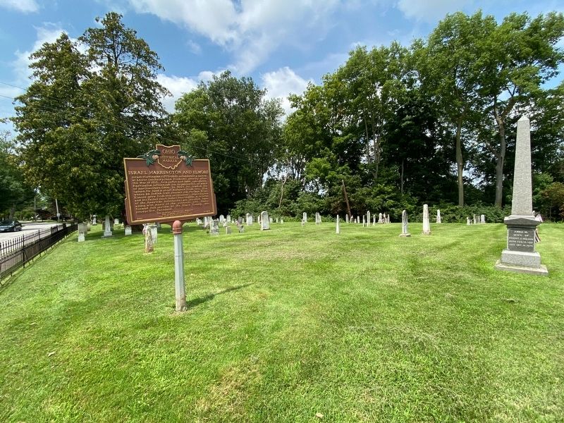
Israel Harrington and Elmore Marker image. Click for full size.
Photographed By J.T. Lambrou, July 21, 2021
1. Israel Harrington and Elmore Marker
Inscription. Israel Harrington (1779-1841) established a tavern at Lower Sandusky (now Fremont) shortly after the War of 1812. As a judge and land speculator, Harrington influenced the organization of much of northwestern Ohio. In 1824 he traded the tavern for land a short distance from this site, where an Indian trail crossed the Portage River. Elmore grew from this settlement. Harrington and his father (also Israel Harrington, a veteran of the American Revolution) are interred here, along with many of the pioneers who transformed this section of the Black Swamp into productive farmland.
 
Erected 2001 by The Elmore Historical Society, The Elmore Community and The Ohio Historical Society. (Marker Number 7-62.)
 
Topics and series. This historical marker is listed in these topic lists: Cemeteries & Burial SitesIndustry & CommerceSettlements & Settlers. In addition, it is included in the Ohio Historical Society / The Ohio History Connection series list. A significant historical year for this entry is 1824.
 
Location. 41° 28.683′ N, 83° 17.422′ W. Marker is in Elmore, Ohio, in Ottawa County. Marker is at the intersection of Rice Street (County Road 18) and Clinton Street (County Road 18), on the right when traveling west on Rice Street. The
Paid Advertisement
Click on the ad for more information.
Please report objectionable advertising to the Editor.
Click or scan to see
this page online
marker stands in Harrington Cemetery. Touch for map. Marker is at or near this postal address: 556 Rice St, Elmore OH 43416, United States of America. Touch for directions.
 
Other nearby markers. At least 8 other markers are within 5 miles of this marker, measured as the crow flies. Elmore Veterans Memorial (within shouting distance of this marker); Elmore World War I & World War II Veterans Memorial (approx. ¼ mile away); State Route 51 Concrete Arch Bridge over the Portage River (approx. 0.3 miles away); Veteran Park (approx. 0.6 miles away); Sugar Creek Cemetery (approx. 3½ miles away); Genoa (approx. 4.1 miles away); POW-MIA Memorial (approx. 4.2 miles away); Woodville World War I Memorial (approx. 4.2 miles away). Touch for a list and map of all markers in Elmore.
 
Israel Harrington and Elmore Marker image. Click for full size.
Photographed By J.T. Lambrou, July 21, 2021
2. Israel Harrington and Elmore Marker
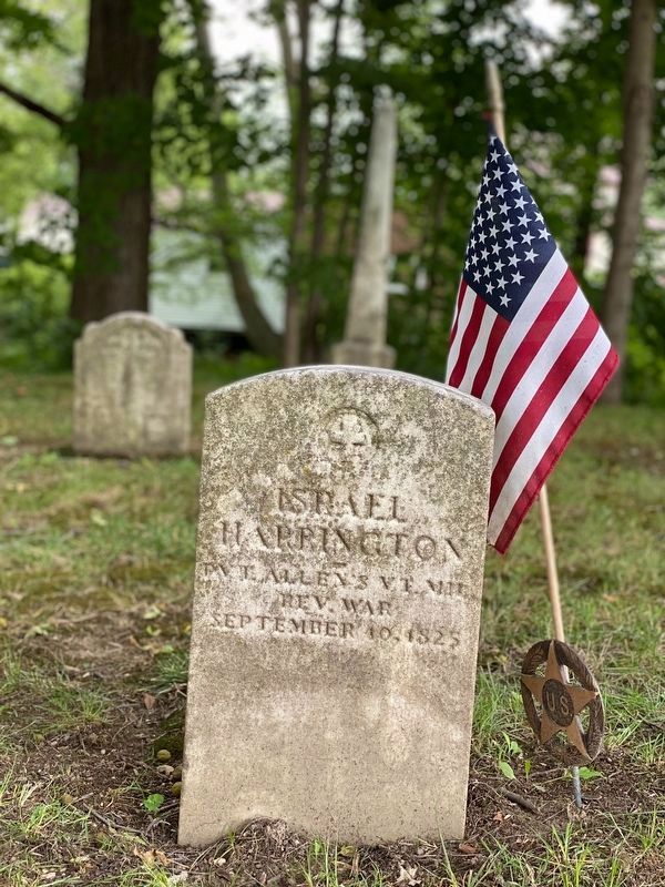
Israel Harrington image. Click for full size.
Photographed By J.T. Lambrou, July 21, 2021
3. Israel Harrington
Father
Israel Harrington and Elmore image. Click for full size.
Photographed By J.T. Lambrou, July 21, 2021
4. Israel Harrington and Elmore
Located in Harrington Cemetery.
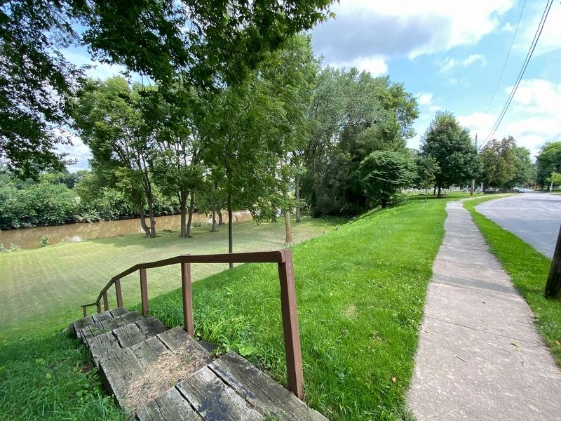
Black Swamp image. Click for full size.
Photographed By J.T. Lambrou, July 21, 2021
5. Black Swamp
Area cultivated by Israel Harrington
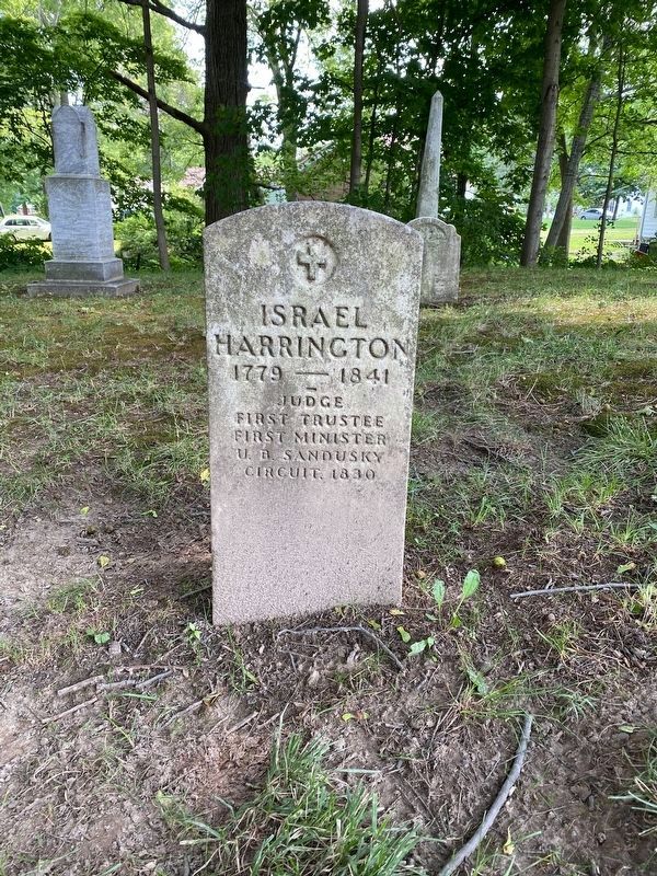
Israel Harrington image. Click for full size.
Photographed By J.T. Lambrou, July 21, 2021
6. Israel Harrington
Son
 
 
Credits. This page was last revised on July 23, 2021. It was originally submitted on July 22, 2021, by J.T. Lambrou of New Boston, Michigan. This page has been viewed 156 times since then and 17 times this year. Photos:   1, 2, 3, 4, 5, 6. submitted on July 22, 2021, by J.T. Lambrou of New Boston, Michigan. • Devry Becker Jones was the editor who published this page.
Share this page.  
Share on Tumblr
m=177750

CeraNet Cloud Computing sponsors the Historical Marker Database.
This website earns income from purchases you make after using our links to Amazon.com. We appreciate your support.
Paid Advertisement
May. 7, 2024