Leave Nothing Useful Behind
Cumberland Gap National Historical Park
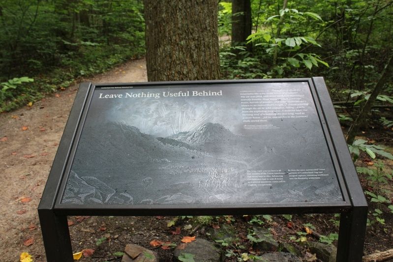
Cumberland Gap, September 17, 1862
The explosion shook the mountains like a toy in the hands of a monster. The air was filled with dense smoke, so that I could scarcely breathe. Huge masses of rock, cartridge boxes, barrels of powder, and other materials were blown to an indescribable height, and went whirling through the air in wind confusion, falling…a mile from the exploding magazine. A moment later, the burning roof of a building 180-feet-long, used as a store-house…fell in, and set fire to the [cannon] shells stored there.
Lieutenant Colonel George Gallup
14th Kentucky Volunteer Regiment, United States Army
Left behind with orders to burn all supplies and ammunition.
Erected by National Park Service, U.S. Department of the Interior.
Topics. This historical marker is listed
this page online
Location. 36° 36.246′ N, 83° 40.43′ W. Marker is near Middlesboro, Kentucky, in Bell County. It is on Wilderness Road Trail, on the left when traveling west. Marker located within Cumberland Gap National Historical Park. Touch for map. Marker is in this post office area: Middlesboro KY 40965, United States of America. Touch for directions.

Regionally, this marker is in Eastern Kentucky and in the Cumberland Plateau. It is also in the American South, specifically in the Upper South, in Appalachia, and specifically in Southern Appalachia. Globally, it is in North America, the Western Hemisphere, the Western World, and the Anglosphere. Historically, it finds itself in what was once the territory of the Mississippian Culture and also the Antebellum South.
Other nearby markers. At least 8 other markers are within walking distance of this marker: Daniel Boone Trail (here, next to this marker); Daniel Boone's Trail (here, next to this marker); a different marker also named Daniel Boone's Trail (a few steps from this marker); Indian Rock (within shouting
Also see . . . Cumberland Gap National Historical Park. National Park Service (Submitted on July 24, 2021.)
Credits. This page was last revised on July 25, 2021. It was originally submitted on July 24, 2021, by Tom Bosse of Jefferson City, Tennessee. This page has been viewed 620 times since then and 55 times this year. Photos: 1, 2, 3, 4. submitted on July 24, 2021, by Tom Bosse of Jefferson City, Tennessee. • Bernard Fisher was the editor who published this page.
