Bayou Meto in Arkansas County, Arkansas — The American South (West South Central)
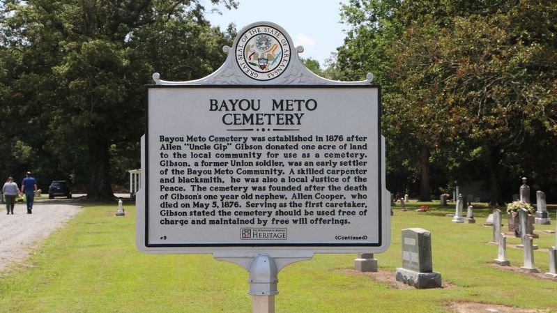
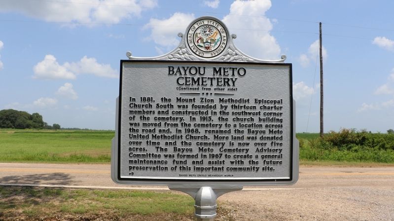
Bayou Meto Cemetery
Bayou Meto Cemetery was established in 1876 after Allen "Uncle Gip" Gibson donated one acre of land to the local community for use as a cemetery. Gibson, a former Union soldier, was an early settler of the Bayou Meto Community. A skilled carpenter and blacksmith, he was also a local Justice of the Peace. The cemetery was founded after the death of Gibson's one year old nephew, Allen Cooper, who died on May 5, 1876. Serving as the first caretaker, Gibson stated the cemetery should be used free of charge and maintained by free will offerings.
In 1881, the Mount Zion Methodist Episcopal Church South was founded by thirteen charter members and constructed in the southwest corner of the cemetery. In 1915, the church building was moved from the cemetery to a location across the road and, in 1968, renamed the Bayou Meto United Methodist Church. More land was donated over time and the cemetery is now over five acres. The Bayou Meta Cemetery Advisory Committee was formed in 1967 to create a general maintenance fund and assist with the future preservation of this important community site.
Erected 2021 by Bayou Meto United Methodist Women; Department of Arkansas Heritage. (Marker Number 9.)
Topics. This historical marker is listed in these topic lists: Cemeteries & Burial Sites
Location. 34° 13.389′ N, 91° 31.061′ W. Marker is in Bayou Meto, Arkansas, in Arkansas County. Marker is on State Highway 276, 0.2 miles east of Riley Lane (State Highway 276 Spur), on the right when traveling east. The marker stands on the right side of the west entrance to the cemetery. Touch for map. Marker is at or near this postal address: 1087 Hwy 276, Stuttgart AR 72160, United States of America. Touch for directions.
Other nearby markers. At least 8 other markers are within 17 miles of this marker, measured as the crow flies. Bayou Meto United Methodist Church (about 500 feet away, measured in a direct line); Bayou Meto Schoolhouse (approx. 0.4 miles away); South Bend Plantation (approx. 12 miles away); A.M. Bohnert Rice Plantation Pump No. 2 Engine (approx. 15 miles away); Battle of Arkansas Post (approx. 15˝ miles away); Immanuel High School (approx. 16.6 miles away); 38,000 Reasons to Fight (approx. 17 miles away); Four guns...opened on us and a thousand rifles from the pits (approx. 17 miles away). Touch for a list and map of all markers in Bayou Meto.
Credits. This page was last revised on July 27, 2021. It was originally submitted on July 26, 2021, by Ashley Sides of Little Rock, Arkansas. This page has been viewed 328 times since then and 71 times this year. Photos: 1, 2, 3. submitted on July 27, 2021, by Ashley Sides of Little Rock, Arkansas. • Devry Becker Jones was the editor who published this page.


