Downtown in Louisville in Jefferson County, Kentucky — The American South (East South Central)
Louisville Water Company
Historic Site
— Bourbon District - 104 West —
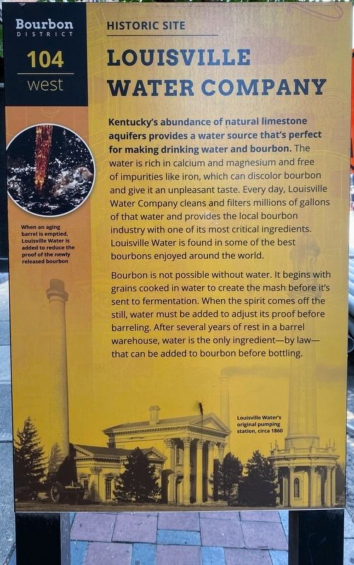
Kentucky's abundance of natural limestone aquifers provides a water source that's perfect for making drinking water and bourbon. The water is rich in calcium and magnesium and free of impurities like iron, which can discolor bourbon and give it an unpleasant taste. Every day, Louisville Water Company cleans and filters millions of gallons of that water and provides the local bourbon industry with one of its most critical ingredients. Louisville Water is found in some of the best bourbons enjoyed around the world.
Bourbon is not possible without water. It begins with grains cooked in water to create the mash before it's sent to fermentation. When the spirit comes off the still, water must be added to adjust its proof before barreling. After several years of rest in a barrel warehouse, water is the only ingredient - by law - that can be added to bourbon before bottling.
[Caption:]
When an aging barrel is emptied, Louisville Water is added to reduce the proof of the newly released bourbon.
Louisville Water's original pumping station, circa 1860.
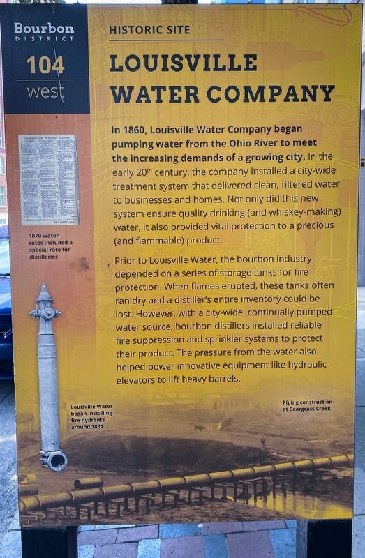
In 1860, Louisville Water Company began pumping water from the Ohio River to meet the increasing demands of a growing city. In the early 20th century, the company installed a city-wide treatment system that delivered clean, filtered water to businesses and homes. Not only did this new system ensure quality drinking (and whiskey-making) water, it also provided vital protection to a precious (and flammable) product.
Prior to Louisville Water, the bourbon industry depended on a series of storage tanks for fire protection. When flames erupted, these tanks often ran dry and a distiller's entire inventory could be lost. However, with a city-wide, continually pumped water source, bourbon distillers installed reliable fire suppression and sprinkler systems to protect their product. The pressure from the water also helped power innovative equipment like hydraulic elevators to lift heavy barrels.
[Captions:]
1870 water rates included a special rate for distilleries
Louisville Water began installing fire hydrants around 1881
Piping construction at Beargrass Creek
Topics. This historical marker is listed in this topic list: Industry & Commerce. A significant historical year for this entry is 1860.
Location. 38° 15.365′ N, 85° 45.12′ W. Marker is in Louisville, Kentucky, in Jefferson County. It is in Downtown. Marker is on West Main Street (U.S. 31E) just west of South 1st Street (U.S. 60), on the left when traveling west. Touch for map. Marker is at or near this postal address: 107 W Main St, Louisville KY 40202, United States of America. Touch for directions.
Other nearby markers. At least 8 other markers are within walking distance of this marker. Old Forester Distilling Co. (within shouting distance of this marker); Birth of Truth In Advertising (within shouting distance of this marker); First Louisville Slugger Bat (about 300 feet away, measured in a direct line); The Galt House (about 300 feet away); Slave Trading In Louisville / Garrison Slave Pen Site (about 300 feet away); Second African Baptist Church (about 400 feet away); The Discovery of the Ohio River (about 400 feet away); Slavery Laws In Old Kentucky / Site of Arterburn Brothers Slave Pens (about 700 feet away). Touch for a list and map of all markers in Louisville.
Credits. This page was last revised on February 12, 2023. It was originally submitted on July 30, 2021, by Shane Oliver of Richmond, Virginia. This page has been viewed 216 times since then and 9 times this year. Photos: 1, 2. submitted on July 31, 2021, by Shane Oliver of Richmond, Virginia. • Devry Becker Jones was the editor who published this page.

