Marker Logo HMdb.org THE HISTORICAL
MARKER DATABASE
“Bite-Size Bits of Local, National, and Global History”
Near Edwards in Hinds County, Mississippi — The American South (East South Central)
 

Contested Crossing


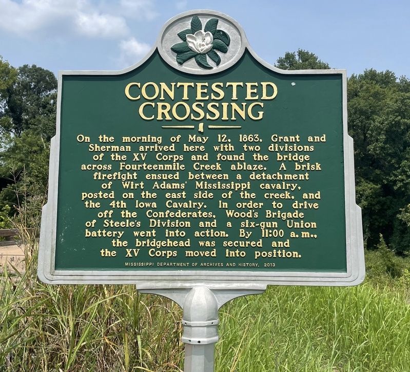
Contested Crossing Marker image. Click for full size.
Photographed By Mark Hilton, July 30, 2021
1. Contested Crossing Marker
Inscription. On the morning of May 12, 1863, Grant and Sherman arrived here with two divisions of the XV Corps and found the bridge across Fourteenmile Creek ablaze. A brisk firefight ensued between a detachment of Wirt Adams' Mississippi cavalry, posted on the east side of the creek, and the 4th Iowa Cavalry. In order to drive off the Confederates, Wood's Brigade of Steele's Division and a six-gun Union battery went into action. By 11:00 a. m., the bridgehead was secured and the XV Corps moved into position.
 
Erected 2013 by Mississippi Department of Archives and History.
 
Topics and series. This historical marker is listed in this topic list: War, US Civil. In addition, it is included in the Mississippi State Historical Marker Program series list. A significant historical date for this entry is May 12, 1863.
 
Location. 32° 13.514′ N, 90° 33.191′ W. Marker is near Edwards, Mississippi, in Hinds County. Marker is on Old Port Gibson Road, 0.2 miles north of Learned Road, on the right when traveling north. Touch for map. Marker is in this post office area: Edwards MS 39066, United States of America. Touch for directions.
 
Other nearby markers. At least 8 other markers are within 6 miles of this marker, measured as the crow flies. Change of Plans (approx. 0.8 miles away); Deans Stand (approx. 0.9 miles away); North to the Railroads (approx. 4.2 miles away); Mt. Moriah
Paid Advertisement
Click on the ad for more information.
Please report objectionable advertising to the Editor.
Click or scan to see
this page online
(approx. 5˝ miles away); Artillery Duel (approx. 5˝ miles away); 1863 Vicksburg Campaign (approx. 5˝ miles away); Indecision! Indecision! Indecision!/A Prompt Concentration of Our Forces (approx. 5˝ miles away); The Vicksburg Campaign (approx. 5˝ miles away). Touch for a list and map of all markers in Edwards.
 
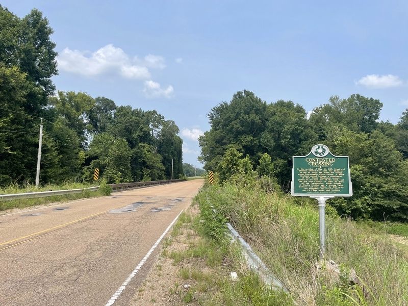
Marker with Fourteenmile Creek (at bridge) in background. image. Click for full size.
Photographed By Mark Hilton, July 30, 2021
2. Marker with Fourteenmile Creek (at bridge) in background.
Gen. Ulysses S. Grant/Gen. William T. Sherman/Conf. Gen. Wirt Adams/Gen. Charles R. Woods image. Click for full size.
Public domain
3. Gen. Ulysses S. Grant/Gen. William T. Sherman/Conf. Gen. Wirt Adams/Gen. Charles R. Woods
Generals mentioned on marker.
 
 
Credits. This page was last revised on July 31, 2021. It was originally submitted on July 31, 2021, by Mark Hilton of Montgomery, Alabama. This page has been viewed 185 times since then and 17 times this year. Photos:   1, 2, 3. submitted on July 31, 2021, by Mark Hilton of Montgomery, Alabama.
Share this page.  
Share on Tumblr
m=178365

CeraNet Cloud Computing sponsors the Historical Marker Database.
This website earns income from purchases you make after using our links to Amazon.com. We appreciate your support.
Paid Advertisement
May. 7, 2024