Downtown in Louisville in Jefferson County, Kentucky — The American South (East South Central)
General George Rogers Clark
Founder of Louisville
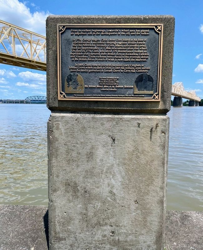
In 1778, George Rogers Clark chose Corn Island as his base of operations for a successful campaign against British forts of the Old Northwest Territory. Corn Island, since eroded away, once lay approximately 1/2 mile downstream from this wharf. On June 24, 1778, Clark and about 170 frontiersmen formed an expedition that captured three British forts at Kaskaskia, Cahokia and Vincennes. These victories were crucial to the eventual defeat of the British forces in much of what is now called the Midwest.
In 1809, Clark came to live with his sister, Lucy Croghan, at Locust Grove where he did in 1818. In 1869 his remains were moved from the family graveyard at Locust Grove to Cave Hill Cemetery.
George Rogers Clark
or the Revolutionary War,
visit the headquarters of
The National Society Sons of the American Revolution
Louisville, Kentucky
Erected 2000 by Illinois, Indiana, Kentucky, Michigan, Ohio and Wisconsin Societies - Sons of the American Revolution.
Topics. This historical marker is listed in these topic lists: Patriots & Patriotism • War, US Revolutionary.
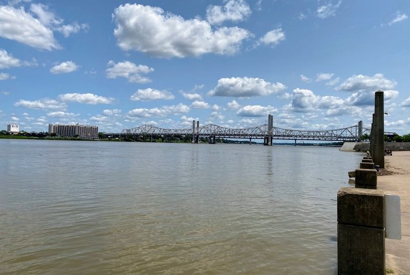
Location. 38° 15.567′ N, 85° 45.12′ W. Marker is in Louisville, Kentucky, in Jefferson County. It is in Downtown. Marker is on W River Road, on the right when traveling west. Marker is located along the Louisville Riverfront, to the east of the George Rogers Clark Memorial Bridge. Touch for map. Marker is at or near this postal address: 131 W River Road, Louisville KY 40202, United States of America. Touch for directions.
Other nearby markers. At least 8 other markers are within walking distance of this marker. Life Saving Station 10 (approx. 0.2 miles away); U.S. Coast Guard World War II Operations in Louisville (approx. 0.2 miles away); Mayor Andrew Broaddus (approx. 0.2 miles away); Belle of Louisville (approx. 0.2 miles away); Visitors at Louisville Wharf / Louisville’s Steamboat Era (approx. 0.2 miles away); Captain John F. Gilooly (approx. 0.2 miles away); a different marker also named Belle of Louisville (approx. 0.2 miles away); The Discovery of the Ohio River (approx. 0.2 miles away). Touch for a list and map of all markers in Louisville.
Credits. This page was last revised on February 12, 2023. It was originally submitted on July 31, 2021, by Shane Oliver of Richmond, Virginia. This page has been viewed 197 times since then and 11 times this year. Photos: 1, 2, 3. submitted on July 31, 2021, by Shane Oliver of Richmond, Virginia. • Bill Pfingsten was the editor who published this page.


